
Hiking Esther Mountain in the Adirondacks
On my hike up Whiteface, we took a slight detour in the wrong direction. When we approached the trail sign for Esther, and read, “path not maintained or marked,” we trudged on to Whiteface. After all, I wasn’t chasing the 46er list.
Joke’s on me because three years later…

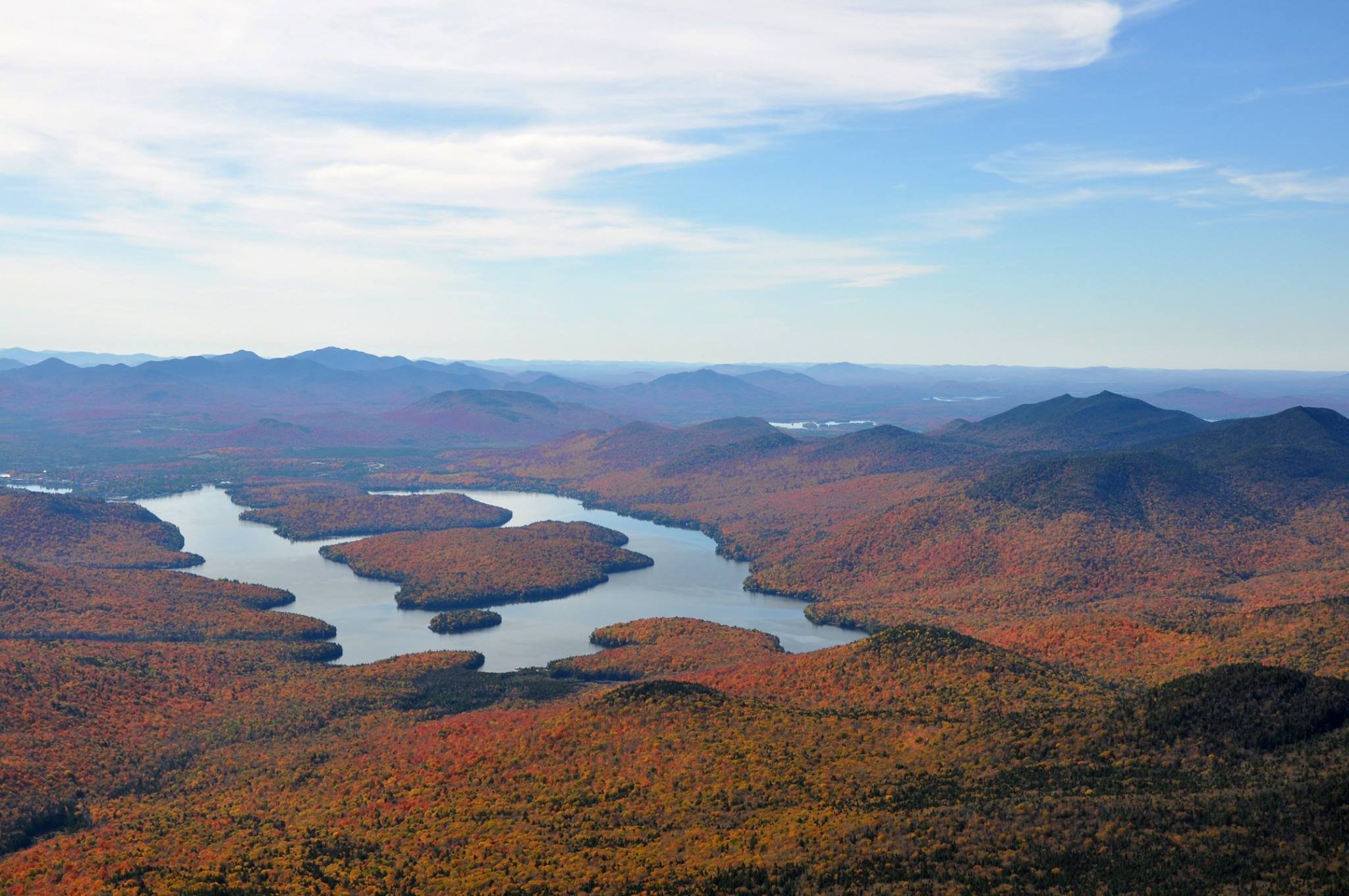
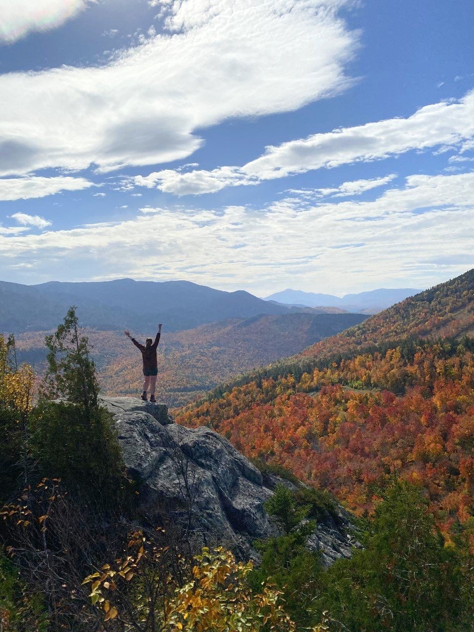
I first discovered the Adirondacks from one of my best friends in college who was living in Hawaii at the time. She sent me a picture of Whiteface’s stony summit path and said, “you have to go there.” Naturally, I drove four hours the next morning (luckily it was the weekend), drove the road up Whiteface, and indulged in the best foliage I had ever seen. Still possibly the best foliage in all my years living in New England since.
I mean look at those colors. I took the photos of Whiteface Mountain below back in October 2016. I had only survived the Franconia Ridge the summer prior and had no idea the mountains and views in store when I’d move to Massachusetts the following year.
Little did I know that five years later I’d hike up the very mountain that first introduced me to the Adirondacks.
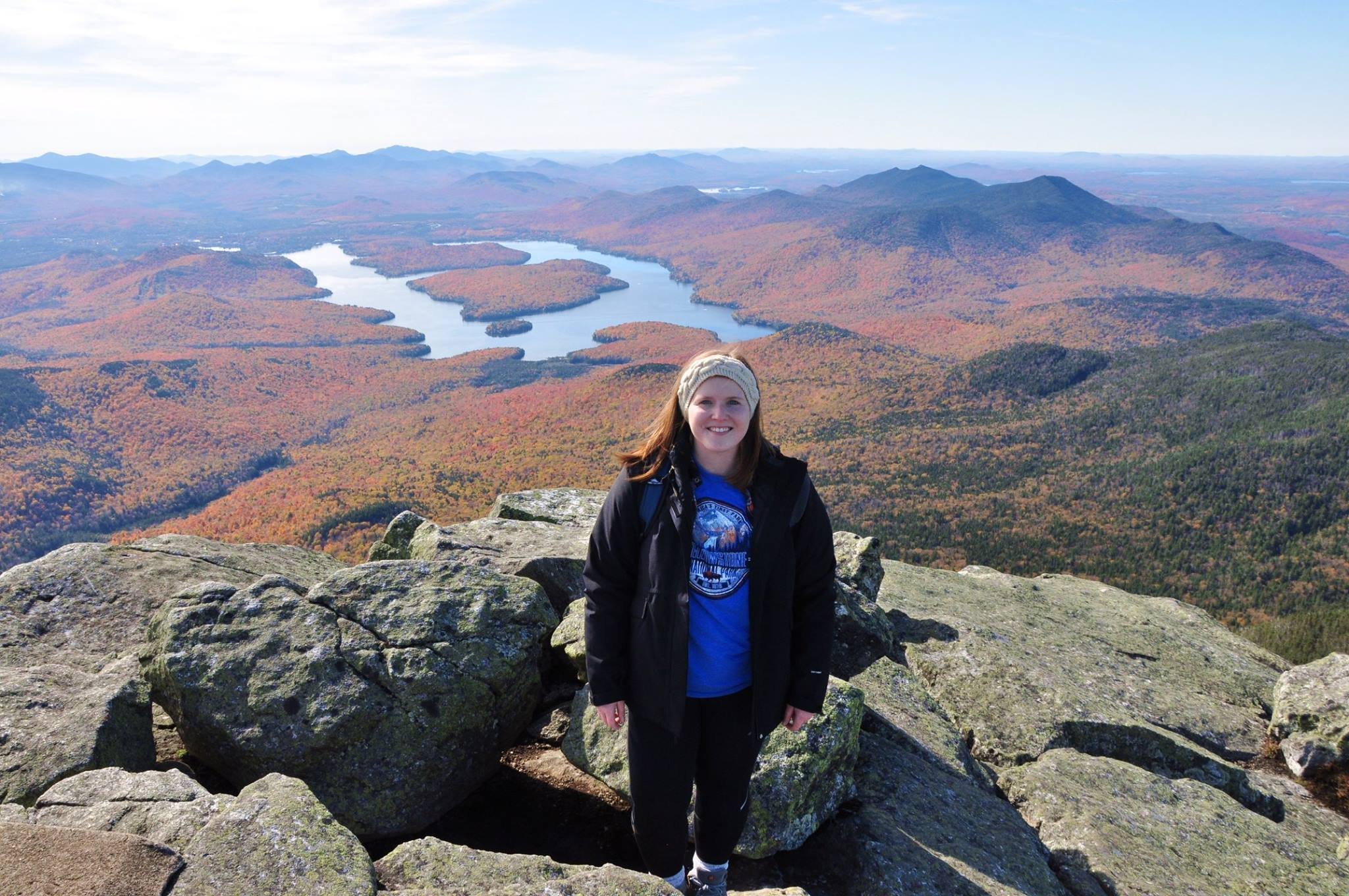
Whiteface Mountain in October 2020
Featuring a naive me, thinking I wouldn’t take on the Adirondack 46 at some point.
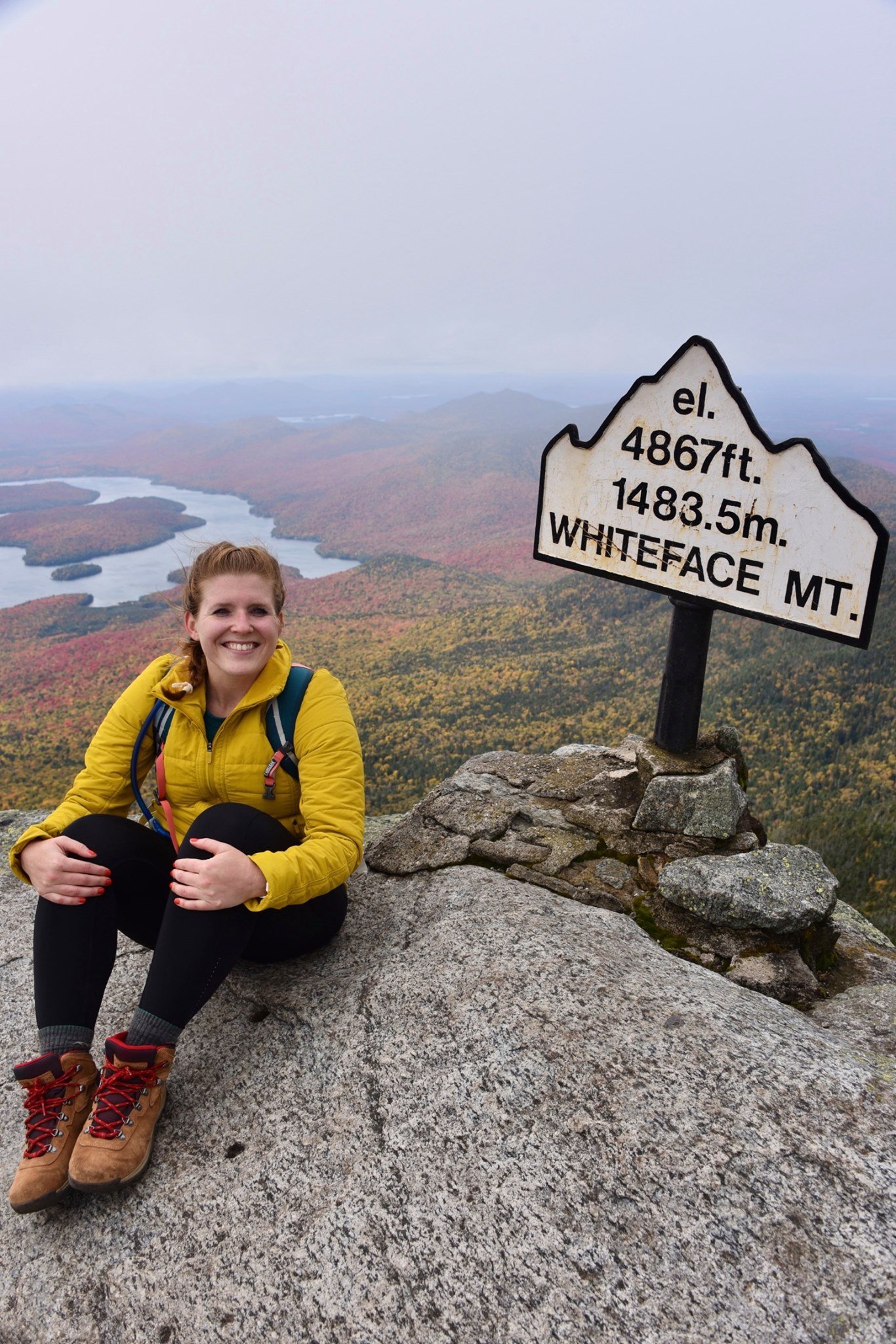
It also comes in at 4,867 feet, making it one of the highest peaks in the Adirondacks. Of course this places Whiteface on the 46er list (New York’s 46 highest peaks). Along one trail to Whiteface is a short detour to Esther Mountain.
On my hike up Whiteface, we took a slight detour in the wrong direction. When we approached the trail sign for Esther, it read, “path not maintained or marked.” Dejected from the detour, we trudged onward to Whiteface. After all, I wasn’t chasing the 46er list. I was there to spend time outside, and see the foliage. Not push on to a viewless summit in uncharted terrain.

Joke’s on me because three years after my Whiteface ascent, I decided I wanted to tackle the 46 highest peaks in the Adirondacks. So here I was with a free Saturday and a craving for a good climb. The weather was sunny and the temperature was moderate. I made a go for it!
Last weekend, I parked at the Atmospheric Sciences Research Center at 110 Marble Mt Ln, Wilmington, NY 12997. Plenty of parking here, but be sure to not park at the center itself. The trail is indicated with a visible sign.
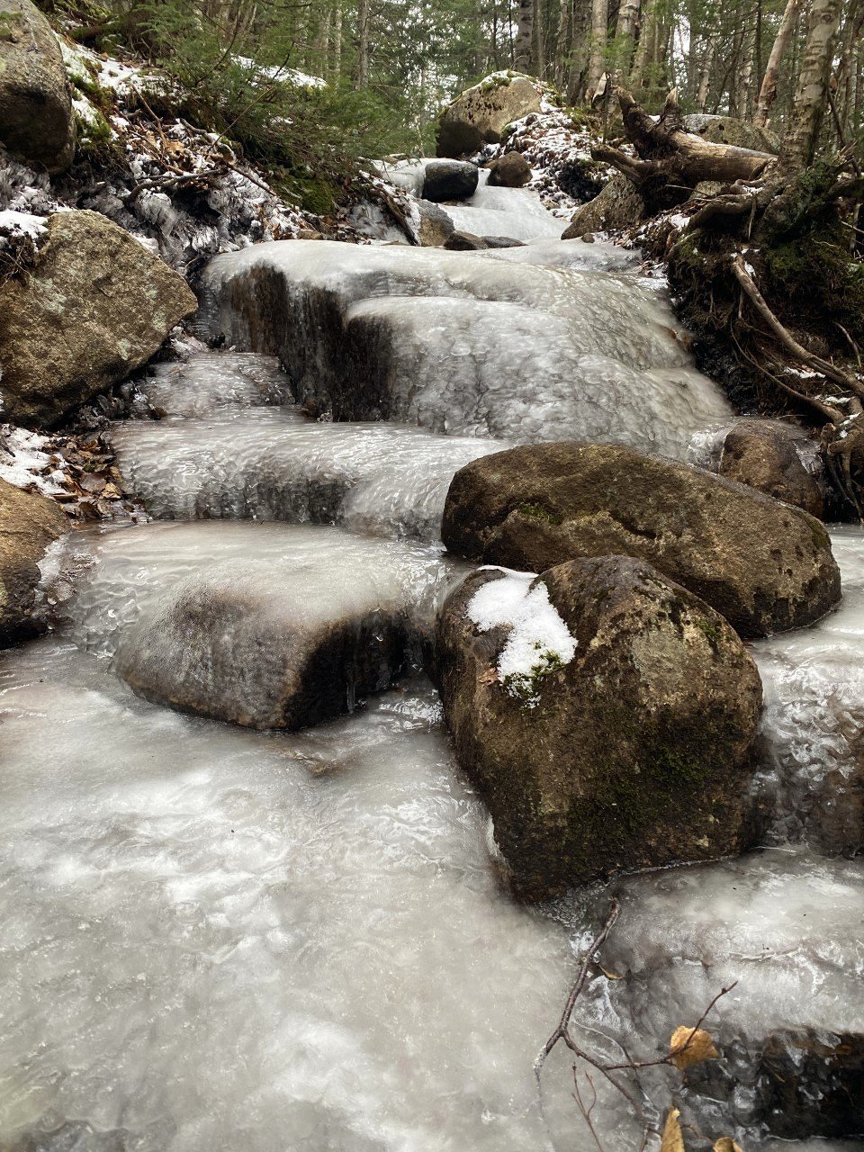
From the start of the trail, it’s a lovely (short-lived) flat path before the 2,000 foot climb begins. A real-world, snow-covered stair climber. What more could you wish for?
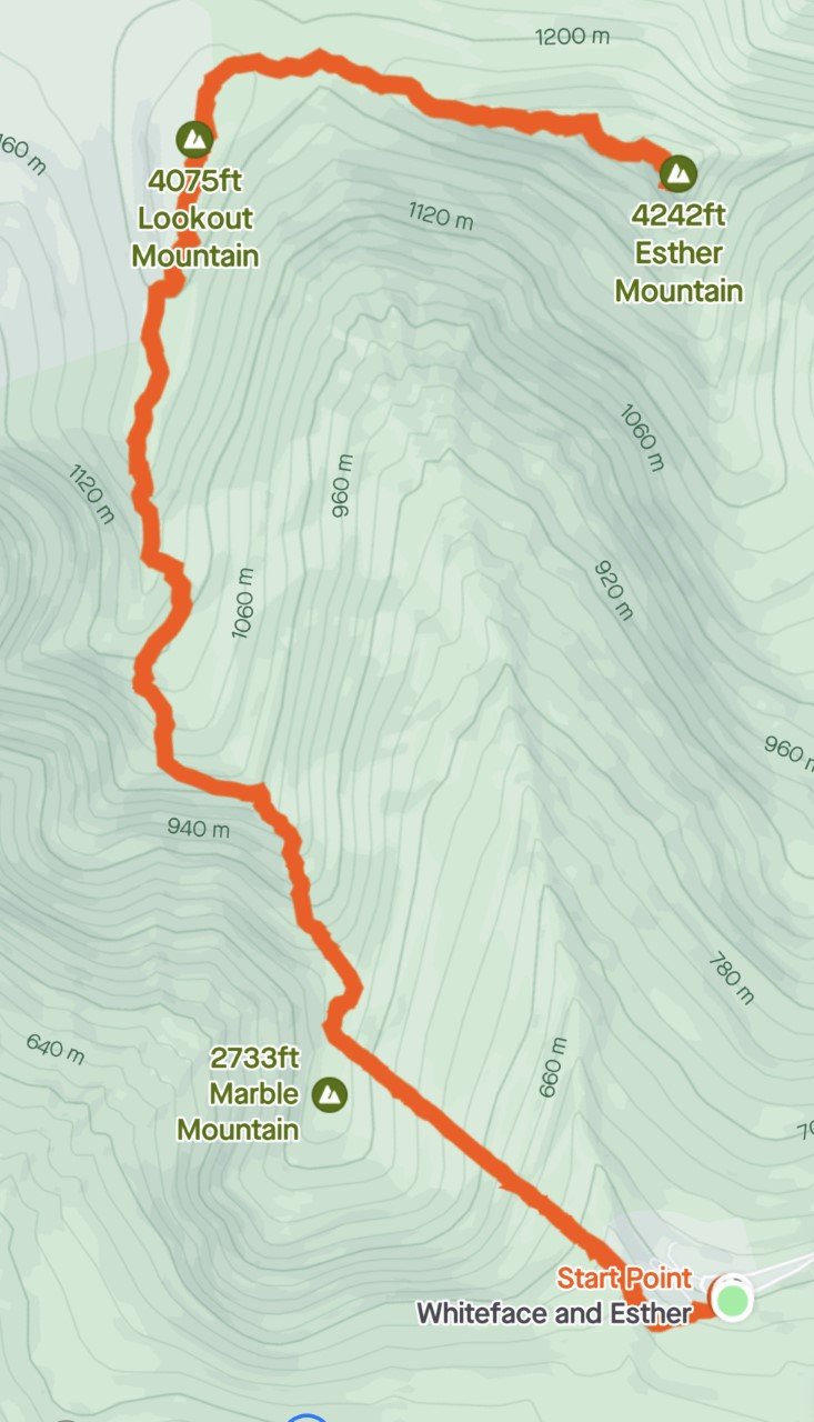
Trail Route from Strava
An out-and-back 6.3 miles with about 2,800 feet of elevation gain.
The great part in summer is that the sunshine is covered for this brutal, sweaty climb. The best part in winter when all the tree branches are bare, is that the sun shines just enough to warm your uncovered face, while the rest of your body is fired up.
I love a good climb, and Esther was no different. At about .8 miles, you reach Marble Mountain, roughly 2,700 feet. A great break spot, complete with rocks to sit on and a view worth gazing at. When you’re done, the next leg of the trip continues to climb (shocking, I know), up to Lookout Mountain at 4,075 feet.
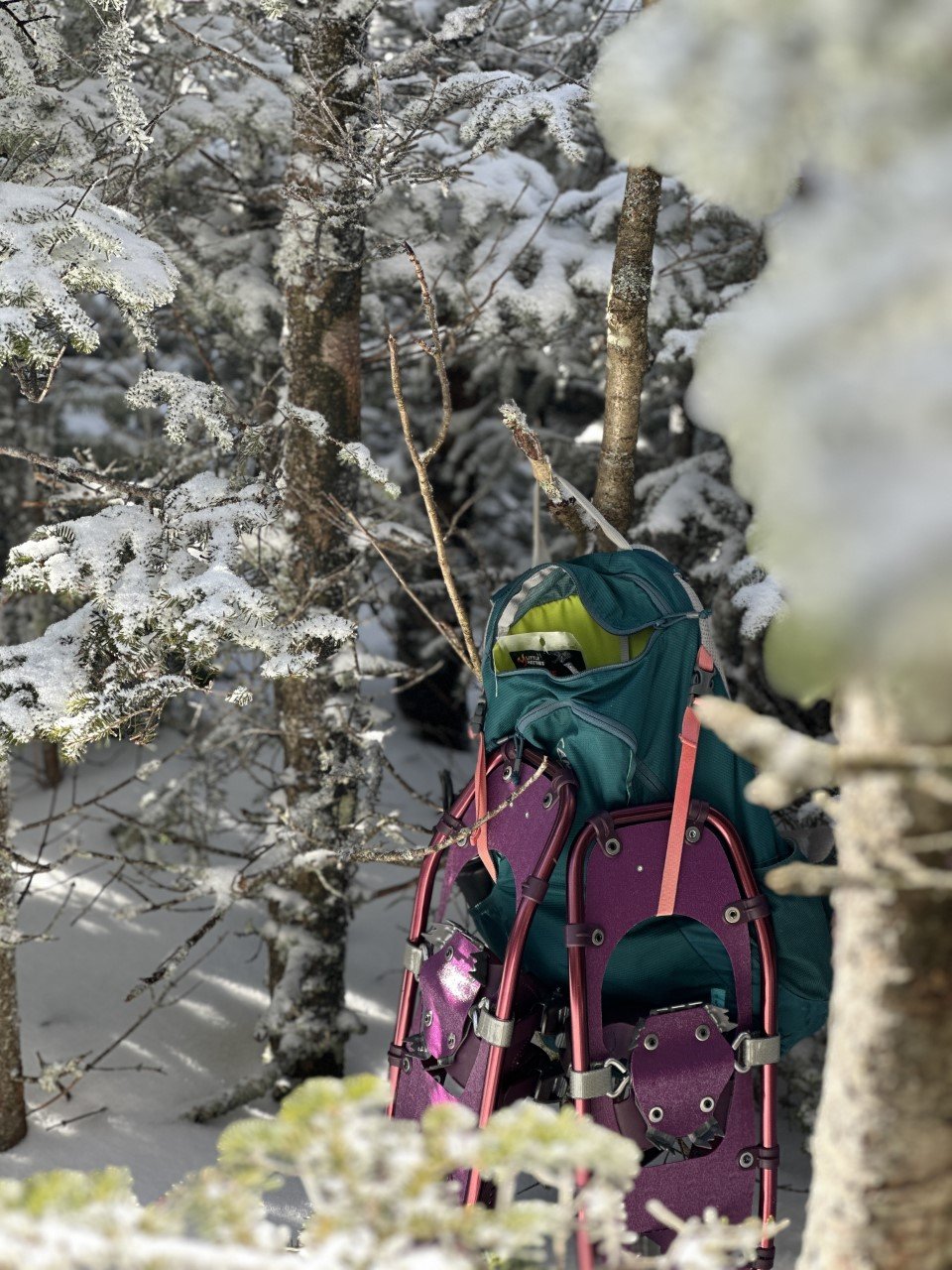
Snowshoes are actually required in the Adirondacks during the winter with more than 8 inches of snow.
The trail was very packed down, so I used microspikes on the ascent. I thought I’d try out my new snowshoes on the descent and they were incredible. These Winter Walker snowshoes from L.L.Bean are super affordable and did me well on a 4,000 footer! They are currently on sale too!

Esther Trail
The iconic Esther sign I referenced earlier is at this point, where you can either turn left for Whiteface, or head right, to the “not maintained” path. The beauty of winter (and several snowshoers before you) is having a very clear path outlined for you. I never faltered from the trail.
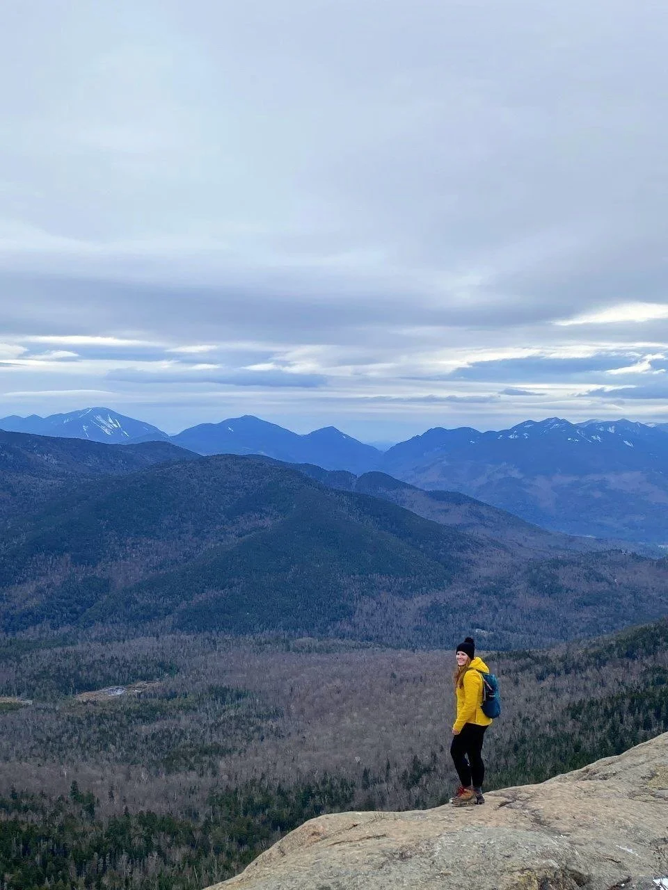
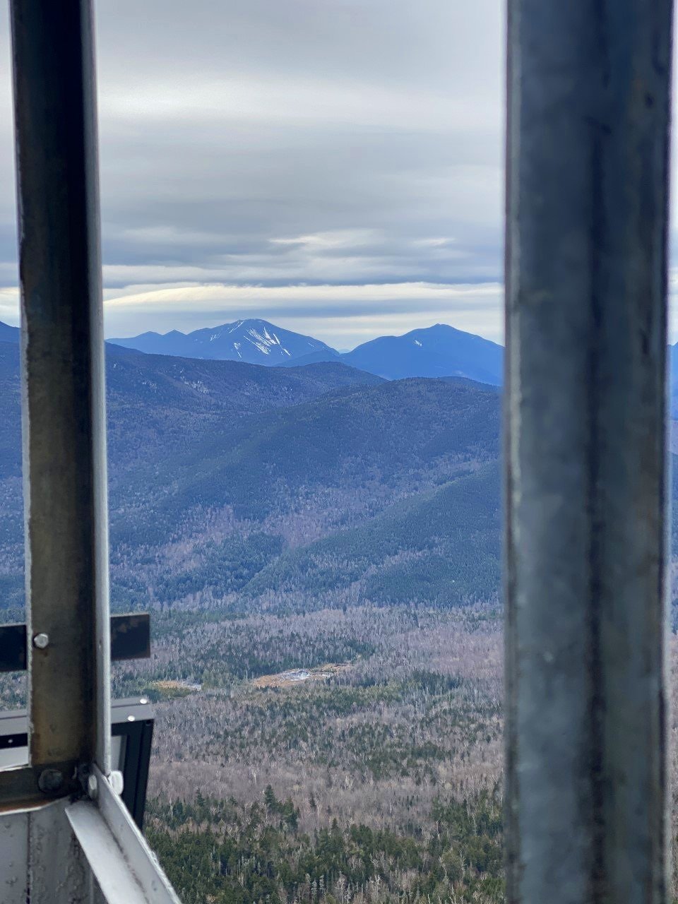
After a bit more climbing (several hundred feet), I soaked up the summit to myself. Everyone I have talked to Esther about always brings up the summer mudfest, or the lack of summit views. I’m not sure if it was because this was my first hike back in the Adirondacks after months away with marathon training, or if there were several feet of snow that elevated me, but I loved the far-off views of Whiteface I saw.
I’m a little biased because I also love winter hiking. A lot. I spent about an hour on the summit wanting to enjoy the perfect day before I headed down.
When I reached my car, I clocked in about 2,800 feet of climbing in 6.3 miles of going out-and-back on the Marble Mountain trail to the Esther trail.

The mountain is apparently named after Esther, a fifteen-year-old girl who was the first known person to summit. Turns out, she hiked up here just for the love of hiking. How fitting considering that was the exact way I felt all day up there. Hiking up Esther Mountain in the winter is definitely the way to go.
This was my 21st peak of the 46. Here’s to many more summit smiles!
If you enjoyed this trail review, check out these mountains:
Cascade and Porter Mountains in the ADKs
Twins, Zealand, Bonds Traverse in the Whites

How to Spend 24 Hours in Ithaca, New York
Here’s what to do with 24 hours in Ithaca, New York:
1. Hike in…
One part about teaching in New England I love is having an additional winter break. A week off in February right when the days are short, and the weather is cold is perfect. A close friend of mine from Texas decided to visit for the weekend with only one request: to experience winter.
After a few warmer days, I knew we needed to head north. One spot that’s always been on my list is Ithaca. Known mostly for two colleges in town, Cornell and Ithaca College, Ithaca has way more to offer than an incredible education.
A quaint, charming town way north of the common New York city experience proved to be the perfect winter getaway.
Here’s how we spent a day in Ithaca, New York:
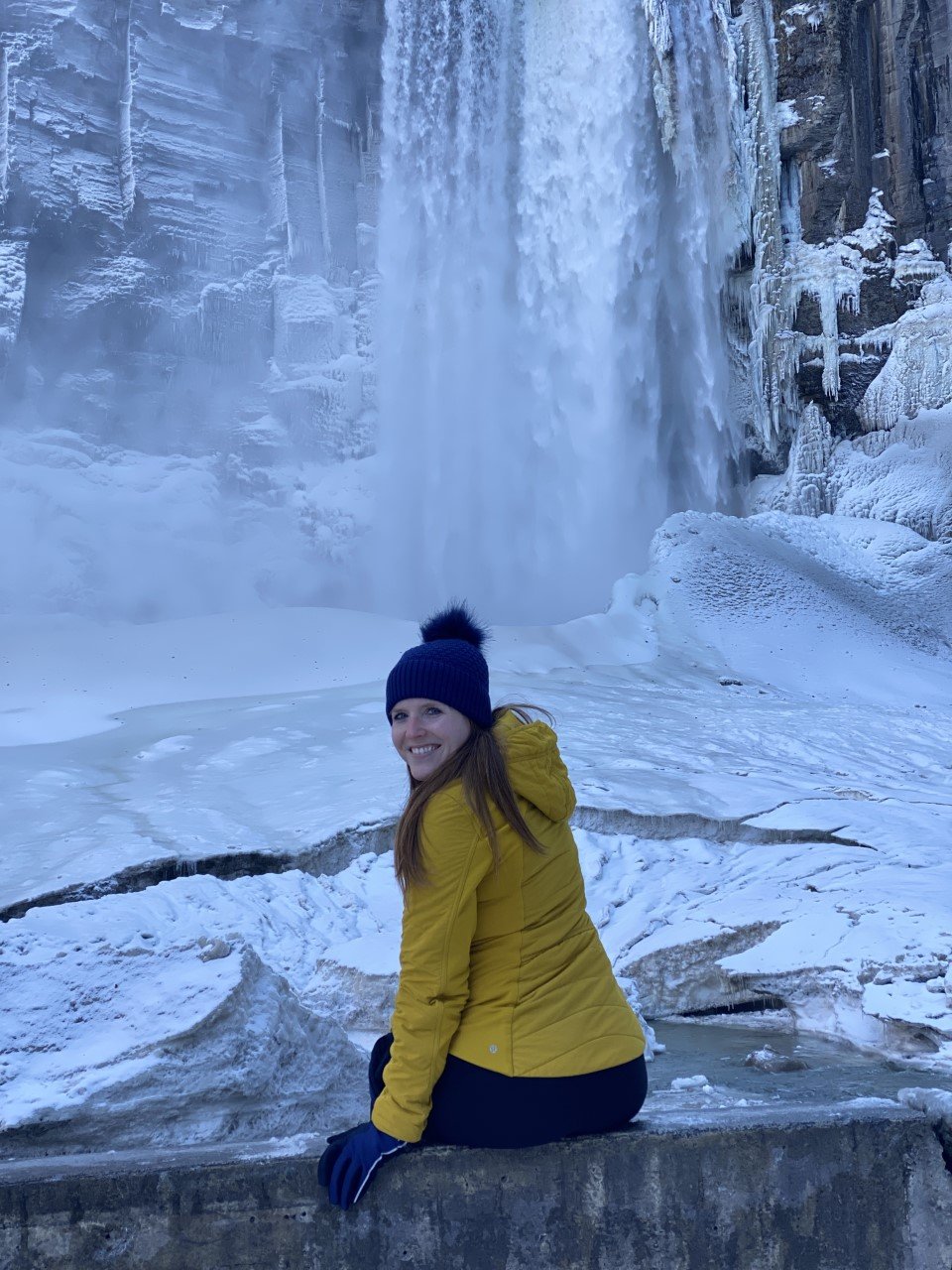
1. Hike in Taughannock Falls State Park.
Taughannock Falls in all its wintry glory.
Hike is a loose term given the usual hikes I find myself chasing after. This time, we were chasing waterfalls instead. Taughannock Falls features a massive, 215-foot waterfall. And in winter, you can bet there’s incredible icy formations all around.
The park is popular, but we arrived in the afternoon and managed to snag a parking spot right away. Though the lot is small, the hike itself is a quick walk, so there likely wouldn’t be a long wait for another car to exit shortly.

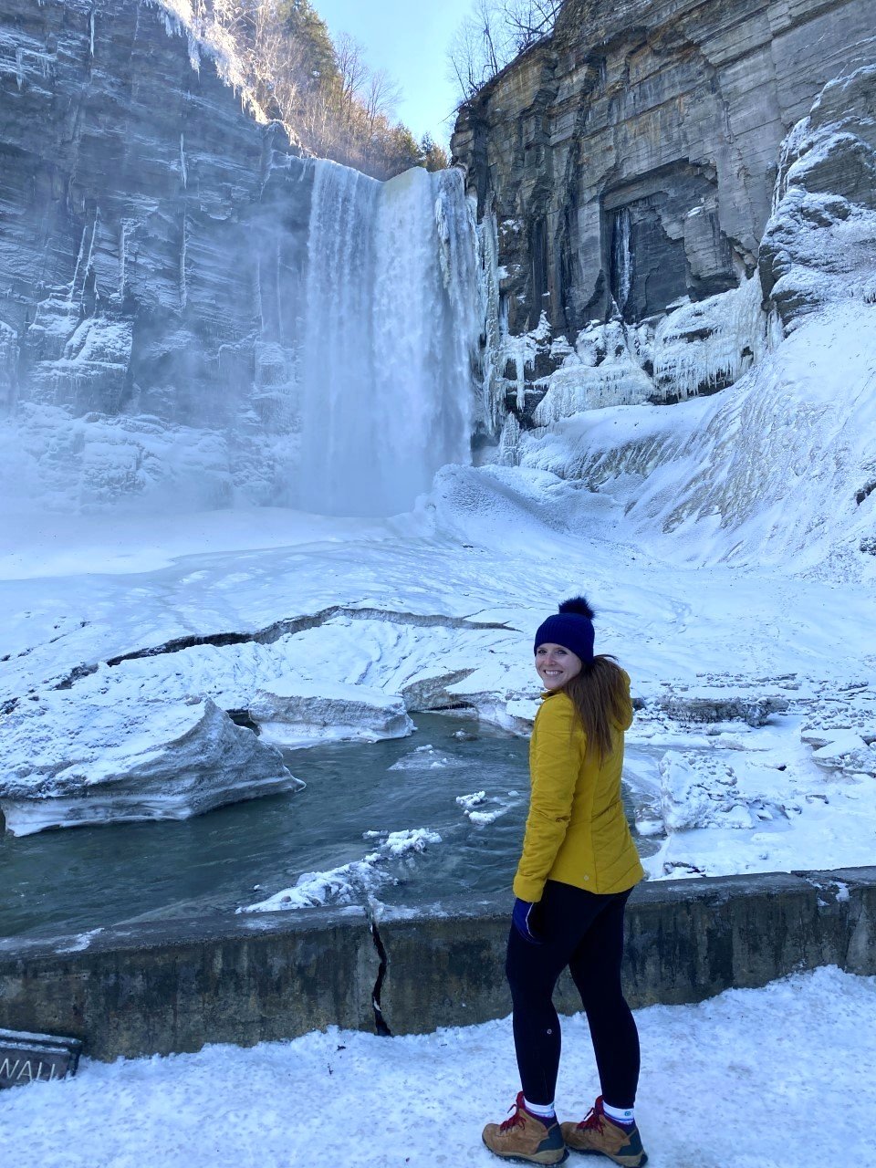
From the parking lot, we walked on a mostly paved path. The path is extremely scenic – you easily forget you’re relatively close to civilization and it’s a wonder this isn’t a more popular destination.
High cliffs, a rushing river, and the winter magic made this trek feel like we were hiking in a national park.
We reached a short bridge about ¾ of a mile into our walk. The falls are visible from this bridge, but we walked a bit further on the path to get a close-up view.
Surprisingly, Taughannock Falls is actually three stories taller than Niagara Falls (not too far away from Ithaca). I’m not a big waterfall gal, but winter changes the game for me. This view was stunning and I couldn’t get enough!
Once you get your dose, drive up the road a couple minutes for a birds-eye-view of the falls from the overlook.
Things to note:
Both the trails mentioned above are open year-round, while the rim ones are not.
There is a $7 park entrance fee. The overlook is free though!
Dogs are allowed on a leash!
2. Peek into Cornell University’s Uris library.
I love a good library, and Cornell’s Uris Library is quite the gem. Think Belle from Beauty and Beast’s library meets J.K.’s Rowling’s rendition in her novels. The best part? It’s open twenty-four hours with incredible sunset views over nearby Cayuga Lake.
It was peacefully quiet when we entered and remained so as we explored. If you’re a book lover, it’s worth a quick stop here.

We did feel odd being back on a college campus after graduating several years ago. I definitely had flashbacks to all the late nights in the PCL library in Austin. I probably would’ve enjoyed going to the library more with views like these though (or I might’ve studied more…).

3. Grab dinner in Ithaca Commons.
I had major New England vibes in Ithaca Commons – pedestrian-only for a couple blocks of shops and restaurants. Parking was easy to find once we navigated the streets.
One of my favorite finds in a new town is walking along the main street, or in this case, the Commons.
Similar to Burlington, Vermont, Ithaca comes alive in this area. A few restaurants were closed Sunday when we visited (and a few closed permanently, sadly), but there were a handful of delicious options on this last-minute trip.

3. Enjoy a bagel breakfast at Collegetown Bagels.
Since we had a four-and-a-half-hour drive home to Western Mass, we needed to head out early in the morning, but not before finding a coffee and breakfast spot.
We enjoyed a fresh cup of coffee from Gimme! Coffee, followed by bagels from Collegetown Bagels.
Collegetown had every type of breakfast sandwich imaginable and felt like the place you could create something wild and they’d make it happen.
I had the Rise n’ Shine with a couple changes: a bagel with jalapeño cream cheese, roasted red peppers, provolone, and sausage. Anytime there’s jalapeño cream cheese on the menu, you can almost guarantee I’ll be ordering it.
I suggest grabbing the bagels to go and heading to the final stop on the itinerary: Ithaca Falls.

4. Look in awe at Ithaca Falls.
I told my friends I had one more surprise in store. When I parked in an empty parking lot off a street, they were confused. They followed me for a minute and were immediately awestruck by Ithaca Falls.
This waterfall is literally on the side of the road. How is Ithaca so lucky?
Tip: The path down to the falls is paved, but with the wintry weather, it had a lovely layer of ice on top. I used microspikes to get to the bottom of the falls.
We stayed at a charming, pet-friendly, and very affordable AirBnB just moments from Ithaca Commons, which made all the adventuring in under twenty-four hours possible!
Though we only checked out two waterfalls, the Ithaca area is actually home to over one hundred waterfalls. It’s one-liner is “Ithaca is gorges.” So fitting. Have you visited any?
If you enjoyed this post, you may also like:
Everything You Need to See in Acadia National Park, Maine

Lake Placid 9er Hiking Challenge
Over the span of 31.31 miles, I climbed 10,388 ft along these 9 summits. Here’s how I broke down the Lake Placid 9er hiking challenge:

I never grow tired of the beauty of these majestic mountains.
If I’m being honest, the Lake Placid 9 originally didn’t appeal to me. I love the brutal nature of a long day hike. Of miles and hours spent climbing a couple thousand feet for the triumphant feeling at the summit. Even if the view isn’t there.
I first heard about the Lake Placid 9 after hiking a couple of the ADK 46. I thought, why spend my limited time in these gorgeous mountains on very short hikes? Well it turns out, these short hikes sure know how to hold their own.
When mapping out my fall foliage adventures, I usually spend one weekend in the Adirondacks and the rest chasing the colors in New Hampshire. This year, after spending an early September weekend in the Adirondacks showing my parents the beauty New York has to offer, I decided to spend more time in upstate NY. Instead of New Hampshire. I know, I hardly recognized myself too.
My parents were up for a short hike, so I picked the shortest one of the Lake Placid 9: Cobble Hill. After this hike, I had an idea.
What if I combine my fall foliage chasing adventures with this short hiking challenge? It’d motivate me to get out there, and I’d gain more experience up in these rugged mountains. Plus, I’m a sucker for the foliage photos.
And thus began my multiple trips to Keene and Lake Placid, NY in September to October, with one final lap in November.
Over the span of 31.31 miles, I climbed 10,388 ft along these 9 summits. Here’s how I broke down the challenge:
1. Cobble Hill
Distance: 2.89 mi
Elevation Gain: 610 ft
Location: Lake Placid, NY
With my parents visiting for a short weekend, I wanted them to experience an ADK hike without too much exhaustion. Since we were staying in Lake Placid, I figured why not finally check out Cobble Hill.
We hiked the steep, shorter way up, and took the longer, gradual way down. I highly recommend this route because you get a bit of rock climbing with a rope ascending, but descend on a lovely trail walk next to a private pond. It’s a great way to get your feet wet starting out on this challenge!

My route to Cobble Hill is above.
2. Mt. Jo

Third trek up this mountain gave way to a new view!
Distance: 1.94 mi
Elevation Gain: 761 ft
Location: North Elba, NY
Technically this was my third time hiking up this mountain. Every time I hit the trail, my hope to find the iconic view is strong. This hope slowly withers away as I simply couldn’t find the lookout point.
After two failed attempts, I wasn’t leaving the summit this time around without seeing the heart-shaped lake in its entirety. Aptly named, Heart Lake. You’re in luck, because my determined self found it this time so you won’t have to hike up multiple times (unless you choose to!).
Mt. Jo is an extremely popular mountain because of the trails, location, and views. When you arrive at the ADK Mountain Club Loj, you’ll pay $15 as a non-member for a full day or $7 for a half day. Depending on the weekend, you may get lucky with an afternoon. If it’s peak foliage season on a late September or early October weekend, you may way to
After parking, you embark on a short traverse before finding two roads diverged in the woods. You can take the short way, or the long way. I’ve never taken the long way, but be prepared for some stairclimbing if you take the short route.
The trail is a swift one mile up, and I took the same route back. Stay cautious heading down on the rocks, especially if you’re taking this on in the fall where often times rocks are wet due to those rainy autumn forecasts.

Tip: The view at the summit isn’t the best view. The best view is easy to miss. When you’re near the ladders, there’s a trail a few steps away that is sure to give you a reason to love Mt. Jo.
My route is on the left.
3. Mt. Van Hoevenberg

Distance: 4.7 mi
Elevation Gain: 1,047 ft
Location: Lake Placid, NY
Mt. Van Hoevenberg has two trails to the summit: a newly constructed one, and the old one. I was already familiar with the ADK Loj area, so I chose the older path. The parking here is extremely limited – maybe less than ten cars can fit. I went at a less popular time of day, so it worked in my favor.
The distance of this hike is longer than Mt. Jo, but the first mile is a simple walk in the woods. It’s quite lovely! After climbing 1,000 feet in roughly a mile, expansive views of the valley open up. This hike is a true gem!
It’s definitely one I’d love to revisit in winter when the peaks are snow-capped. The trails are an out-and-back, unless you have another car to park on the ski area side where the new trail begins.
Here’s my route:

The trail to Mt. Van Hoevenberg.
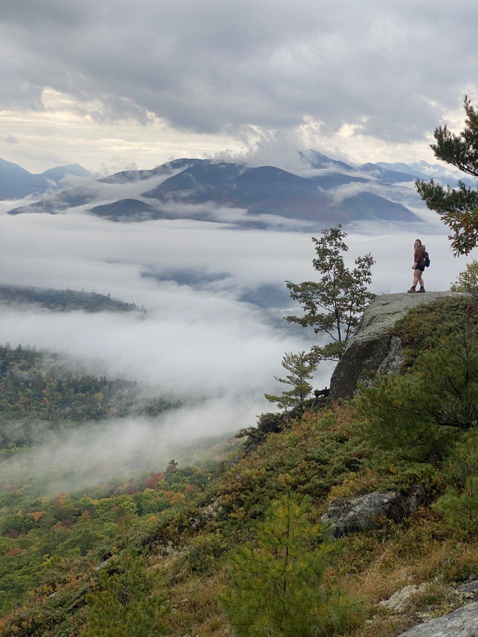
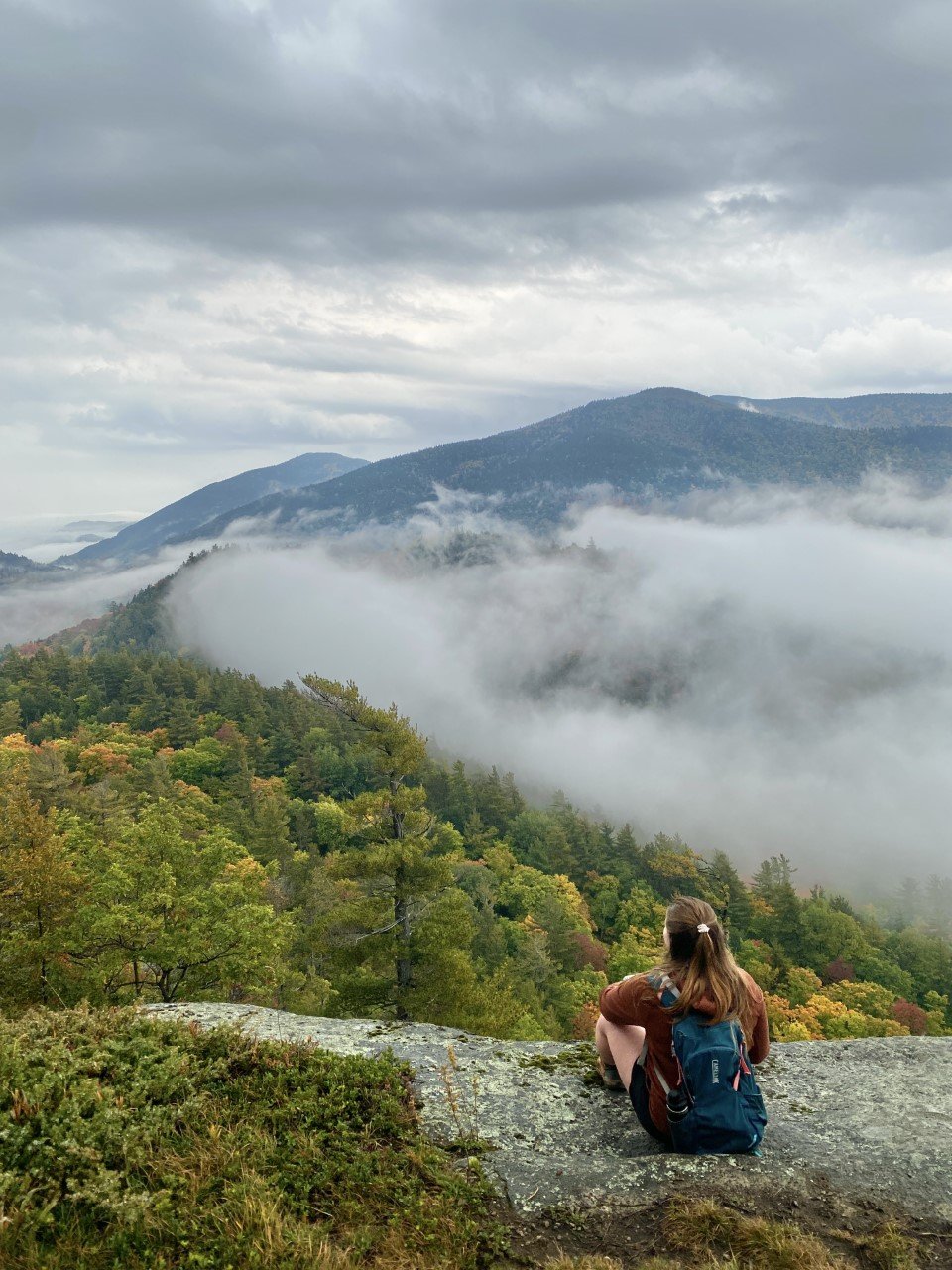
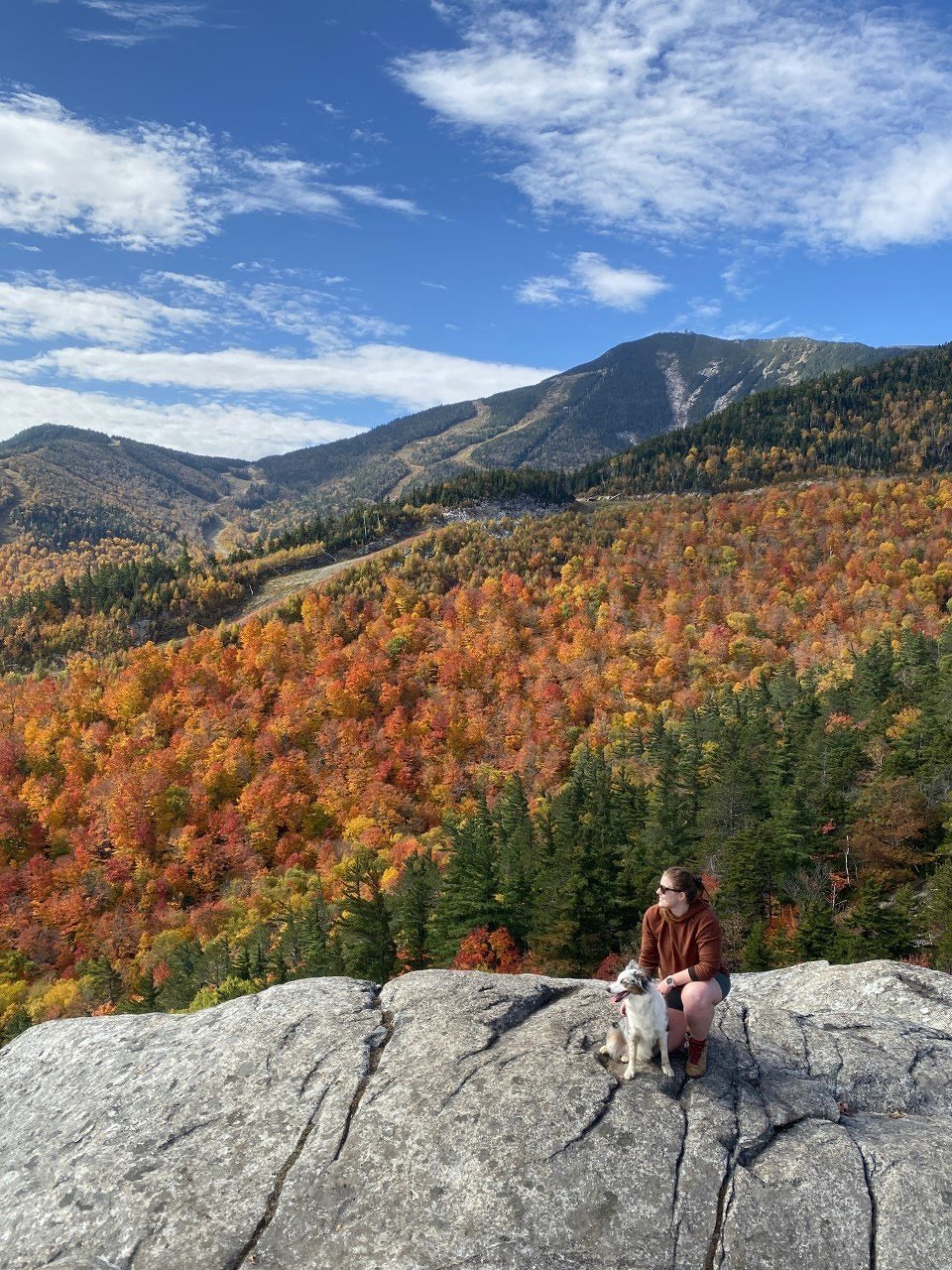
4. Big Crow Mountain

A solo summit on a moody evening.
Distance: 1.34 mi
Elevation Gain: 610 ft
Location: Keene, NY
When I entered Keene for this hike, the clouds decided to join me. I knew it was a short distance, so I thought I’d knock it out and if I got a view, I’d be two for two. The parking lot for Big Crow is also the lot for one of the routes up Hurricane. An AWD vehicle would be best as the last mile felt a little sketchy in my RAV4, but still doable. This road isn’t maintained in the winter months, so get this hike in in the summer or fall from this trailhead.
A speedy, consistent climb of 600 feet in under three-quarters of a mile again opened to wide-scaping views of these mountains that are slowly feeling like home to me. I set up my tripod as the clouds rolled in, took a few pictures at the top, and headed back down.
I made a mental note to come back to hike Hurricane from this parking lot since I was now familiar with the drive up.
Here’s my route:
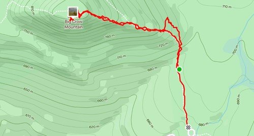
Route map above to Big Crow Mountain.
5. Baxter Mountain
Distance: 3 mi
Elevation Gain: 869 ft
Location: Keene, NY
After the stormy wonder of Big Crow, I knew I had to try out Baxter on this trip up to Lake Placid despite the rainy forecast. I woke up to the steady pitter-patter of raindrops. Contemplating just driving back home, I thought, why not just get out for a three miler?
I made my way over to Keene and parked along the road for this trailhead. The sprinkles fell from the sky and with each step, my disappointment of seeing a view grew. On the way to the summit, there are great viewpoints (arguably better than the summit!). For the fifth time on my Lake Placid 9er journey, I lucked out with the views.

Tip: Always go for it when there’s light rain and you don’t think you’ll get a view. You may just end up with this.
My route is on the right. The photos are where the viewpoints are.
If you’re tackling the challenge, head to the summit to say hello, then stop for the views on the way back.
6. Bear Den Mountain
Distance: 3.82 mi
Elevation Gain: 1,542 ft
Location: Wilmington, NY
The day I embarked up Bear Den was a toasty one. A crisp marshmallow in the campfire on a summer night. Quite the opposite of my previous visit to the mountains with the rainy hike up Baxter. Park at the Whiteface Mountain Ski Center and you’re right at the trailhead. The first mile of this hike doubles as a mountain biking route, so be aware if you have a furry friend with you. The trail’s switchbacks keep things interesting as you make your way up. Just tell yourself you’re almost there, trust me, it helps.
It doesn’t help, but every step is a step closer to the summit! I was in absolute awe atop the summit. The foliage, in unison with the summery weather, lit Whiteface Mountain on fire. It was incredible to gaze my eyes upon.
After awhile of solitude on the summit, I realized the group I passed quite some time ago never summited. As my mind pondered, my eyes wandered. A couple odd colors caught my eye. Those little dots were the other hikers! They had made their way to a rocky surface across the way.
I was curious where they had turned for that added bit of solitude (plus a different angle!). When I headed down, I realized this was another case of the Mt. Jo hidden treasure.

The view of Bear Den’s summit.
As you approach the Bear Den summit, you turn left. Instead, turn right at this sign. There is a very well-trodden trail that leads to that open-rock summit with these views of Bear Den’s summit.

Here’s my route, including the totally-worth-it right turn detour.
7. Pitchoff Mountain

The famous Balanced Rocks!
Distance: 4.15 mi
Elevation Gain: 1,744 ft
Location: Lake Placid, NY
I was saving Pitchoff for a perfect day. The summit itself is hardly impressive, but a steady climb leads you there with views to the right of Cascade and Porter. It’s neat to see where you’ve hiked before.
After the summit, I returned back to finally see Balanced Rocks. It doesn’t look like much on the trail, but it’s another iconic view like Heart Lake from Mt. Jo. I’ve seen it from the road more times than I can count. Two rocks sit on a very open summit looking as if you could just flick them and they’d fall off. Almost like the Glen Boulder trail in the White Mountains.

Truly the perfect sunset hike in the Adirondacks.
You’ll have incredible water views from here, as well as a great shot of the Olympic jumping complex. It’s a phenomenal sunset spot if you decide to take this mountain on later in the day. The trail is easy to follow with a headlamp at night afterwards.

Here’s my route to both Pitchoff Mountain and Balanced Rocks.

8. Catamount Mountain
Distance: 4 mi
Elevation Gain: 1,624 ft
Location: Wilmington, NY
Oh, Catamount. When researching the Lake Placid 9, this hike was advertised as fun with a side of scary. I took this trail on thinking I’d get Catamount done by the early afternoon with enough time to also trek up Hurricane in the same day. This hike didn’t go as planned at all!
The elevation gain was serious and the hike feels very isolated on a weekday. The trail itself is well-marked and easy to follow. The “fun” comes into play when you’re closer to the summit and features all sorts of rocks to climb. Everyone’s favorite is this little sliver to climb up and through in order to continue the hike.
If I was alone, I think it would’ve felt more enjoyable, but when I hike with my dog, she occupies my mind. I worry about her moves and how she’s going to climb up. The drop is a little steep. After this point, the rest of the trail is smooth sailing.
I would advise against hiking this one on a rainy day, which the summit for me ended up being a little rainy. After eight summits out of nine, I was bound to have a clouded summit. It was fitting it was the toughest one for me! I was able to sneak a peek of what some of the summit views might’ve looked like on my descent.

My route to Catamount Mountain.
9. Hurricane Mountain
Incredible views all around atop Hurricane.
Distance: 5.47 mi
Elevation Gain: 1,581 ft
Location: Keene, NY
The final peak for me was Hurricane Mountain, and as I told myself a month earlier, I was going to park where I did for Big Crow. This trailhead is a popular summer one as it’s the shortest ascent to the famous Hurricane Mountain fire tower.
I made it just in time before winter entered the mountains and the road would have to be maintained (which it isn’t). At the end of November, I lucked out with a beautiful day to myself on this summit. I summitted swiftly, to my surprise. This hike turned out to be one of my favorites. Catamount for me came in as one with the most elevation gain, but Hurricane is the longest distance-wise. Though after hiking the NH 48 and a few of the ADK 46, a 5.5 mile hike feels light in my mind.
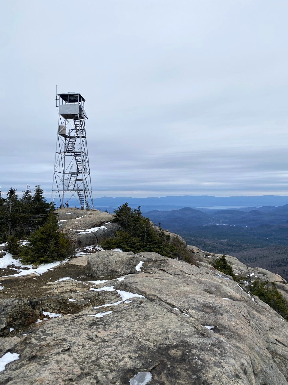
Maybe it was the solitude, or the fire tower, or even the fact that it was shoulder season, so all the foliage chasers sat this one out that day. Whatever it was, it sure felt good to end in this moment.

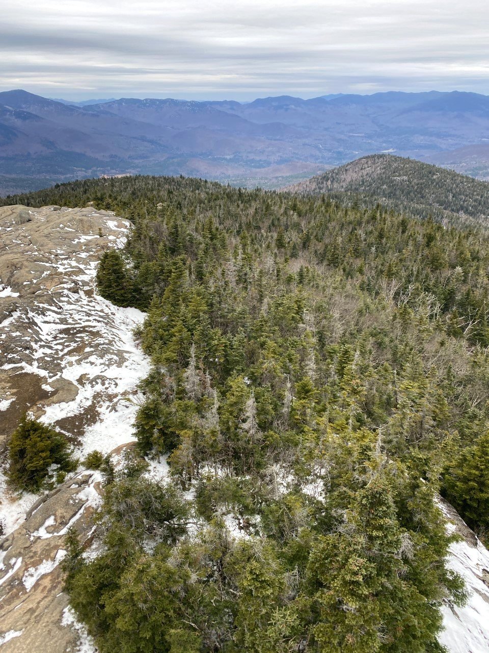
The hike up Hurricane Mountain offers incredible views from the summit, as well as from the fire tower.
My very straightforward route is on the left.
Are you ready for a winter challenge? Take on the Lake Placid 9 in the winter months to earn a special patch for the added difficulty of navigating winter.
Would you hike these nine mountains? Let me know!