
The Best Local Hike in Western Massachusetts
Everything you need to know about the best local gem hike in Western Mass…

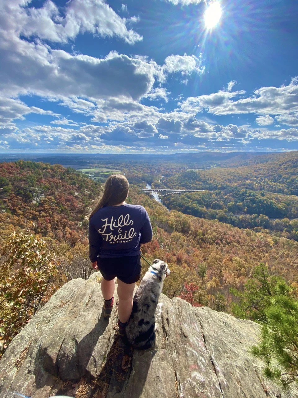
Tekoa’s rocky ledge viewpoint is Western Massachusetts’ best-kept secret. Read on to find out how to get here.
One of the top reasons on my list for wanting to move to Western Massachusetts was for the outdoor adventuring. Growing up in a suburb of Dallas, hiking looked like going to local park and exploring the woods. It was a great way to pass a Saturday afternoon (and who can complain about time spent outdoors/), but I craved more. I wanted longer trails. Elevation gain. Summit views.
Western Mass has this hidden beauty that only those who visit will ever uncover. Most people who visit Massachusetts frequent Boston or the Cape. There’s a running joke up here that Worcester is Western Massachusetts to Bostonians. Very few take the scenic drive out to what I consider to be the real gem of the state.
I may be biased, but Western Mass has it all—from outdoorsy adventures to breweries, to easy access to day trips. In the six years I have resided here, I frequent many of the same trails. In the last year, however, I discovered countless new ones. My all-time favorite? Tekoa Mountain. And here’s why.
Tekoa is something special.
It’s not easily accessible. It’s not a walk in the woods like many Western Mass favorites. It’s immersed in nature. Untouched, it feels like. Overgrown at times. Rarely do I see other hikers on this mountain despite its beauty.
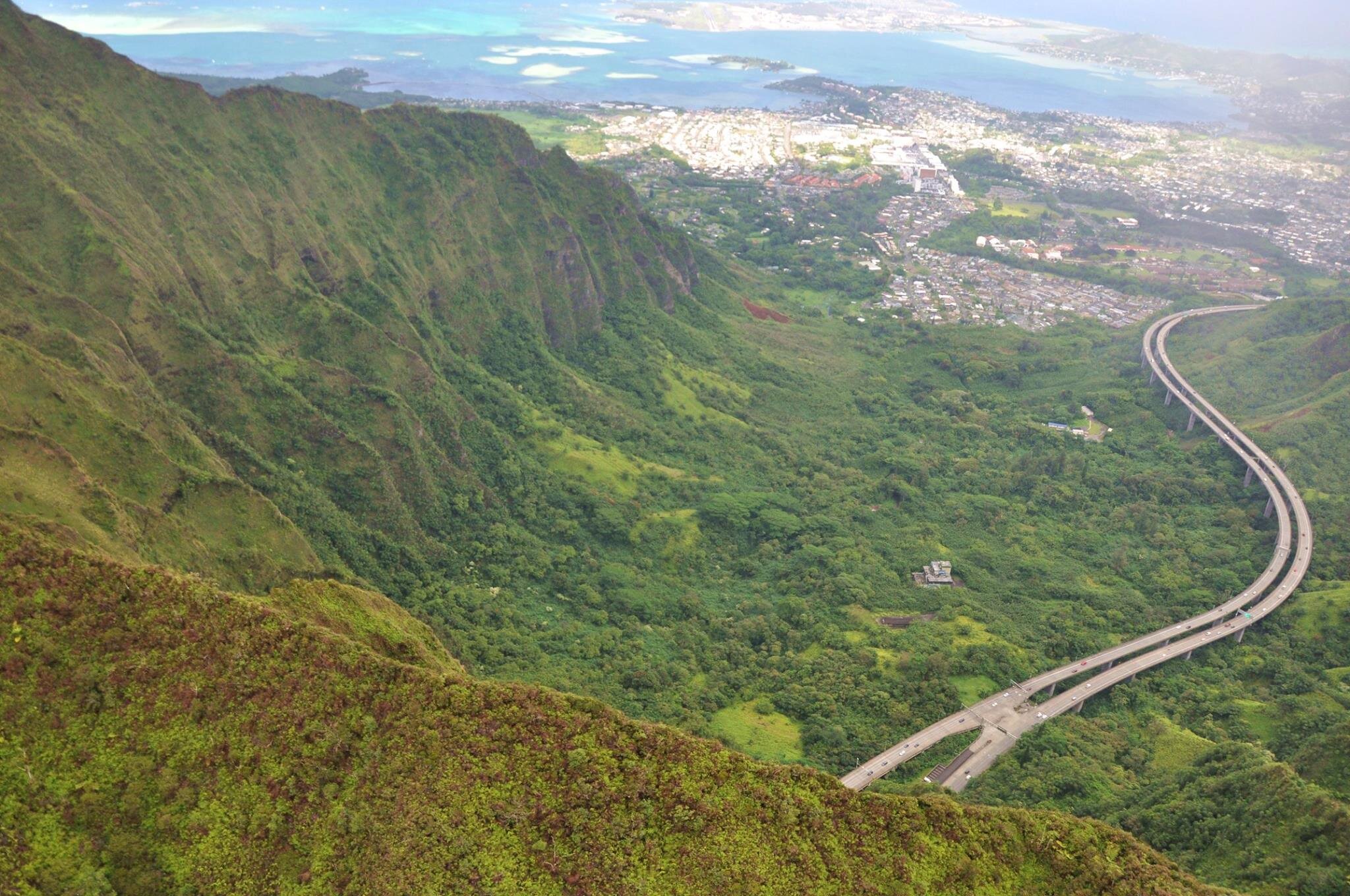
I first stumbled upon it on a solo drive to upstate New York. Everyone driving to that area of New York on the Mass Pike crosses over a bridge that showcases encompassing valley views. Yes, that bridge you see way down there in the images above.
If you’re able to glance long enough, you notice a rocky ledge on the upper righthand side. After I caught sight of it for the first time, I made a mental note of the town I was driving through (Russell, MA), and researched it as soon as I could. Want to know what I found?

Nothing.
No trail maps, no trail reviews—nothing on AllTrails, and that says something.
I found a few comments about a steep route up that involved a sketchy parking situation that I was not keen on venturing into. I put off the search for a couple years and decided to try again last fall. I lucked out after some digging and found a legal parking spot. With a little trial, some error, and a sprinkle of wrong turns, I finally found my favorite outdoor gem in Western Massachusetts and it sure was worth the wait.
Everything you need to know about hiking to the ledge atop Tekoa Mountain:
Parking – This is the trickiest part. The safest parking I found is along a residential road that ends with a gate that the town needs access to. There is room for about five cars to avoid blocking the gate. I plug in 48 Reservoir Road, Westfield, MA into Google Maps. This is technically in the town of Montgomery, but it will show up as Westfield. Once you’re on this quiet road, drive to the end. Park there. Again, be sure to not block the gate.
Cost – Free!
Distance – About 5 miles out-and-back with a little over 1,000 feet elevation gain. There is an option to make a loop at the summit for a sunset view and different vantage point of the valley (with a little bushwhacking involved). If I could do it as a beginner bushwhacker, so can you! Sunset technically can’t be seen from the ledge, so this loop is great if you want that sunbeam shining through.
Difficulty – The reason this hike is my absolute favorite (and a Western Massachusetts hidden gem) is because most people think they need to travel a far distance for a tougher hike. I was one of those people, so I totally get it. What I love about this hike is that it’s local, peaceful, and has a climb. I love those short, easy hikes as much as the next hiker, but there’s something to be said for putting in the work and getting the payout once you reach the summit.

The route I take (logged on Strava) is above. From the parking to the viewpoint as an out-and-back.
Trail Details – After parking on Reservoir Road, follow the road behind the gate for a little under half a mile. It’s a steady, slight climb on a wide, gravel road. Veer left at the half mile mark and you’ll approach a gorgeous view atop a bridge of the Tekoa Reservoir. The calming stream and serene surroundings provides a great opportunity to catch your breath and enjoy the scenery.
When you’re ready, continue onwards and upwards. You’ll reach a Y intersection. Take the right, even though there’s a very official-looking sign on the left (it’s an informational sign). It’s not the direction you want for this hike.
Coming up is one of the best parts of this hike: the climb. After you turn right, you’ll follow along Moose Meadow Brook until you’re about a mile in. Here’s where I’ve gone astray far too many times. As you approach a mile, keep your eyes peeled for a left turn off the road into a dirt trail. It’s easy to miss if you’re deep in conversation, trail running, or just enjoying your hike. You’ll know you went too far if you cross another scenic bridge at a mile in. This bridge is great, but it means you missed the turn.
Once you’re in the woods, a gorgeous, well-trekked walk along a stream before the climb kicks in around a mile and a half in awaits you. This is one of my favorite parts of this hike because I have yet to come across anyone on this trail. It’s just the sound of the stream, the chirping of birds, and me. And my thoughts of bear encounters flooding in, of course. The first big climb of the hike flattens out for a tenth of a mile before beginning the final ascent to the ridgeline. Continue following the yellow markers. Though I usually see chipmunks or squirrels on this hike, I saw a bear for the first time here in May.

Tekoa in Winter
After one lovely dumping of snow, I knew I had to get out on the trail up Tekoa. It definitely did not disappoint. Snowshoes would have been a smart choice considering how infrequently traversed this trail is.
Depending on the season, the trail here is not maintained well. Be sure to bring bug spray or wear long pants to avoid any fun bug or plant reactions.
Once you finish that second, steep climb, you will find your trail opens up like a T. There are red markers here to remind you to take this trail back. Take a left and follow the yellow markers until you reach the summit. There are a few rolling hills and some rusty car parts along the way.
The viewpoint is approached from a wide clearing at the top with distant views of Springfield to your left. Take the trail to the right of the rock pile to reach the iconic, rocky ledge view you may have seen from the Mass Pike.
As always, please leave no trace. Whatever you bring onto the hike, please take back out with you to ensure this local gem stays beautiful for everyone.

You really cannot go wrong with any season you choose to accomplish this hike in. From foliage in the fall, to snow-capped hills in the winter, to the luscious greenery of spring — the constancy of a great view remains unchanged.
Tip: This is an incredible spot for sunset, and though the trail itself is not maintained well in terms of overgrowth, the trail markers have reflective stickers on them. For someone who is easily distracted in nature, I found these stickers so helpful with my headlamp even while trail running post-sunset.
What makes your favorite hike your favorite? Are you adding Tekoa to your list of must do hikes in Massachusetts? I’d love to know!
If you’re looking for more New England hikes and gems, you’ll enjoy:

How to Spend 24 Hours in Ithaca, New York
Here’s what to do with 24 hours in Ithaca, New York:
1. Hike in…
One part about teaching in New England I love is having an additional winter break. A week off in February right when the days are short, and the weather is cold is perfect. A close friend of mine from Texas decided to visit for the weekend with only one request: to experience winter.
After a few warmer days, I knew we needed to head north. One spot that’s always been on my list is Ithaca. Known mostly for two colleges in town, Cornell and Ithaca College, Ithaca has way more to offer than an incredible education.
A quaint, charming town way north of the common New York city experience proved to be the perfect winter getaway.
Here’s how we spent a day in Ithaca, New York:
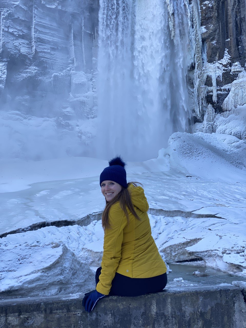
1. Hike in Taughannock Falls State Park.
Taughannock Falls in all its wintry glory.
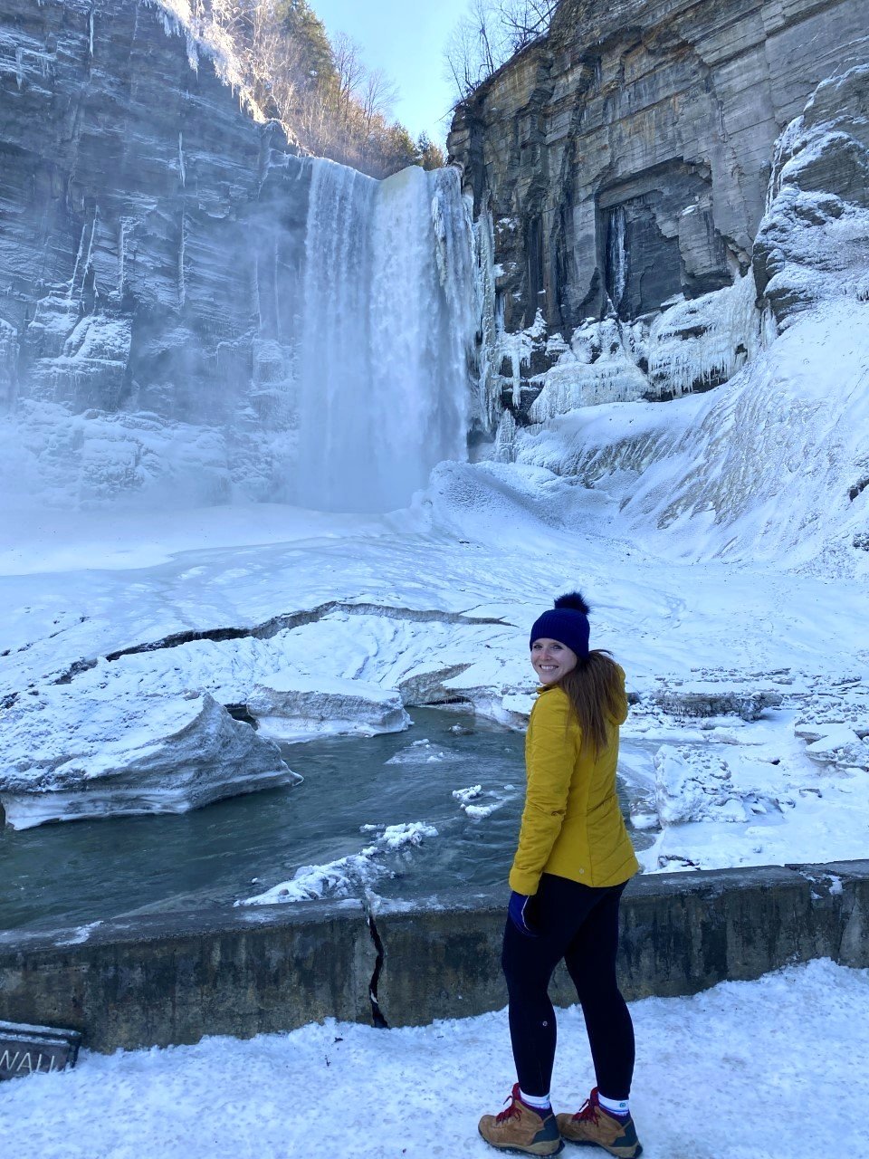
Hike is a loose term given the usual hikes I find myself chasing after. This time, we were chasing waterfalls instead. Taughannock Falls features a massive, 215-foot waterfall. And in winter, you can bet there’s incredible icy formations all around.
The park is popular, but we arrived in the afternoon and managed to snag a parking spot right away. Though the lot is small, the hike itself is a quick walk, so there likely wouldn’t be a long wait for another car to exit shortly.

From the parking lot, we walked on a mostly paved path. The path is extremely scenic – you easily forget you’re relatively close to civilization and it’s a wonder this isn’t a more popular destination.
High cliffs, a rushing river, and the winter magic made this trek feel like we were hiking in a national park.
We reached a short bridge about ¾ of a mile into our walk. The falls are visible from this bridge, but we walked a bit further on the path to get a close-up view.
Surprisingly, Taughannock Falls is actually three stories taller than Niagara Falls (not too far away from Ithaca). I’m not a big waterfall gal, but winter changes the game for me. This view was stunning and I couldn’t get enough!
Once you get your dose, drive up the road a couple minutes for a birds-eye-view of the falls from the overlook.
Things to note:
Both the trails mentioned above are open year-round, while the rim ones are not.
There is a $7 park entrance fee. The overlook is free though!
Dogs are allowed on a leash!
2. Peek into Cornell University’s Uris library.
I love a good library, and Cornell’s Uris Library is quite the gem. Think Belle from Beauty and Beast’s library meets J.K.’s Rowling’s rendition in her novels. The best part? It’s open twenty-four hours with incredible sunset views over nearby Cayuga Lake.
It was peacefully quiet when we entered and remained so as we explored. If you’re a book lover, it’s worth a quick stop here.

We did feel odd being back on a college campus after graduating several years ago. I definitely had flashbacks to all the late nights in the PCL library in Austin. I probably would’ve enjoyed going to the library more with views like these though (or I might’ve studied more…).

3. Grab dinner in Ithaca Commons.
I had major New England vibes in Ithaca Commons – pedestrian-only for a couple blocks of shops and restaurants. Parking was easy to find once we navigated the streets.
One of my favorite finds in a new town is walking along the main street, or in this case, the Commons.
Similar to Burlington, Vermont, Ithaca comes alive in this area. A few restaurants were closed Sunday when we visited (and a few closed permanently, sadly), but there were a handful of delicious options on this last-minute trip.

3. Enjoy a bagel breakfast at Collegetown Bagels.
Since we had a four-and-a-half-hour drive home to Western Mass, we needed to head out early in the morning, but not before finding a coffee and breakfast spot.
We enjoyed a fresh cup of coffee from Gimme! Coffee, followed by bagels from Collegetown Bagels.
Collegetown had every type of breakfast sandwich imaginable and felt like the place you could create something wild and they’d make it happen.
I had the Rise n’ Shine with a couple changes: a bagel with jalapeño cream cheese, roasted red peppers, provolone, and sausage. Anytime there’s jalapeño cream cheese on the menu, you can almost guarantee I’ll be ordering it.
I suggest grabbing the bagels to go and heading to the final stop on the itinerary: Ithaca Falls.

4. Look in awe at Ithaca Falls.
I told my friends I had one more surprise in store. When I parked in an empty parking lot off a street, they were confused. They followed me for a minute and were immediately awestruck by Ithaca Falls.
This waterfall is literally on the side of the road. How is Ithaca so lucky?
Tip: The path down to the falls is paved, but with the wintry weather, it had a lovely layer of ice on top. I used microspikes to get to the bottom of the falls.
We stayed at a charming, pet-friendly, and very affordable AirBnB just moments from Ithaca Commons, which made all the adventuring in under twenty-four hours possible!
Though we only checked out two waterfalls, the Ithaca area is actually home to over one hundred waterfalls. It’s one-liner is “Ithaca is gorges.” So fitting. Have you visited any?
If you enjoyed this post, you may also like:
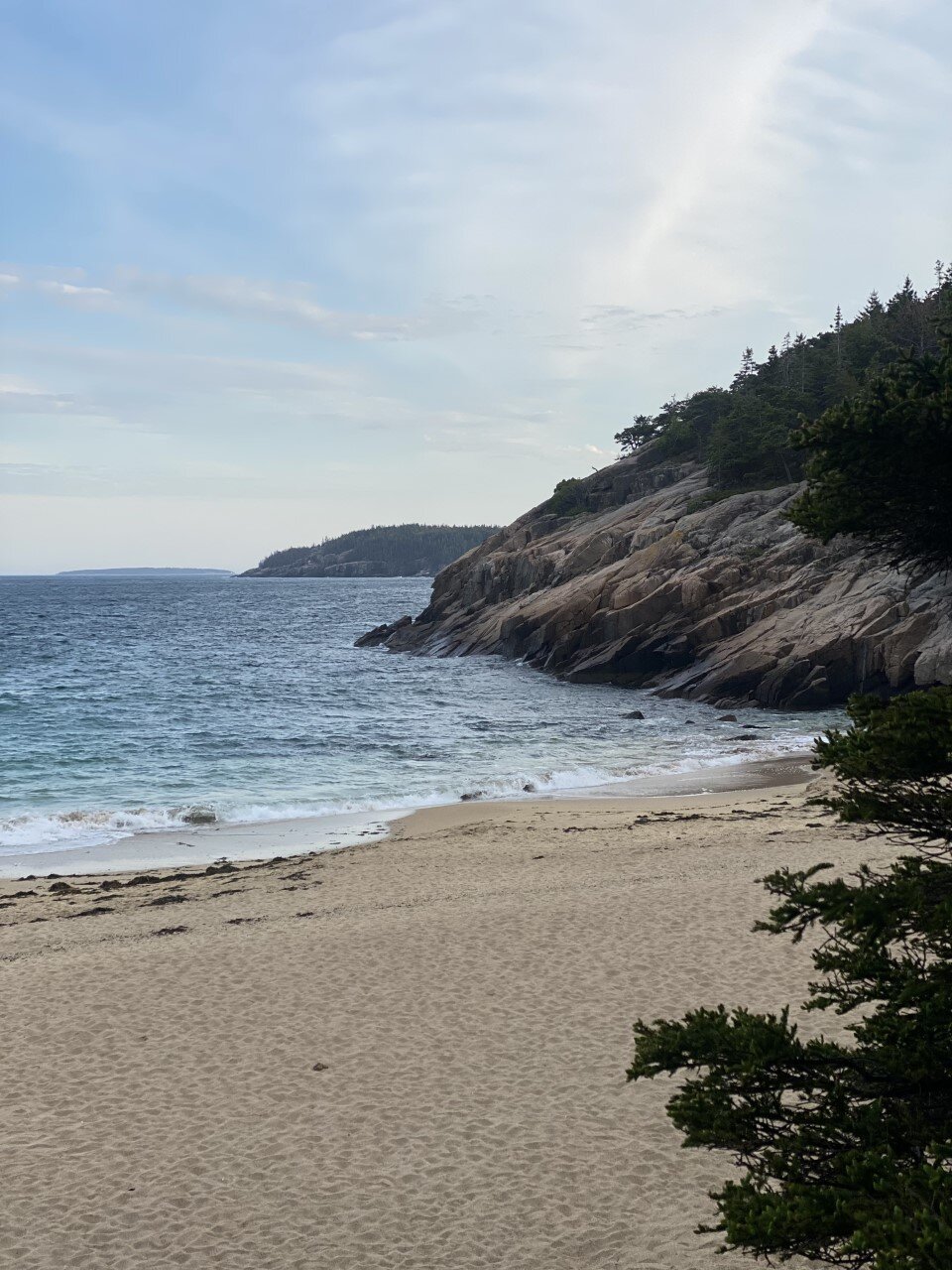
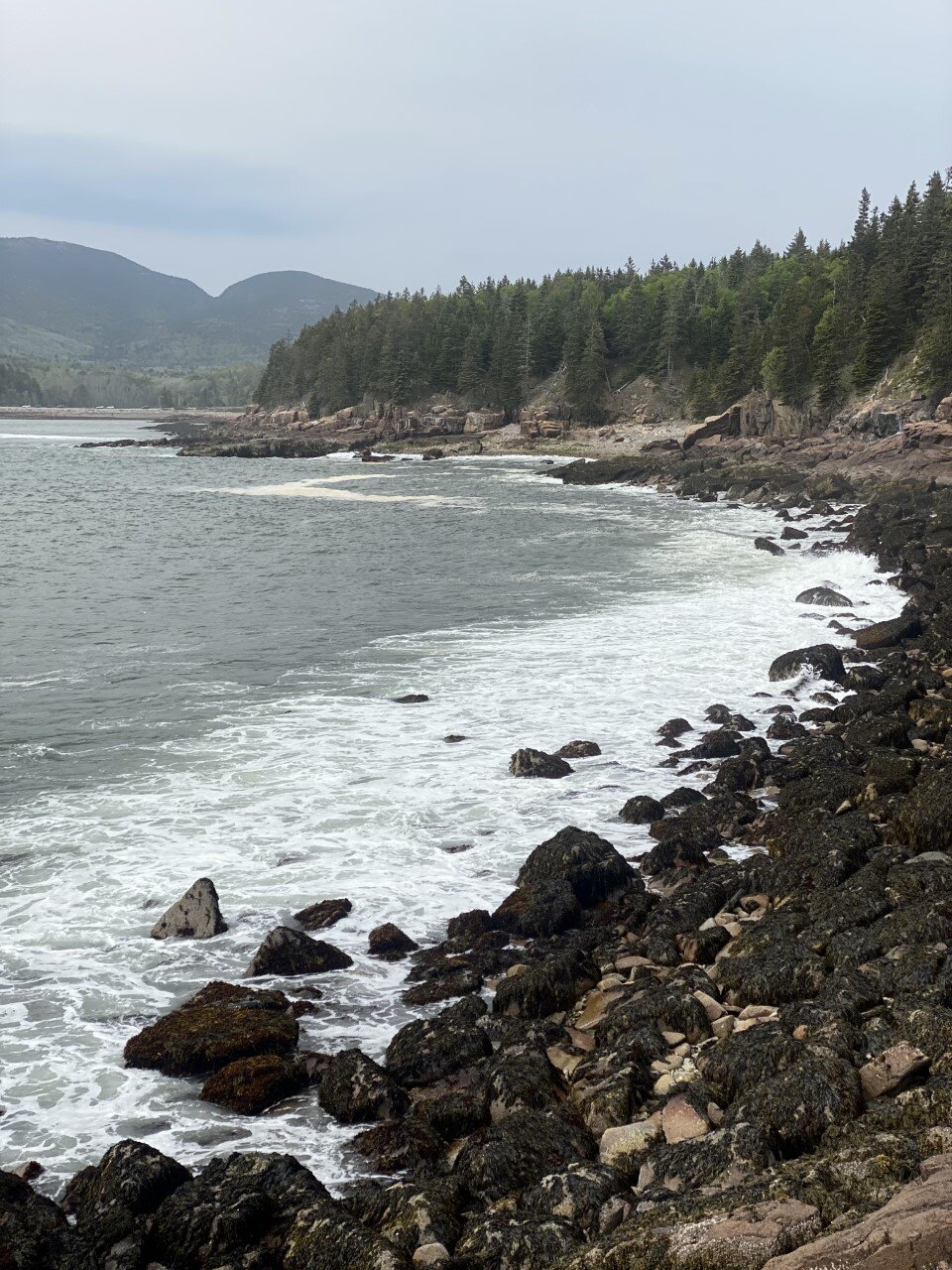
Everything You Need to See in Acadia National Park, Maine

4 Tips for Taking the Best Foliage Photos in New England
In the last five autumns I’ve spent chasing the foliage in New England and upstate New York, I’ve come up with a handful of tips through…
When I moved to New England, I didn’t know what I was getting myself into with seasons. In Texas, we’re either in summer or a chillier version of summer. What I wasn’t ready for is just how stunning fall can be. Contrastly, it can also be very difficult to decipher how to photograph such beautiful scenes.
In the last five autumns I’ve spent chasing the foliage in New England and upstate New York, I’ve come up with a handful of tips through long drives, failed hikes, and hidden gems of how to find the best photos of foliage. My pictures below are from the Adirondacks, which isn’t technically New England as it’s in New York, but given the proximity to the other mountains I frequent, the foliage timing and tips are very similar.
Here are my tips for how to take the best fall foliage photos in the Northeast:
1. If the weather is gloomy, it’s still worth making the trip.

The rain stopped when I reached the summit of Baxter Mountain and the clouds were sweeping through the layers and layers of mountains.
I used to only hike in what I considered ideal weather conditions. It had to be a sunny or clear sky, or absolutely no chance of rain. You wouldn’t catch me hiking in the rain. Wet socks, potentially wet camera gear – not my idea of a good time.
Last weekend, I was eager to get back to the Adirondacks. The only setback was a 100% chance of showers from when I arrived late Friday night to when I was leaving Sunday afternoon. I could’ve canceled. I could’ve stayed in western Massachusetts and shifted gears.
Instead, north I drove. Rainy weather has a unique way of bringing out foliage. It’s the weather of autumn and I’m embracing it this year, instead of turning away from it. Rain brings moodiness to the mountains with low moving clouds. I’m gravitating more toward this moodiness over bluebird days because you can’t plan for this scenery. It just happens because you went out and took a chance.

A cloudy day when the clouds break to let the sunlight in makes for one of my favorite views.
2. Hike lower elevations.
You don’t need to pick a 16-mile, 2,000 foot elevation gain hike to see the foliage. A drive through Lake Placid will easily give you the fall vibes! I highly recommend finding short hikes in the area you want to explore. Often times, they may not be as popular as most people are chasing a hiking list of the high peaks.
If you’re looking at the White Mountains, find a hike in the Lakes region or a less popular hike like Welch and Dickey. Shorter hikes often have parking more available as hikers head in and out at a faster pace. If you’re looking at the Adirondacks, the Lake Placid 9 (9 peaks around Lake Placid) are definitely worthwhile.

When I say hike low, I mean you don’t need to aim for 4,000 footers. Unless you want to! I decided to chase the foliage this year, and not the high peaks for autumn views.

Aerial views provided by reaching the summit of Baxter Mountain.
Don’t be fooled at these lower elevation hikes. The gain is still sweat-breaking! On some of the Lake Placid 9 hikes, you’re gaining 700-800 feet in a mile. Impressive for a 2-3 mile roundtrip hike.

Incredible views after a short hike up Mt. Van Hoevenberg.
3. Pull over when you see a worthwhile view.
There are so many incredible spots around the mountains to pull over safely and snap a photo. Think: rivers, trees, and small towns. Two weekends ago, as I was driving from Lake Placid to Wilmington, I saw a fishing spot that looked scenic.

A beautiful view of Whiteface Mountain from a parking spot at a fishing spot.
I pulled over next to a few fishermen, headed down the bank, and snapped a few shots of falls with foliage galore.

Lake Placid added a new lookout point along Mirror Lake. I stopped when I saw this view while driving by.
4. Don’t expect the perfect shot.
Most photographers edit their photos with fancy programs, so don’t go in thinking you’ll have an incredible aerial view of a mountain lake from a summit. Professional photographers are very good at their jobs – and editing is part of that!
The weather during fall is also very unpredictable. Even if the forecast calls for clouds, you may end up with constant downpour. If it calls for rain, you might get sunburnt because the sun will come out. You never know what you’re going to get – so get out there and be prepared!
Autumn is the perfect season for those moody mountain pictures. In these last couple trips, I’m more and more welcoming of clouds and rainy weather!

A rainy day led to an opening of the skies at the summit of Big Crow mountain.
Last weekend, I planned to call it quits early because of the nonstop rain. Instead, I tied my laces and headed up one of the Lake Placid 9 in Keene, New York. The rain had miraculously ceased and from the skies the clouds parted. I was enamored with foliage views for miles. And mountains immersed in the clouds. Had I just headed home early, I would’ve missed this view.
It wasn’t planned. It wasn’t the view I had seen when researching this hike. To me, it’s the perfect shot to remember the awesome feeling of a new experience hiking solo in new places.

Do you go leaf peeping? What tips would you offer someone trying to see all that foliage has to offer?

Everything You Need to See in Acadia National Park, Maine
Here’s everything you need to see and do in a weekend in Maine’s (and really, the Northeast’s) gem:
Ah, Acadia National Park — where the mountains meet the ocean. Truly, the best of both worlds.
Five years ago, I told myself I’d never run another half marathon unless it was somewhere scenic. It’s not too much to ask for to need great views when you’re running for more than two hours, right? As a result, when I came across a race in Acadia National Park, I thought to myself, this is exactly the place I would run a long race in. And so, I signed up.

I camped with a few friends on park grounds, spent the night gazing at the stars on rocks with the Atlantic breeze chilling my face. I rose the next day, ran for what felt like forever (turns out it’s a hilly course), and experienced Acadia for a brief moment.
Fast forward five years and it felt like time to revisit this spot. We stayed at a KOA (my go-to stay spot for adventures) minutes from Bar Harbor and the park. My first visit, despite running so many miles through the park, didn’t really result in me truly experiencing the park. This time around, we had an agenda full of Acadia adventures to enjoy.
New Englanders are at a slight disadvantage with the National Park system with Acadia being the only national park in the area, but a major advantage is that it’s within driving distance! For us in Western Mass, this drive is about five hours. Not rough at all considering the Adirondacks are a little over a four hour drive and I consider that a day trip sometimes.
If you find yourself looking for local adventure, or wanting to experience the beauty of coastal Maine, Acadia should move up to the top of your travel list.
Here’s everything you need to see and do in a weekend in Maine’s (and really, the Northeast’s) gem:
Hikes

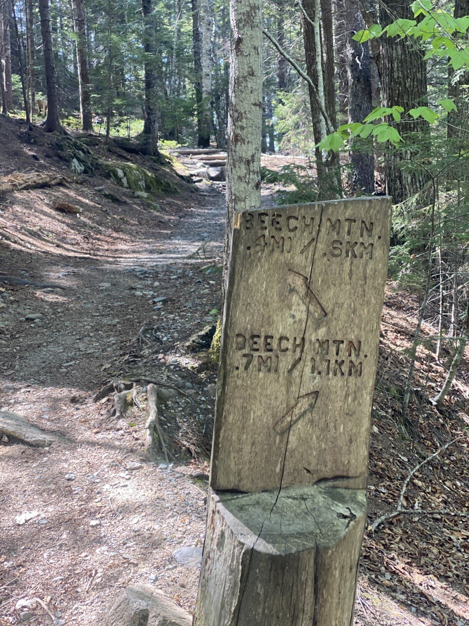
Beech Mountain
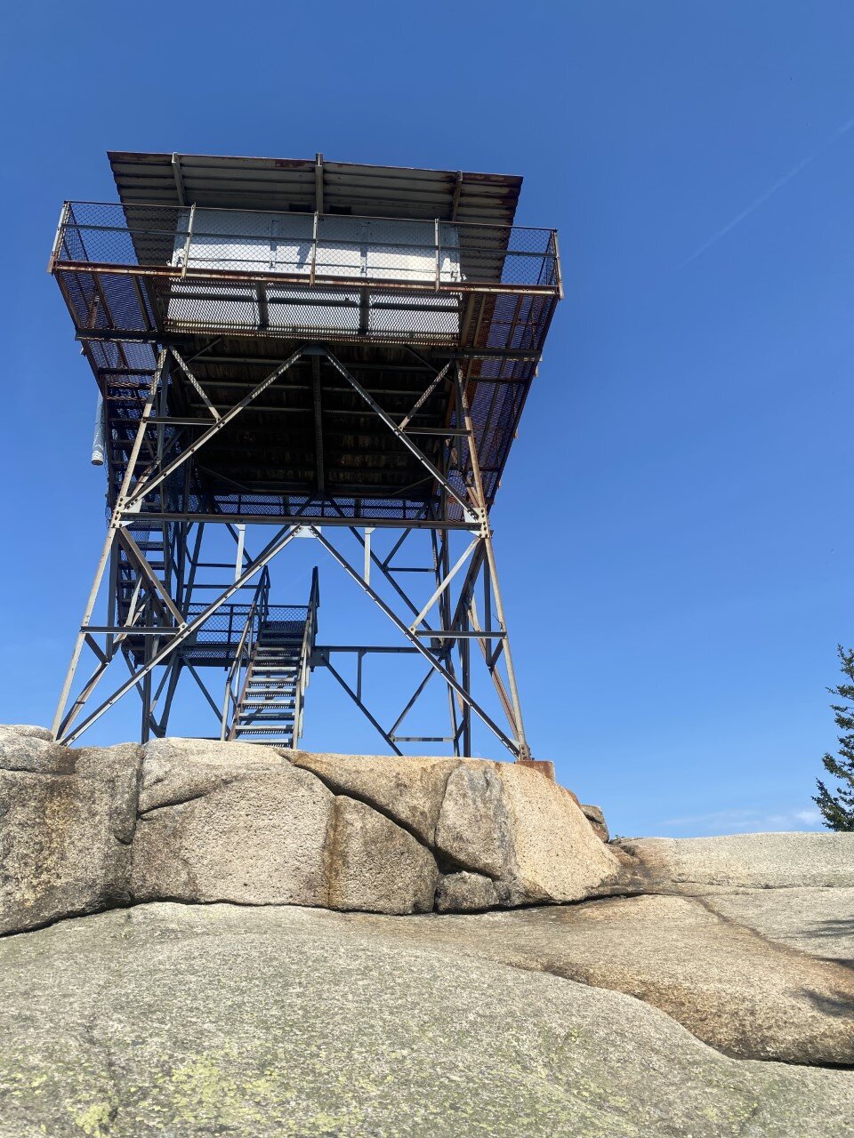
A short, somewhat rocky hike up to a fire tower with stunning views of Echo Lake and nearby peaks. The total hike is a little over a mile. I suggest hiking clockwise for the best views on this loop (along the .4 mi of the trail). You can make it about halfway up the fire tower for a better birds-eye-view. On your way down on the loop, the views get even better. I highly recommend this hike in the afternoon on a sunny day. It’s dog-friendly as well!
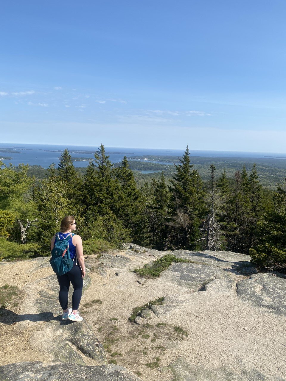
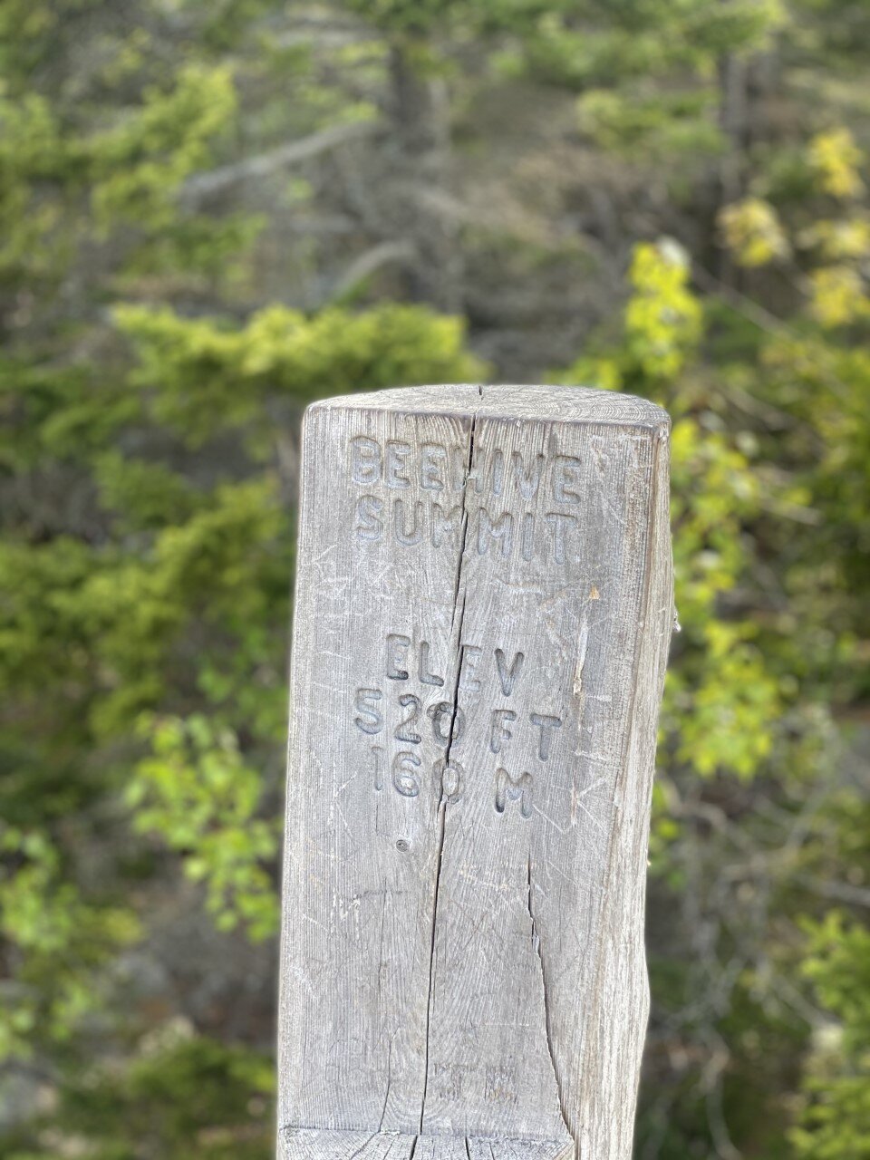
Beehive Mountain
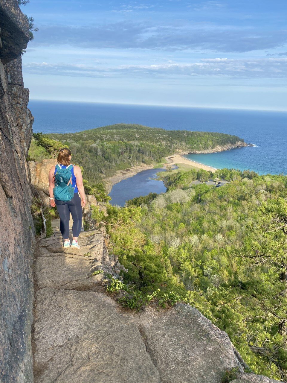
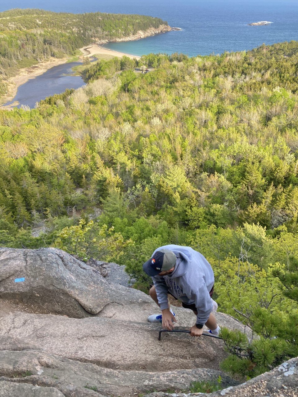
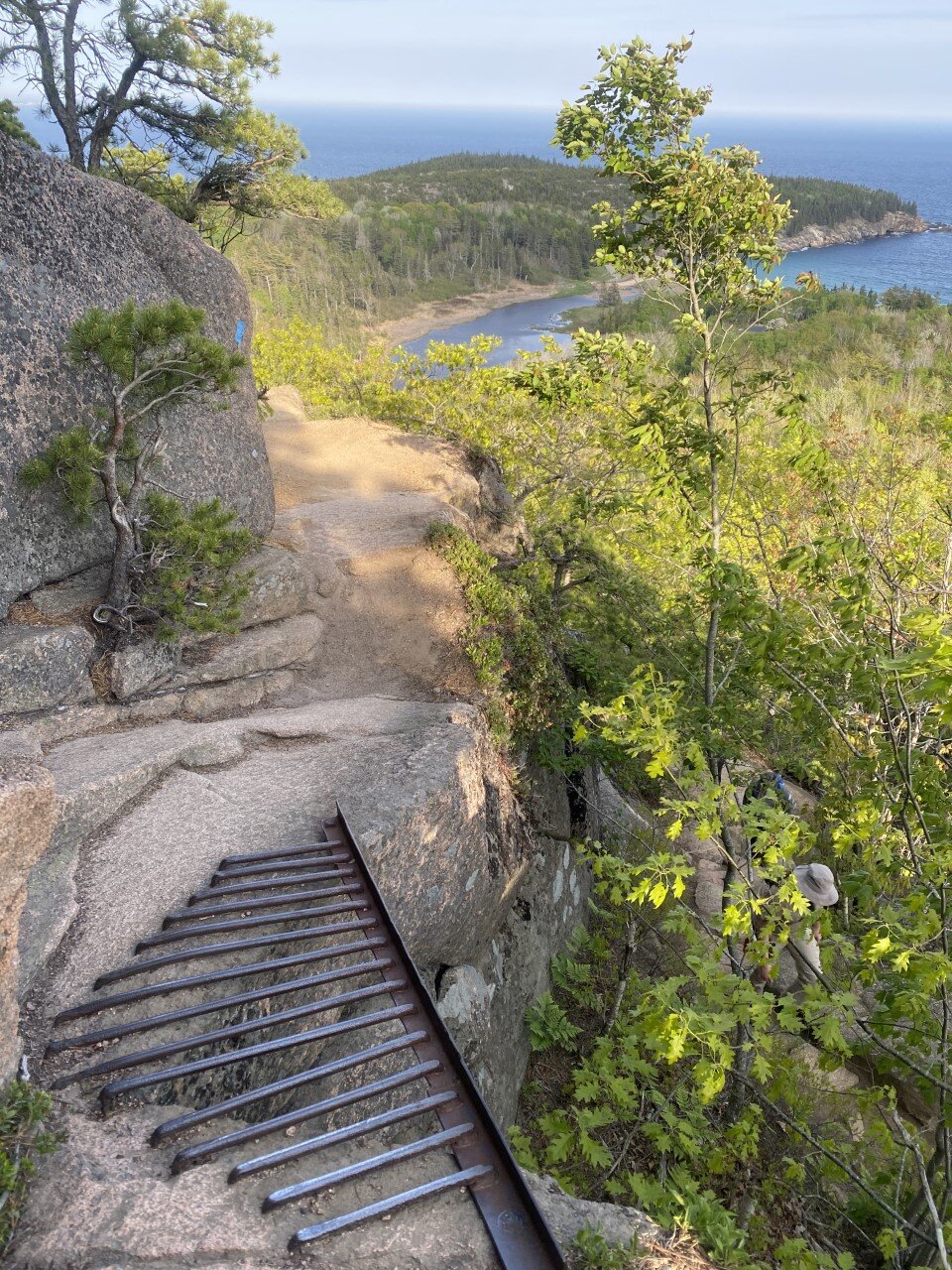
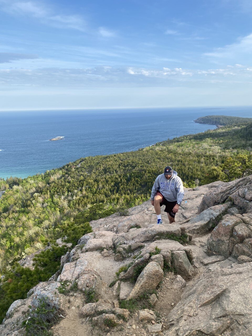
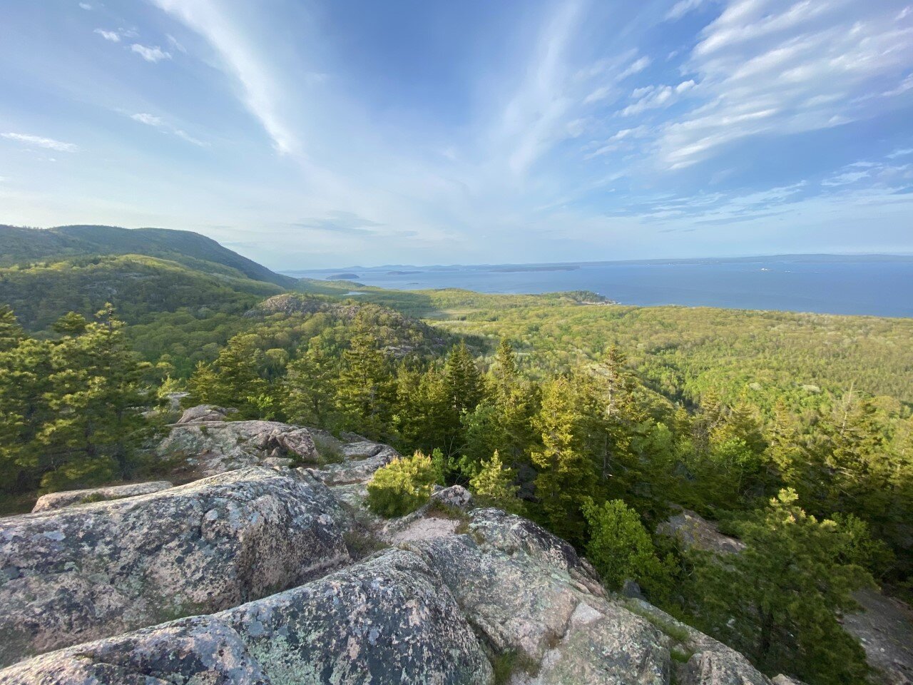
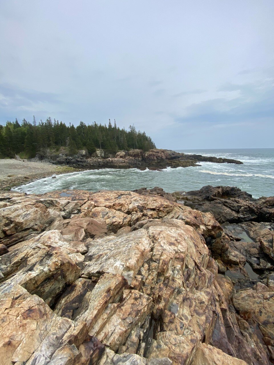
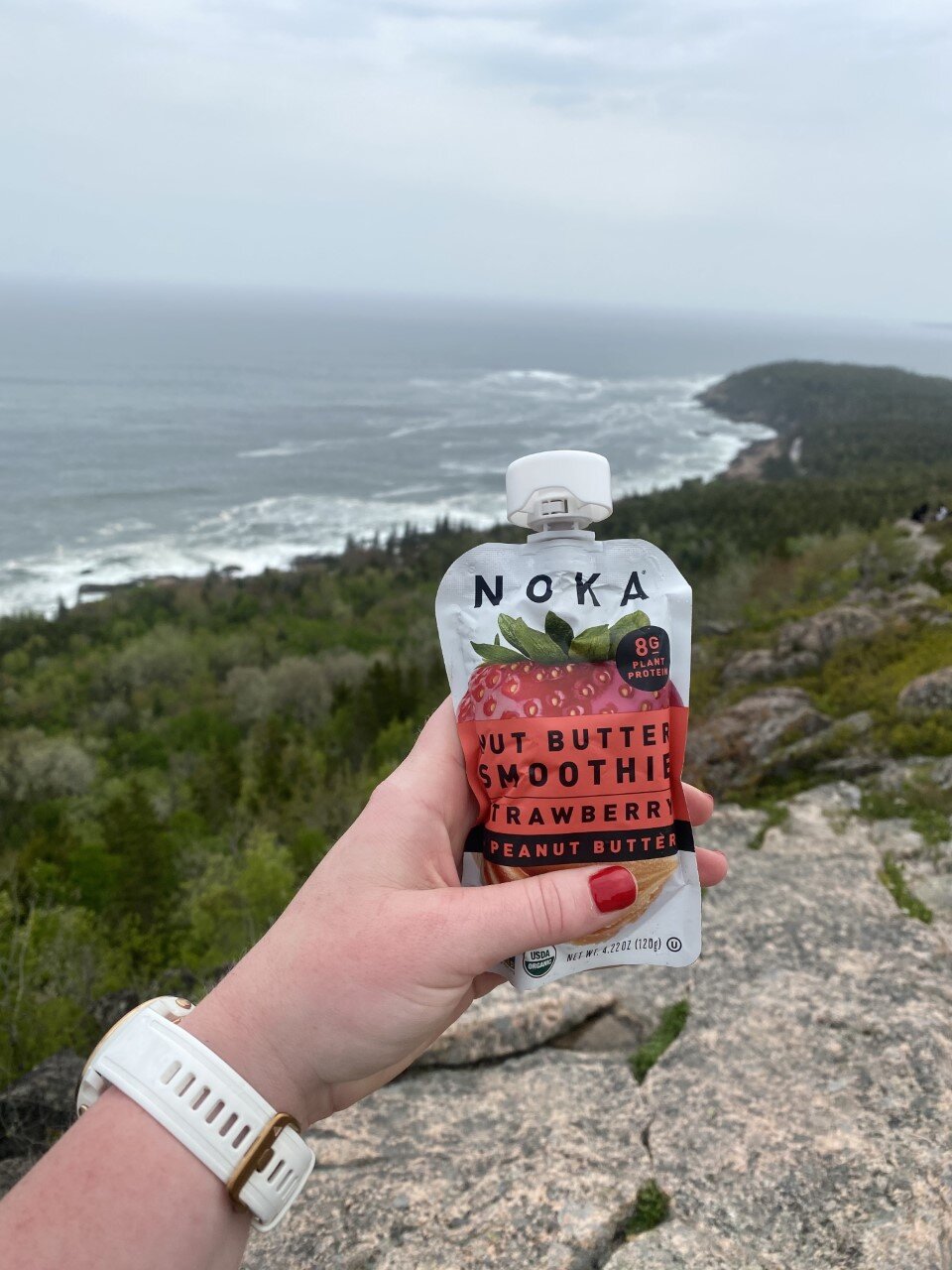
The Beehive trail has been at the top of list. I hike often, so anytime there is a little diversity in the type of terrain or trail, I jump at the opportunity to climb it. Beehive is particularly unique because of its steep incline involving rungs. I soaked it all in. One moment you’re walking along a rocky, dirt path staring up at the summit, and the next you’re climbing up rungs with your hands and gazing at the ocean and sandy beach below. Again, I’m a big fan of intriguing trails.
If you’re afraid of heights, I’d take this trail slow. It’s totally doable for all ages and completely worth it. Once you soak up the beach views, head up to the summit and immerse yourself in Norwegian-like greenery and islands. I felt like I was somewhere far away, a feeling I solemn get in New England, or the U.S. for that matter.
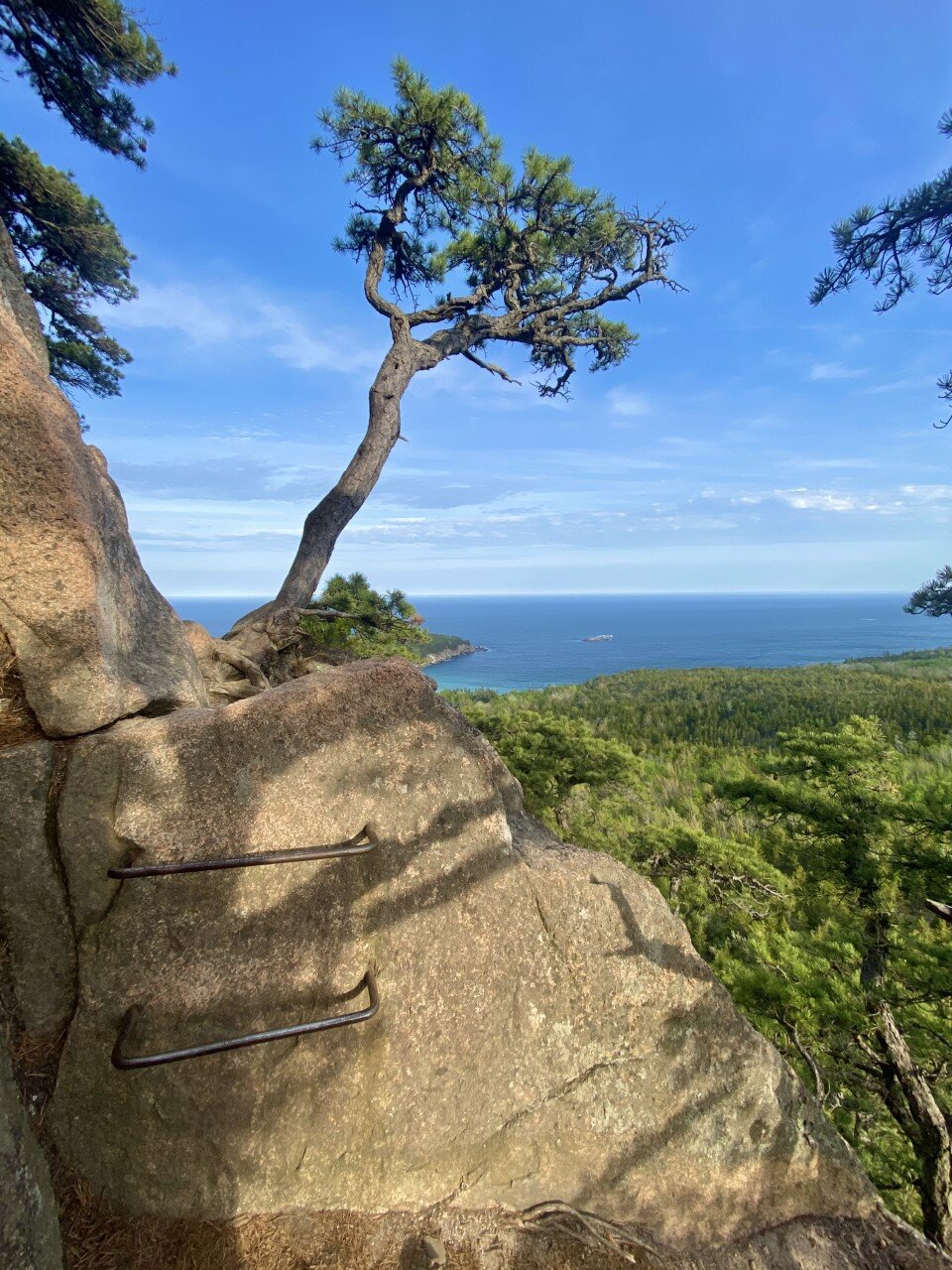
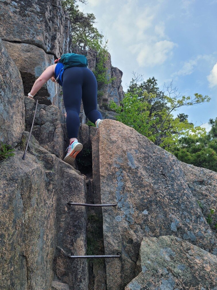
Precipice Trail
This trail sounds epic. More rungs, more incline, more steep drops - it’s my kind of adventure. You climb about 1,000 feet in under a mile. Unfortunately, both of my visits to Acadia have been in May and June, which is prime time for peregrine falcon nesting. This trail is often closed during late spring to summer for this reason. All the more reason for me to visit Acadia again one day in autumn!
Experiences:
View sunset at Bass Harbor Head Lighthouse.
Arrive an hour early to get a scenic spot on the rocks. Parking here is also limited. Bring a rain jacket as the waves enjoy crashing the rocks, thereby soaking you by default. Watch as the colors in the sky unfold before your eyes in vibrant orange and red hues.

Drive the 27-mile Park Loop road.
Stop along the way for hidden gems and solitude in spots like the ones below.

Watch the U.S.’s first sunrise at Cadillac Mountain. You need reservations for the busy summer months due to limited parking, so you’ll need to book a vehicle reservation to snag one of these coveted spots. If you’ve worked up an appetite since you woke up before 4 AM for this experience, head into Bar Harbor for breakfast at Jeannie’s Great Maine Breakfast. Always get a grilled blueberry muffin. Especially when in Maine.


Is Acadia on your list of places to explore? What are you most excited to see or do?

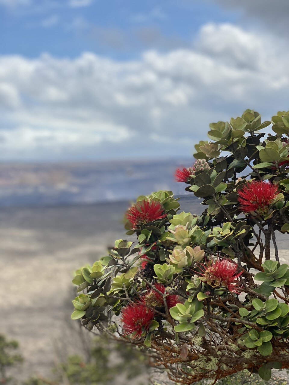
A Guide to Hawai’i Volcanoes National Park

My 32nd national park!
I knew the least about Big Island prior to visiting. All I knew was that Volcanoes National Park resided there, and so I needed to visit. That’s the beauty of wanting to achieve a list. Sometimes, in order to cross a place off, you find unexpected beauty. We stayed in this beautiful Airbnb off the grid right outside the park immersed in the rainforest. I highly recommend it if you’re planning to spend time at Volcanoes!
We headed into the park our first night, headlamps in tow. I usually try to limit my night explorations in unknown places, but seeing this park at nighttime is an absolute must.

The lava glow at Volcanoes National Park.
We drove into the park near the Kīlauea Visitor Center to explore the Kīlauea Overlook. The parking lot was nearly empty on this mid-April evening, and we walked the minute up to the overlook. We weren’t entirely prepared for what we were about to see, or in this instance, not see.
When researching this park, I knew an eruption occurred a few months earlier in December, and I was hoping to catch a glimpse of lava up close. I wanted the feel the radiating warmth of the lava against my skin, but instead I only felt the cool air bringing my body to a chill. If you make it out to this park at night, bring a jacket. Or two.
When we walked up to the Kīlauea Overlook, a hazy reddish hue like a gentle brushstroke of acrylic paint just touching the canvas for the first time caught our eye. “That’s it?” My friend remarked.
Instead of lava flow, we were met with lava glow. The glow appeared a deep orange and red blend on camera. A rarity for the picture to be more astounding than the image in reality. Below is the daytime view.
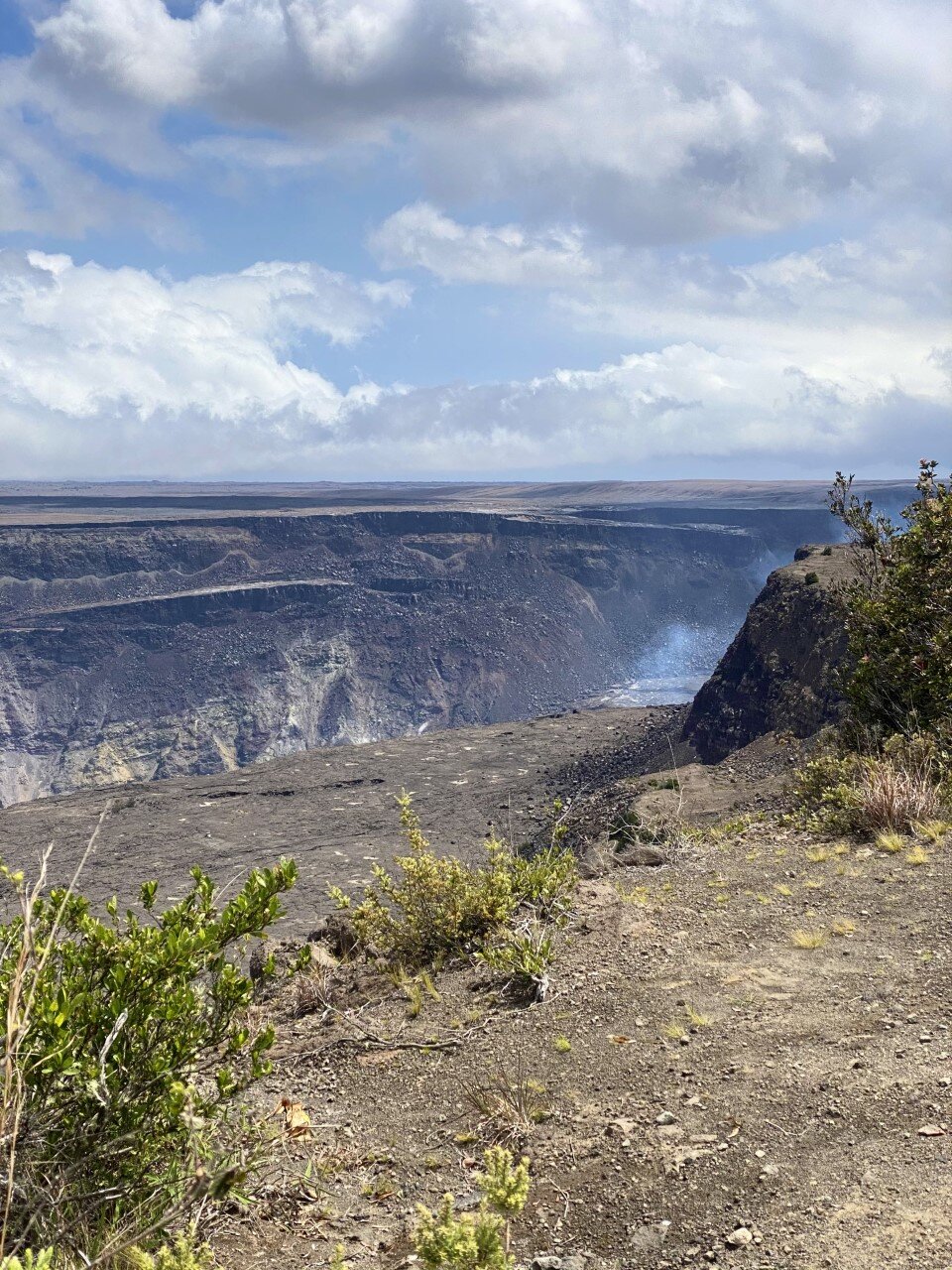
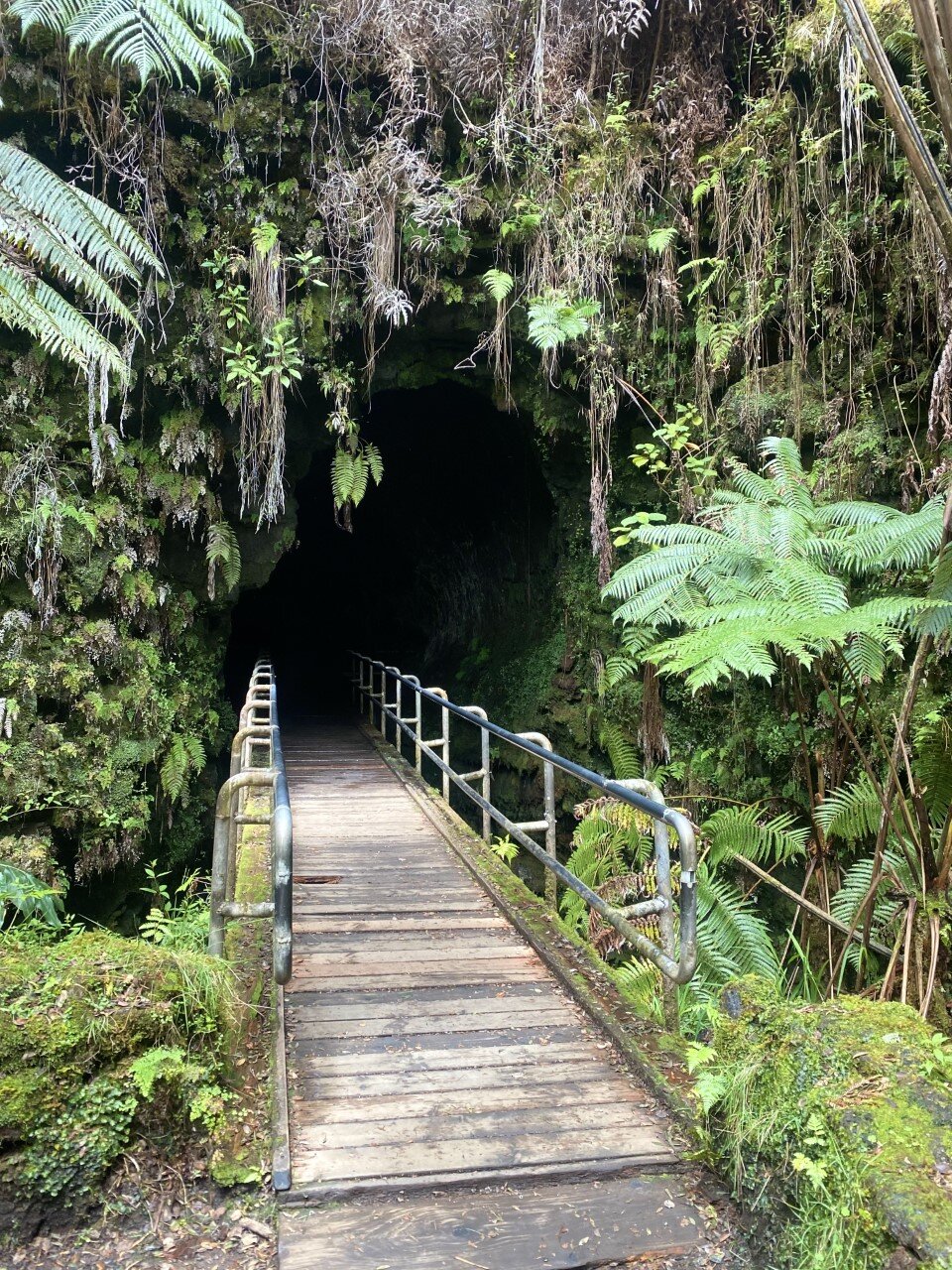
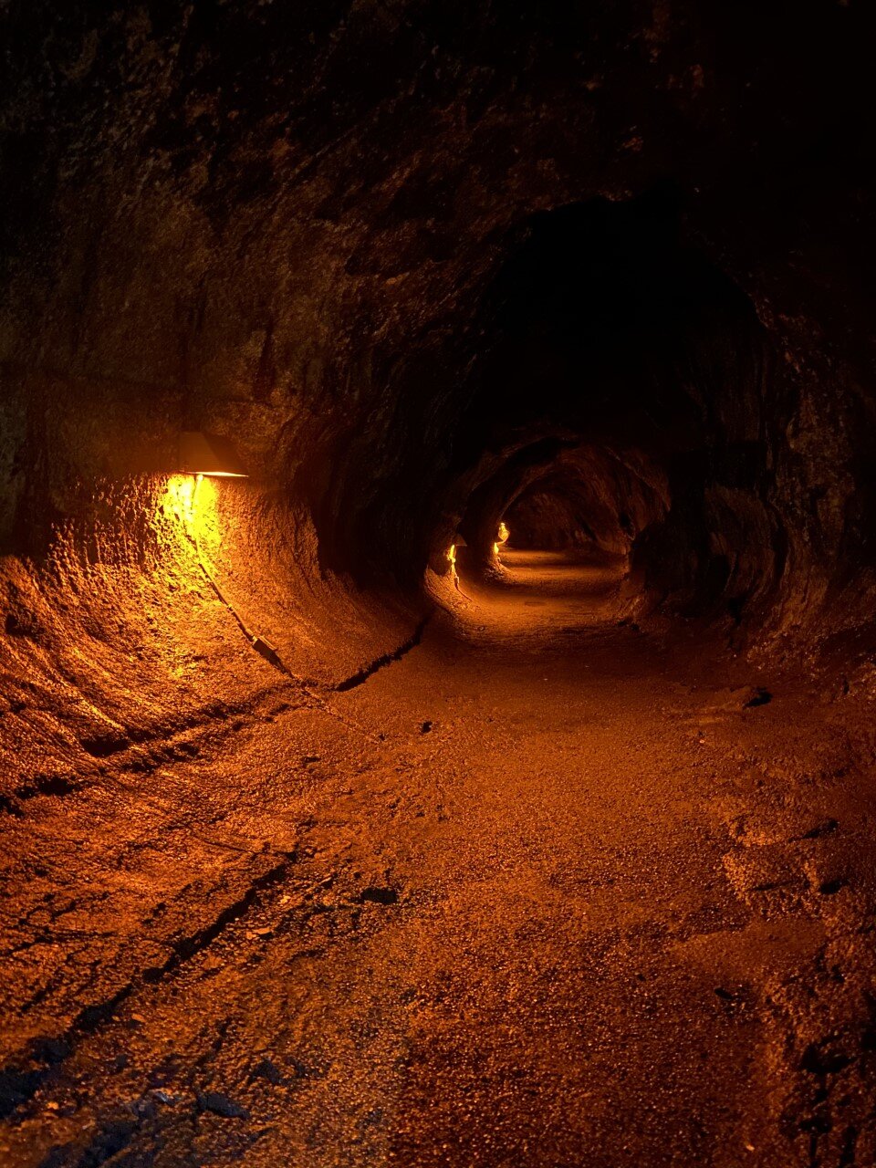
We explored the park in more depth the following day. We discovered another viewpoint at Volcano House that would be neat to see under a starry sky. We walked along the crater rim. Truthfully, I thought there would be hiking in this area, but all the sidewalks are very accessible and were all .2 or .3 miles of walking. Once we felt we had seen the crater enough, we drove onward to the Thurston lava tube. Another short traverse led us through a scenic rainforest and into a lit cave. At night, the lights are off if you want the full cave experience.

Across the street from the lava tube is a beautiful short trail as well with vistas of a crater floor you can actually hike down into and on!
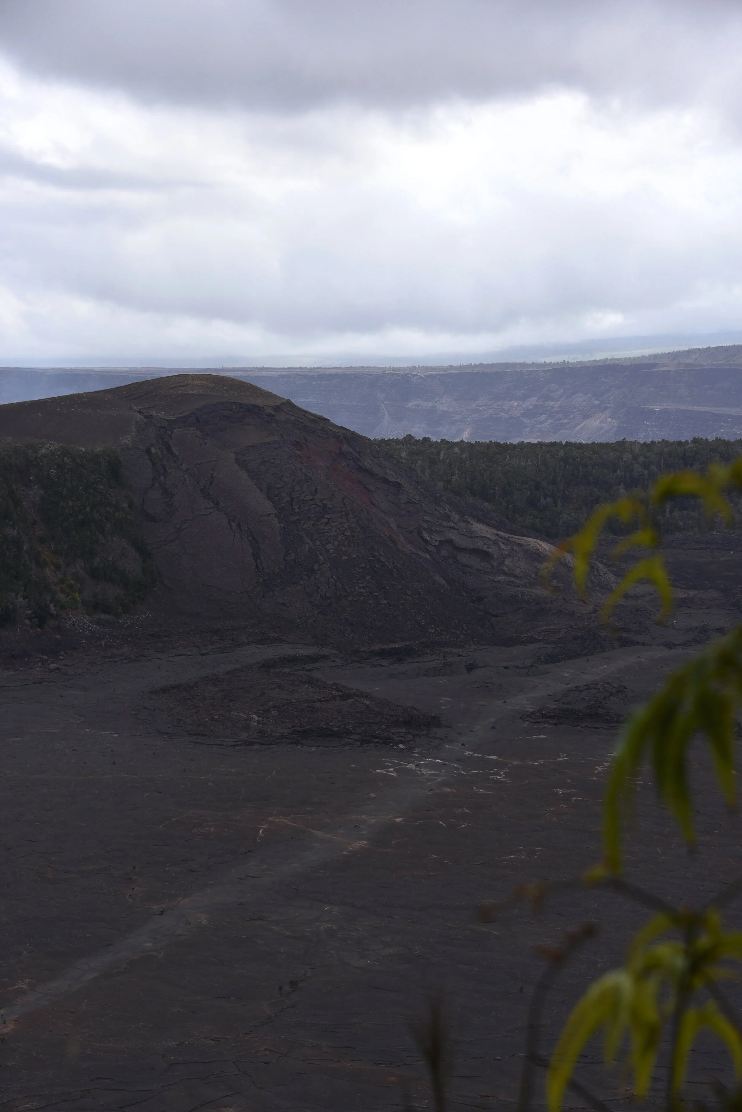
If I come back to Volcanoes one day, I would love to walk across the crater floor at the Kīlauea Iki Crater Overlook. It’s a 400 foot descent and a little over 3 miles of hiking down. The birds-eye-view is above.
We hopped back in the car and headed down the Chain of Craters Road – a road lined with lava rock. The final destination on this road would lead us to the ocean. I love variety in a national park and like Olympic in Washington, Volcanoes provided us with desolate, dark lands contrasted a few miles away with the glimmering ocean.
A .6 mile out-and-back along a road led us to Cliffs of Moher, Ireland views. Also known as the Hōlei Sea Arch on the Big Island. The arch formed from waves slowly eroding it, which is neat to consider it is constantly changing. This little ocean visit was a highlight of the park for me particularly because of the road to get down to it, and eventually, back up.

Hōlei Sea Arch at Volcanoes National Park
Our final adventure led us to the summit of Mauna Kea, one of Hawaii’s largest volcanoes. From its base underwater to the peak, it’s over 33,500 feet, meaning it’s taller than Mt. Everest (if you count what is submerged in water). Pretty neat, right?
There is an observatory 13,803′ feet up to watch the sunset from. We made it up 9,000 feet where we were met with this worrisome sign (the eerie fog didn’t help) and a guard along the road.

And to think, we were just by the coast with the ocean breeze.
We drove from sea level to this point in about an hour and a half, so the sign makes sense. The remainder of the road can only be traveled with AWD, and most rental car companies won’t cover the damage from this road specifically.
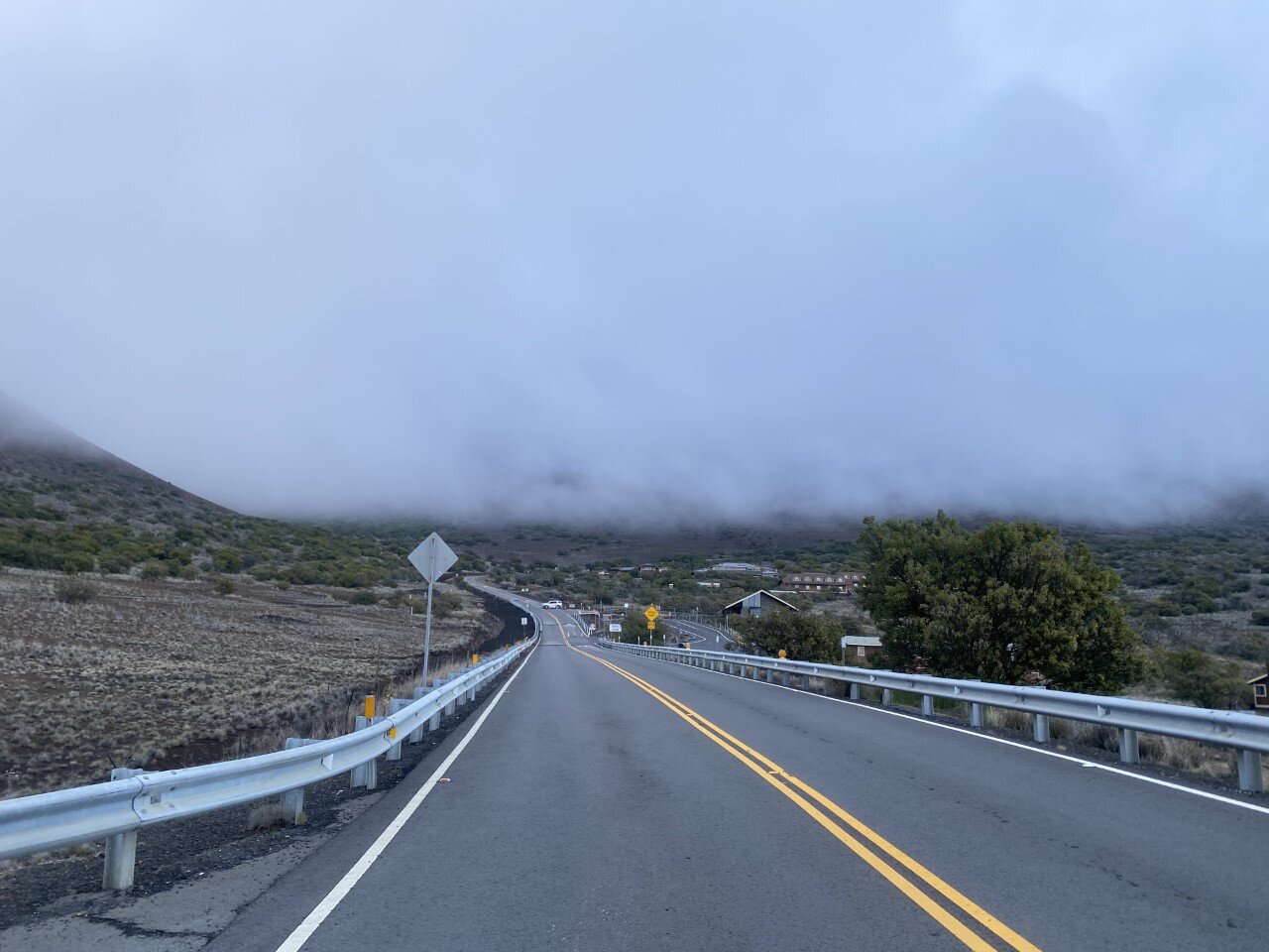
The ominous road that leads to the guard checking if you have AWD or not.
So here’s the sunset from our little spot 9,000 feet up in the sky.

Our sunset above the clouds, but still a few thousand feet below the summit.
Did you have Volcanoes National Park on your list of places to visit? What part of the park can you not wait to explore one day?

Three Must Visit Lakes in the Grand Tetons
When we first planned out our trip to Grand Teton National Park, I was stoked to find out there were several short hikes. From taking a gander at Jenny Lake, to short walks, you are bound to enjoy your time in the Tetons no matter how you spend your time.
The best part? The Tetons also have an incredible bike path (very few national parks do) that takes you from Jackson Hole into and throughout the park. The bike path is paved and lengthy, ending at Jenny Lake. You can also continue along roadside. We were thrilled.

We parked inside the park and biked from there. We brought our own bikes, but there are several places in town to rent from. If cycling isn’t your thing, you can also explore these scenic lakes by foot or by car.

Check out the three lakes I recommend spending your Teton time at:
Taggart & Bradley Lake
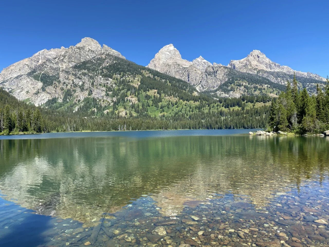
Taggart and Bradley lake are everything you imagine about the Tetons and more. As soon as you park at the trailhead, you are greeted with inspiring views of the Tetons. Just the trailhead parking lot alone is a sight to take in. Arrive early because this parking lot caters to hikers of all types: those who are tackling the grands, those who are going for a leisure stroll, and those who needed a quick pee stop.
We scored the last available parking spot at the Taggart Lake Trailhead (only a few miles in from the national park entrance) and began our hike to Taggart Lake. At a little over two miles, while gazing almost entirely at the Tetons above, we reached Taggart Lake.

Another 1.5 miles on the trail led us to Bradley Lake, which was easy to miss at the junction. This lake was less crowded, and just as stunning as Taggart. A little over two miles led us to complete the loop at around 5.5 miles and 500 feet elevation gain total.

Jackson Lake
This national park is quite large, but we were determined to see as much of it as we possibly could. From hiking to a couple lakes, to biking alongside the road, we also explored the northern part of the park by car. This drive brought us to Jackson Lake, where the summer blue sky seamlessly blended into the shimmering crystal waters.

I could stare at this view forever. It’s the perfect spot to eat your packed lunch, stop for a break, or simply relax. Plenty of viewpoints to pull over for with ample parking to take in this dreamy view.
What’s your preferred way to see the lakes - bike, hike, or drive up to the view?

Best Day Hike in Glacier National Park
Glacier is Montana’s gem. Truly. From the summer wildflower fields to the grazing wildlife, to the glaciers. Oh my goodness the glaciers! I left part of my heart in Glacier and I cannot wait to go back.
With initial plans to hike to the Grinnell Glacier, only to find out the night before that that part of the park was closed (summer 2020), we swiftly searched our NPS map for other hikes. The maps that the park service provides are jampacked with information about wildlife need-to-knows, safety measures to take, and hikes to explore. I highly recommend grabbing a map when you arrive (or check out GNP’s breakdown by regions of the park here).
Turns out, Grinnell Glacier can also be reached from the skies. Lucky me! Instead of reaching the glacier from the ground-level, we’d be hiking up to the lookout spot surrounded by the peaks. In hindsight, part of the park’s closure worked out in our favor because I never would have experienced this trail otherwise.
We set out early in the morning. Early in Glacier summers means 3:30 or 4am with the peak tourism. You would think a park in the furthest part of Montana would be kept as a hidden secret, but alas, the secret’s out. Glacier is a gem no one wants to miss out on.
With only one road to the trail’s access point, we quickly found ourselves in traffic. Shuttles that usually run throughout the park were shut off. Parking was full at Logan Pass, but we were fortunate to snag a spot half a mile away alongside the road in a designated parking spot.

Hiking along the Highline Trail…
Moments later, we embarked on the Highline Trail and I kid you not, every step had mountainscape views. Wildflowers and even some wildlife (deer, marmots, and mountain goats) along the trail as well. My first experience with a marmot is one I’ll never forget. As soon as I set my eyes on this adorable, sunbathing creature, a screech was let out that sounded like someone was being attacked. Turns out this adorable little thing has a fiery side to him. We quickly hiked on.

Even if you only have a couple hours to spare, hiking the Highline Trail is completely worth it. We gave it the day to see the glacier, so we made our way up the majority of the hike’s ascent to the Grinnell Glacier Overlook. The sign lies to you when it says .6 miles away. Trust me.


Closer to a mile of what felt like an endless uphill, we reached shimmering, aqua blue waters outlined by ice. It looked surreal.

With time to spare, we decided to make our way to the Granite Park Chalet, not too far from the start of the ascent to the glacier overlook. Glacier originally had over ten chalets built to mimic the vibe of Switzerland – ultimately, to promote tourism. Why go to Switzerland, when you can have it all right here in Montana? Sadly, various situations led to many of them no longer standing. The Granite Park Chalet is one of two remaining in the backcountry.

The views from this chalet are phenomenal. The fact that this trail is extraordinarily stunning and leads you to a homey chalet just tops it. Bookings fill up swiftly, for good reason, so plan ahead if you’re hoping to snag a spot at this dreamy stay. We did an out-and-back from the chalet, adding up to 3,700 elevation gain in 18 miles of trekking.
The Granite Park Chalet also has a campground below it, not too far away. It’s the perfect entry into the backcountry if that’s your thing. My heart was completely full after this hike. If you only have a day to devote to hiking, this is your trail for a taste of all the delights that Glacier offers.


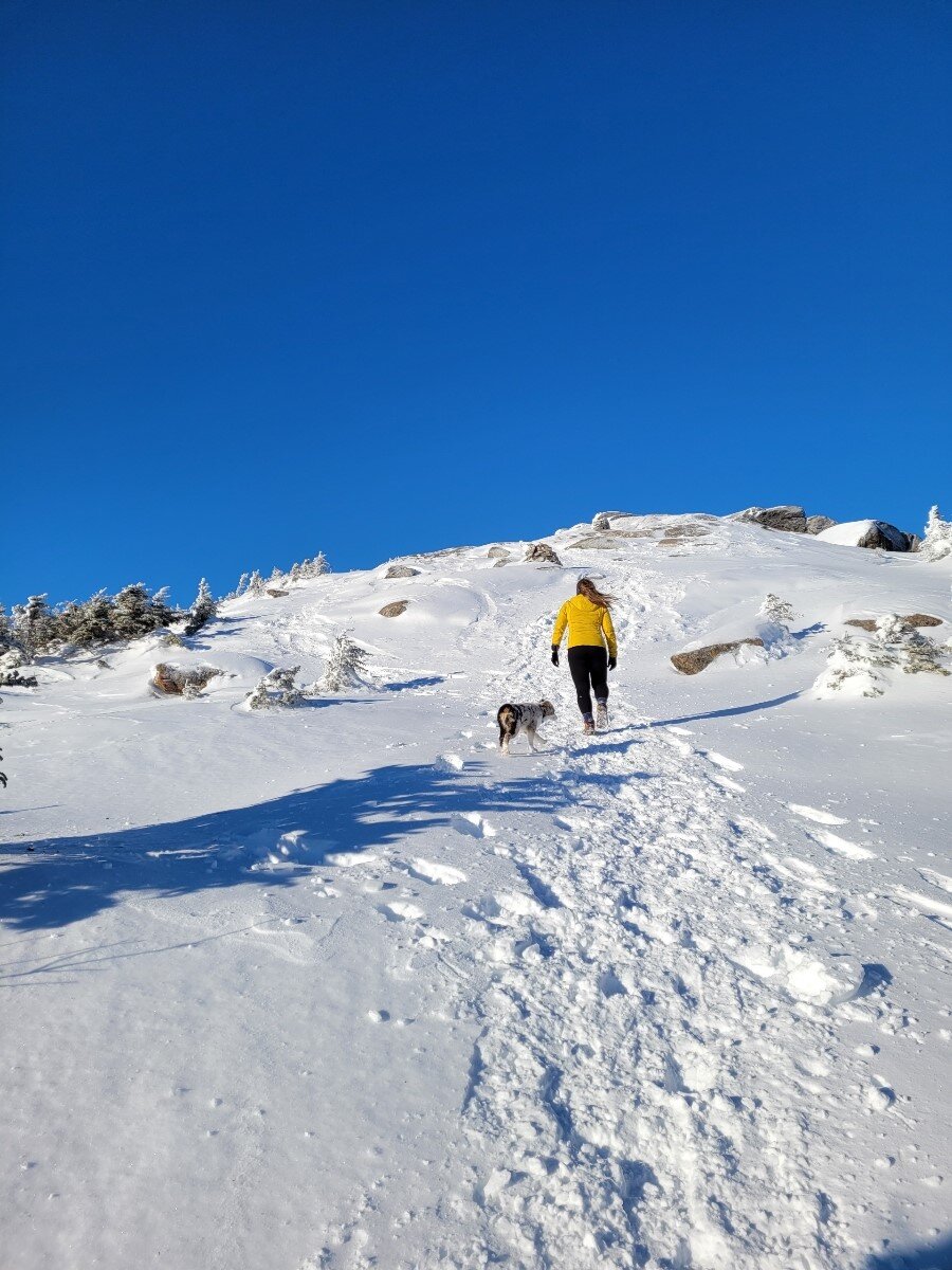
Hiking Cascade and Porter Mountains in the Adirondacks

Winter in the mountains is surreal. Growing up in Texas meant only seeing snow once or twice, and it was mostly ice. I am absolutely enamored by the winterscape in the northeast. From snow-capped peaks to the crunch of spikes in snow on the trail, to the summit sunsets that are more frequent with shorter daylight times. Selfishly I also enjoy having trails to ourselves and not heavy crowds.
This past week, we ventured up to the Adirondacks, a magical gem in New York that feels like New York’s best kept secret. It’s a long drive for many, and it’s not a national park, so it’s not extremely well-known. However, for hikers in New England, it’s a popular destination. Like the New Hampshire 48, there’s a list of 46 high peaks in the Adirondacks that results in accomplishment (and a patch, of course) if completed.
I’ve hiked a couple, but never in winter. Winter in the Adirondacks feels otherworldly to me because of my few trips up there. My first trip up was five years ago. One of my best friends who lived in Hawaii at the time sent me a picture of the Adirondacks and told me I should go. I made a day trip that weekend, which became the first of an annual fall foliage trip.
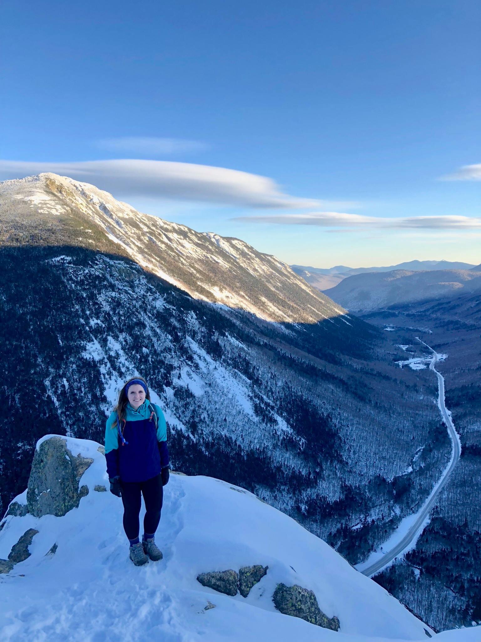
This trip, however, would be the first attempt of a winter trek in these vast mountains. We set our hearts on two of the 46: Cascade and Porter. After arriving in the early afternoon to a nearly empty parking lot, we set out on the 2.4 mile ascent to Cascade along the Cascade Mountain trail. The trail was packed down and clearly labeled. Right before the summit of Cascade, at about 2 miles, there is a y on the trail. One direction leading up to Cascade (head toward “privy”), and the other about .6 miles to Porter. We headed up Cascade first.

One of my favorite parts of winter hiking is the lowered probability of getting lost because you only have two options: follow the trail another hiker sweetly packed down for you, or dive into feet of untouched snow. Seems obvious.

The wind was brutal at the summit, so we descended almost as quickly as we made it above treeline. Beautiful bluebird days can be deceiving weather-wise since we were met with 20 mph winds producing a negative windchill experience atop Cascade.

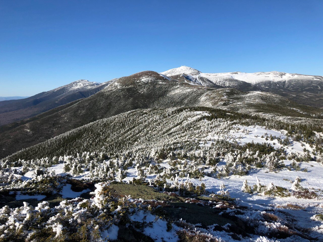
Afterwards, Porter was a fast and beautiful jaunt with views of Cascade. I love ridgelines because you get to see how far your hike has taken you.
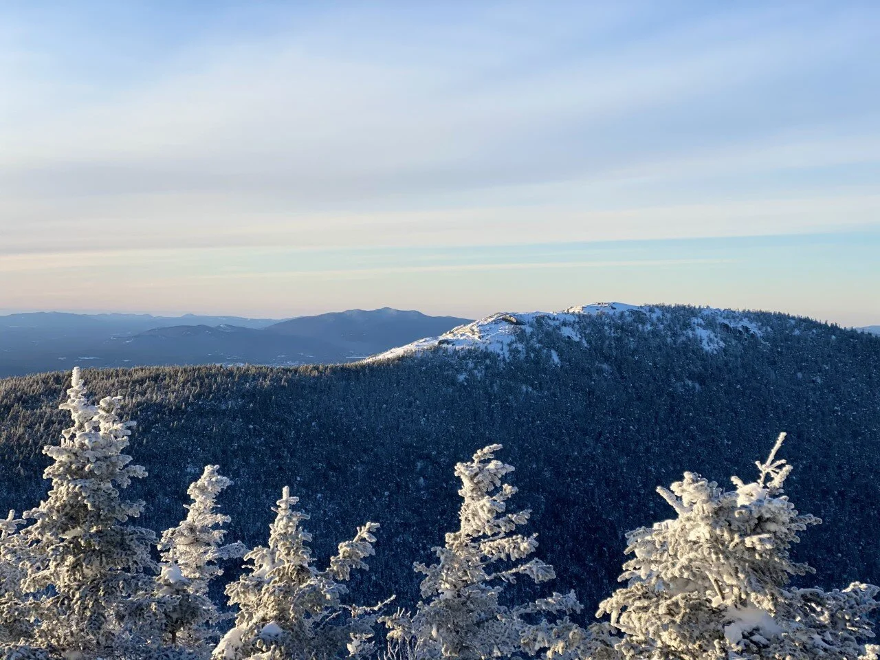
Cascade Mountain trail to the summit of Cascade Mountain (view from Porter Mountain).
We headed down Porter the way we came up and the rest of the hike was a swift and smooth descent. It was also our dog Koah’s first two of the 46! After this trip, I’m already starting to plan the next. The 46 just might be the next hiking challenge we take on.

Should the ADK 46 be our next list to take on? Have you hiked any of the 46 high peaks?

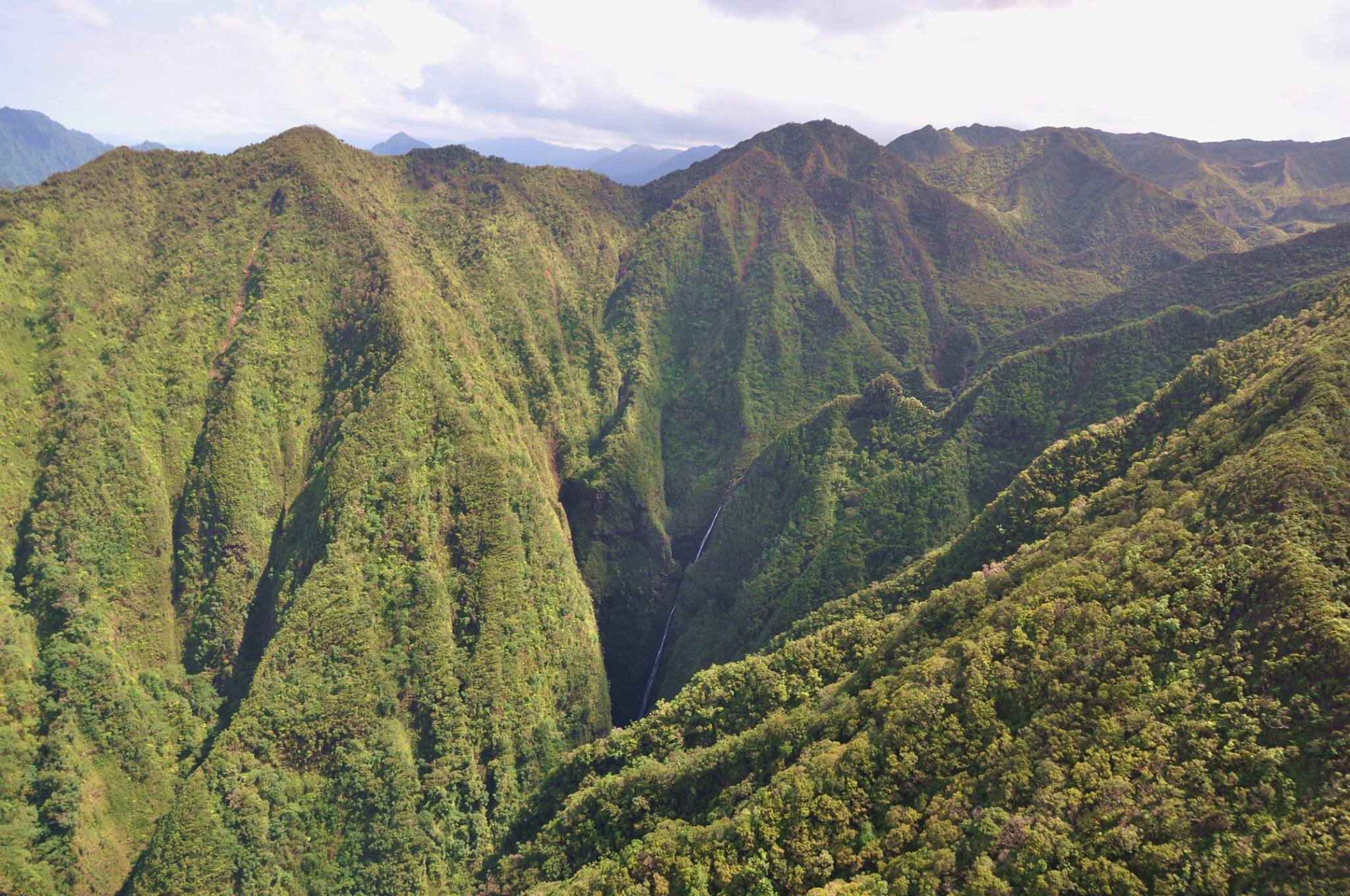
Five Adventure Musts in Oahu, Hawaii
Find yourself in Hawaii for a week without an itinerary, but with a desire to adventure? On my second trip to Oahu, I made sure I saw all that the island has to offer. From açaí bowls to a birds-eye-view of the island, to local-recommended hikes, I left the island saddened to return to a New England winter, but with the promise of returning to experience it again one day.
Given the travel restrictions in Massachusetts over the past few months, the only state we can travel to (without quaranting upon our return) is Hawaii. With that, Hawaii has been on my mind.
Here’s my list of five musts when visiting the forever dreamy Oahu:

1. Take a No-Doors Helicopter Ride
Hear me out if you read that and said absolutely not. It’s completely safe and totally exhilarating. Convinced yet? Magnum Helicopters offers a phenomenal tour from start to finish. I took this tour toward the end of my trip on Oahu, so it felt neat to see parts of the island from above that I had explored on my feet days earlier.
I absolutely love seeing places from a birds-eye-view. I’ve always been fascinated by it and every trip I take incorporates some form of this perspective (probably why I love hiking and flying so much). We flew over the Sacred Falls, Pearl Harbor, the Stairway to Heaven trail, the North Shore, Honolulu, and even the Makapu’u Lighthouse I write about next.
Flip through the pictures below to see Oahu through my lens.
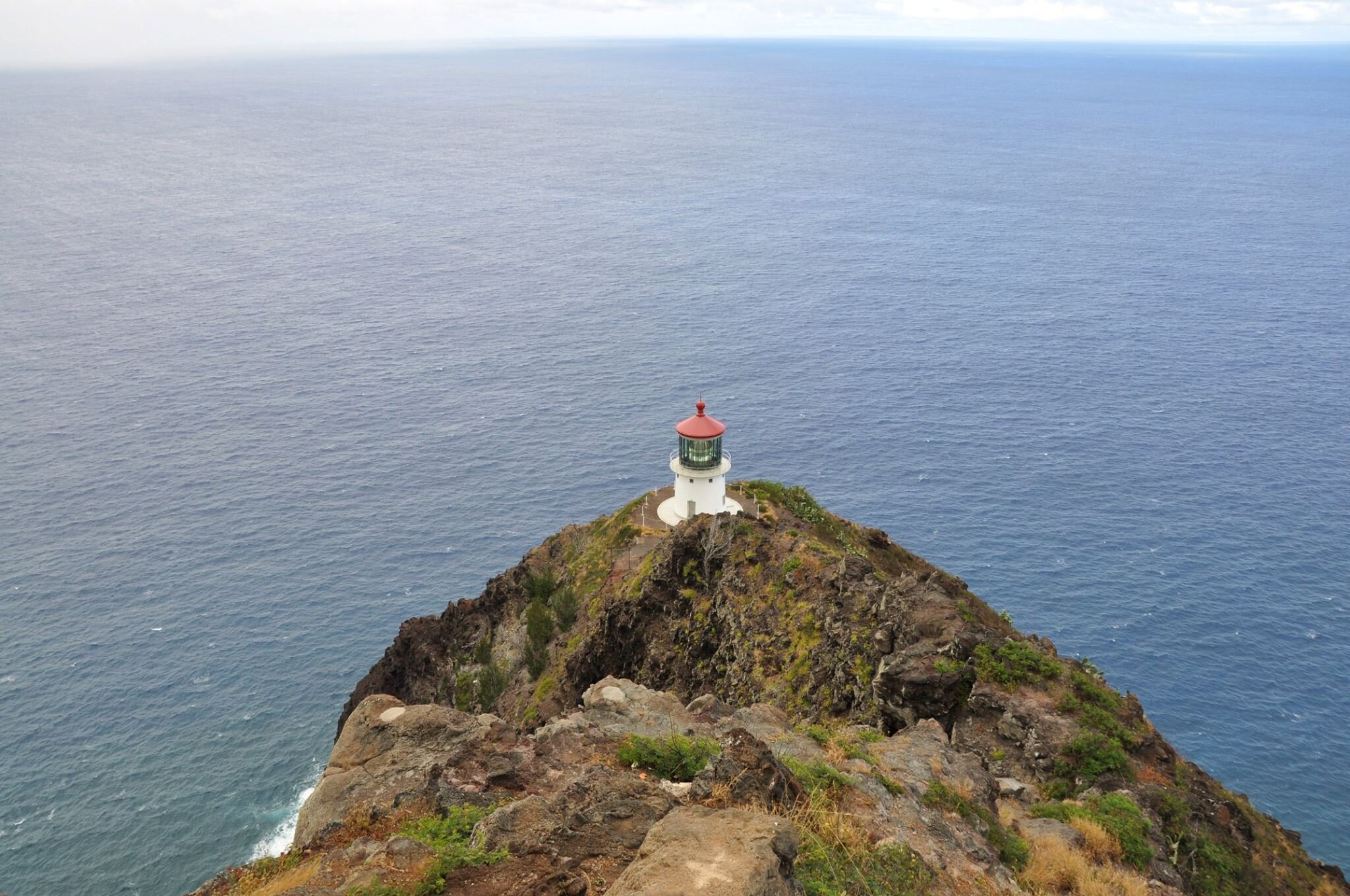


2. Hike Around the Makapu’u Lighthouse
A stunning, two-mile trail to this lighthouse was a must for me. Maine is home to dozens of lighthouses, and I’ve been to many. I go out of my way to visit lighthouses in Texas and Savannah, Georgia, so when I found out Oahu had its own gem, it was at the top of my list.
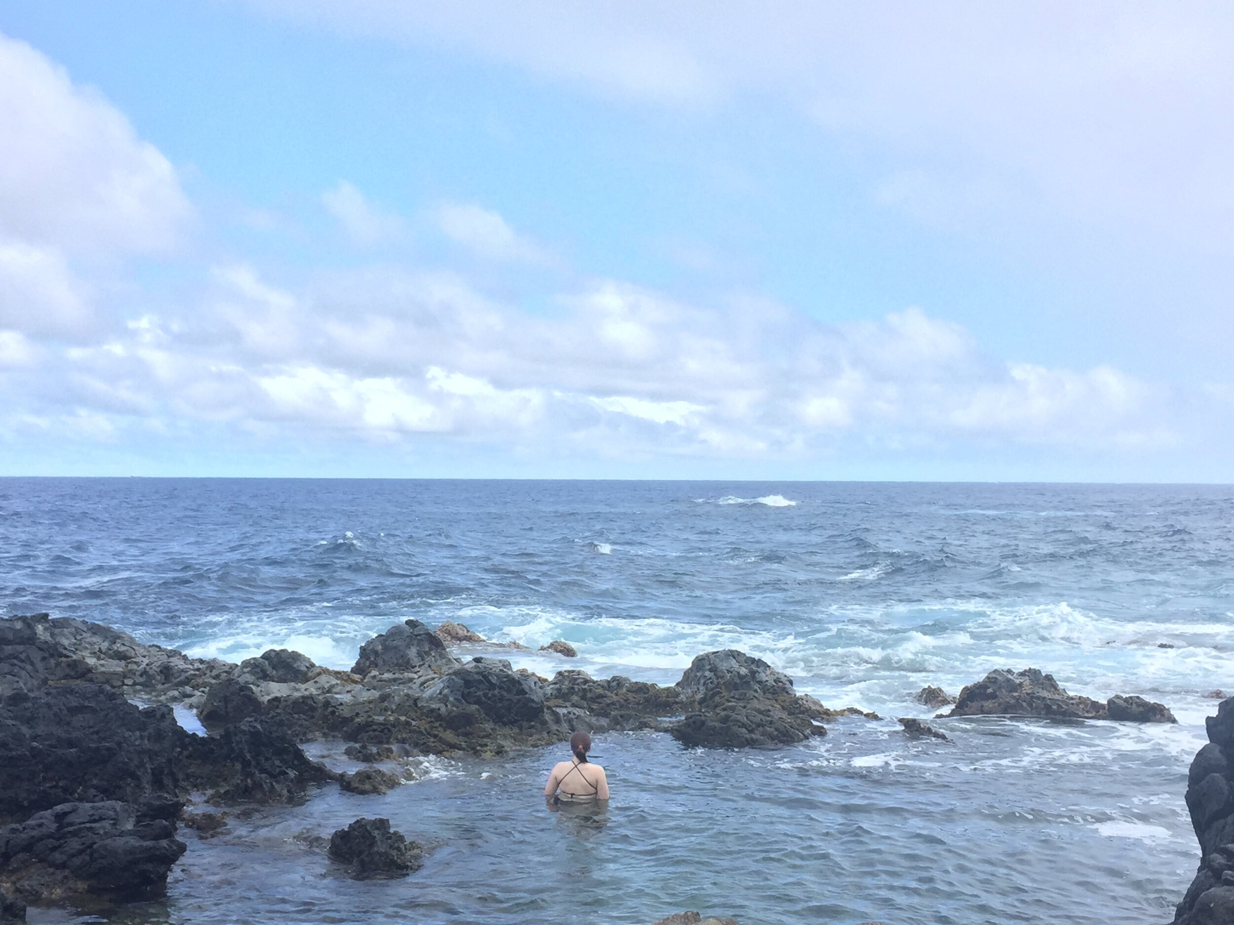
This lighthouse trail needs to be on your list. Give yourself some extra time to head down a steep descent to the Makapu’u tide pools. Wear sturdy shoes for the trek down to the tide pools (and the slow ascent back up, you’ll thank me later!)

3. Take Your Tastebuds on an Adventure With Poke and Açaí Bowls
I’m not a big foodie in general, but I always aim to try what locals eat (like that time I tried guinea pig in Peru because when in Peru…). On Oahu, it was poke and açaí bowls. A lowkey adventure one afternoon was spent grabbing poke at the local market and heading to the beach at my friend Skyla’s suggestion. Poke bowls seem like all the rage now, but I was convinced back in 2017 that I could only get poke on Hawaii’s shores. Little did I know New Hampshire had a poke place along the coast and only a couple years later Western Mass would catch up. Nothing beats that Oahu grocery store poke though.
With the Hawaii sun year-round, açaí bowls are also always a good idea. Açaí stands are around the island like snowcone shacks in Texas.


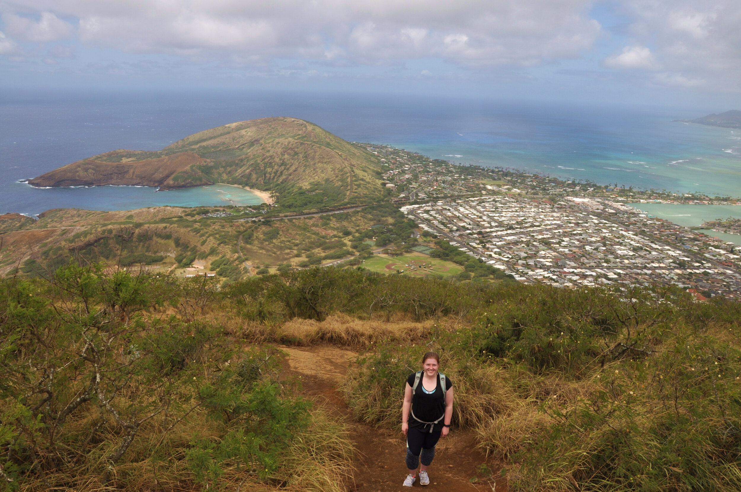
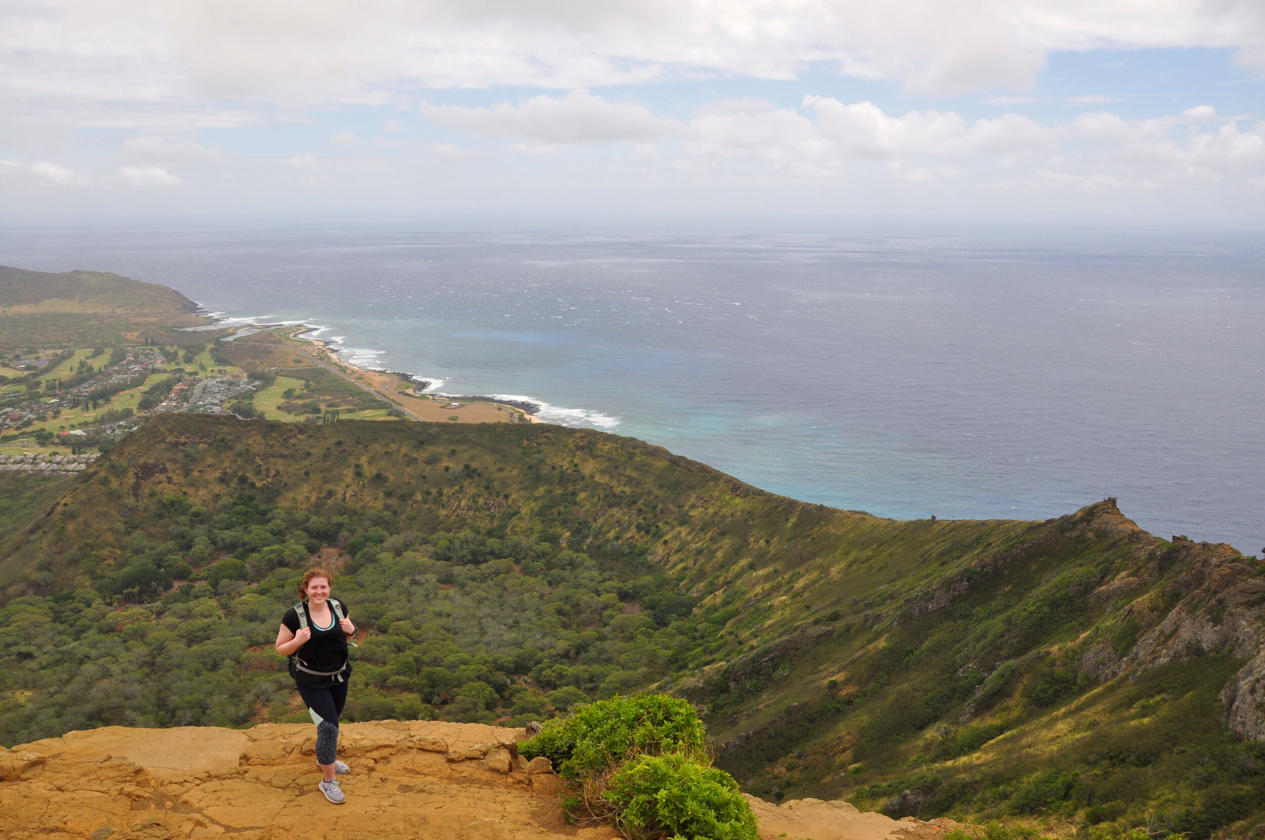
4. Take the Stairs to Koko Crater
One early morning I drove out to the Koko Crater trailhead and began what I thought would be a scenic hike. As had been the case the entire week in Hawaii, this little island continued to exceed my expectations.
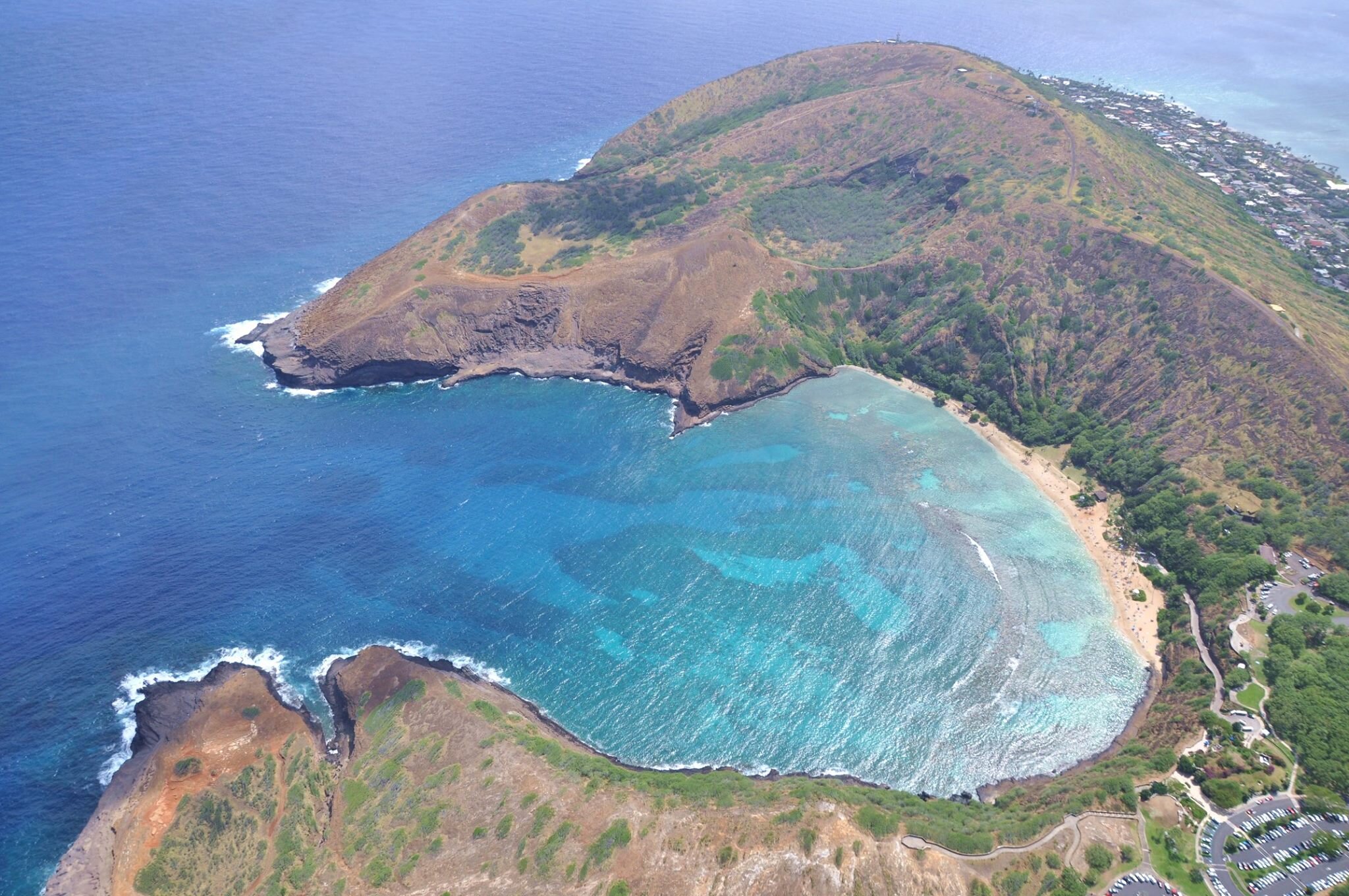
About 1,000 stairs (an old railroad no longer in service) up led me to incredible vistas of this island. The trail is easy to follow from the parking lot and it is right by Hanauma Bay for all your snorkeling excitement after this toasty climb.

5. Catch a North Shore Sunset at Turtle Bay
Turtle Bay Resort is the only resort on the island, but thanks to my local friend’s tip: it’s open to non-bougie visitors, like myself. Skyla and I went to catch the sunset one of my last nights in Hawaii. She said there was nothing quite like a Turtle Bay sunset. We sat outside by the bar that is open to the public and were mesmerized by the sunset. It was my first time, that I can remember, watching the waves engulf the sun fully into the ocean.
Newcomers to Solo Hiking: 6 Perfect New Hampshire Hikes to Take on Alone
One of the perks of teaching is having the month of July off to travel. I spent one July a few summers ago living in southern New Hampshire with a friend. I was so pumped to live near the Whites, even though I had only hiked the Franconia Ridge a year earlier.
With my new proximity to the Whites, I set my sights on hiking. The only problem? My friend spent the summer working, so I was on my own. I had no problem traveling alone or exploring new places by myself, but hiking in unknown terrain with limited cell signal was not a habit of mine. How things would change in the coming years…
I didn’t hike a 4,000 footer once that summer. I was too afraid of the what if’s.
I look back now and regret how close I was to the mountains and how I didn’t take advantage of them. I did spend that July starting out what would later be a weekend regular: hiking alone in the Whites.
I researched short hikes that were clearly marked. I wanted to leave no room for error. Here are the hikes I did that summer (along with a few extras I did later on) that are ideal for first-time adventurers, low-on timers, beginner hikers, or short-on-hiking-pals trekkers:

1. West Rattlesnake Mountain
A 2-mile hike with a little less than 500 ft elevation gain. Beautiful any time of day or year with this view of Squam Lake.

2. Artist’s Bluff
Less than half a mile to this beautiful overlook in the heart of the Whites in Franconia Notch with a bit of a steep incline. I’ve been here a handful of times and the view never gets old.

3. Mt. Willard
Another fan favorite in Franconia Notch is this beautiful 3 mile, out-and-back trail. Perfect for all levels and a jaw-dropping view every time.

3. Mt. Willard (continued)
Same view, different season. A major perk of winter hiking is less hikers along the trail. I hiked Willard with a friend a couple years ago in negative temps and we only crossed paths with a set of hikers at the summit.

4. Welch-Dickey Loop
This was my first attempt at prepping for 4,000 footers. Welch-Dickey is a loop of a little over 4 miles with a little under 2,000 ft gain.
This was also my first experience with NH’s namesake as the granite state, which I experienced in rainy conditions. I wouldn’t recommend this hike in running shoes on a rainy day.

5. Mt. Major
Another under-5 mile hike loop outside the Whites with stunning views. This hike is pretty popular any time of year, so it’s ideal for new solo hikers.
6. Mt. Pierce
A 4,000 footer that you can totally handle. Though this wasn’t my first 4ker, it was the first one I hiked alone. I spent an April break in the mountains and Pierce was first on my list. Three miles up to the summit on a bluebird day led to me bag Eisenhower nearby in the same day, but Pierce alone is well worth the trek.
It is one of the NH 48 with a little over 2,000 ft elevation gain. The climb is well-paced and there are endless views of the presidentials at the summit, including good ol’ Washington.
Have you made it to any of these summits? Which ones do you plan to add to your list? Let me know if you’re going to tackle these summits soon.