
Hike the Adirondacks’ Great Range Traverse in One Day
Hike 8 of the ADK 46 over 20.8 miles and 8,300 feet along the Great Range Traverse. Do it in a day for the Northeast Ultra 8! Here’s all you need to know about the GRT.
Summit of Haystack in the Adirondacks.
New Year resolutions never stuck for me, but for the past several years, goals I set on my birthday have. With every passing year, my individual goals differ, but the categories stay the same (hiking, traveling, fitness, and finances). 2023 was the year I took my hiking goals up a notch.
After wrapping up the New England 67 4,000 footers, I had the Adirondack 46 on my mind. When I first moved to Massachusetts, I hiked one of the 46 a year. I thought I’d keep that up to have a lifelong hiking goal. If I started hiking them once a year at twenty-five, I’d have a goal to pursue past retirement. I should have known better. I always considered the Adirondacks rugged. The trails aren’t as easy to navigate as the Whites, and the mileage increases tremendously with the 46. The Whites were challenging sure, but the times I spent in the Adirondacks I rarely came across other hikers, particularly on the grueling days.
I made my way up to 19 going into May, but I was still too scared to officially write down “become a 46er this year” on my list. So I didn’t. I kept it to myself and decided any free weekend off of summer school I had, I’d drive to my favorite place. And that’s exactly what I did. By the end of September 2023, I only had six remaining peaks. I couldn’t believe it. These six 4,000 footers happened to also all be along the Great Range, and like my NH 48 finish, I knew I wanted to end on an epic adventure.
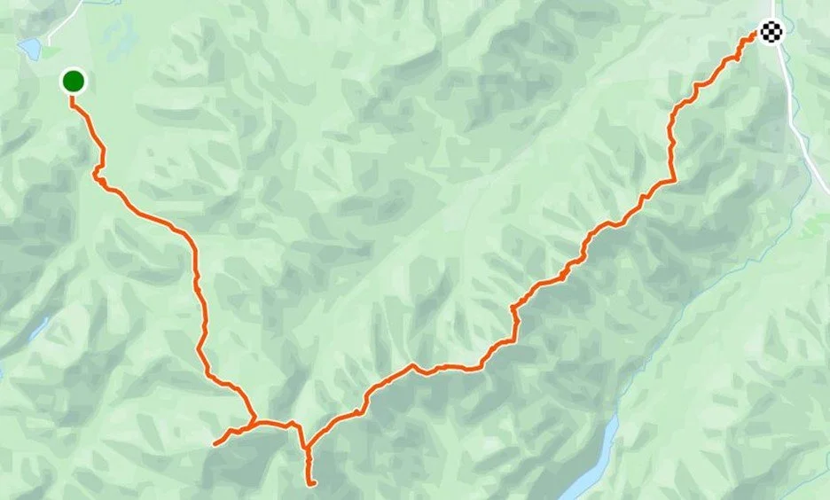
That’s where the single-day Great Range Traverse came in. Roughly a twenty-mile hike with around 9,000 feet of elevation gain. I have had longer days and bigger climbs than this one, but the Adirondack terrain is truly on a different level. Particularly on this one with the famous Saddleback cliffs. I knew I wanted company not only for morale, but as a safety measure. Thankfully, there are others out there who love these mountains and who jump right in when it comes to these challenges instead of shy away. Tom joined me, despite already being a 46er, because he was working on his Northeast Ultras. Completing this hike would not only make me a 46er, but it would also complete another of the Northeast Ultras. The NEU is a list of nine intense hikes in the Northeast that range from 20-52 miles. Told you I wanted an epic adventure, right?
We agreed to start hiking by 3:30 am, so I started the drive from Western Massachusetts a little before midnight to arrive at the trailhead. After dropping one car off at the Rooster Comb trailhead, we made our way to the Adirondack Loj for our official start. Car parked at the start of the Van Hoevenberg Trail and bags packed. We were ready.
Van Hoevenberg Trail > Mt. Marcy (5,305’)
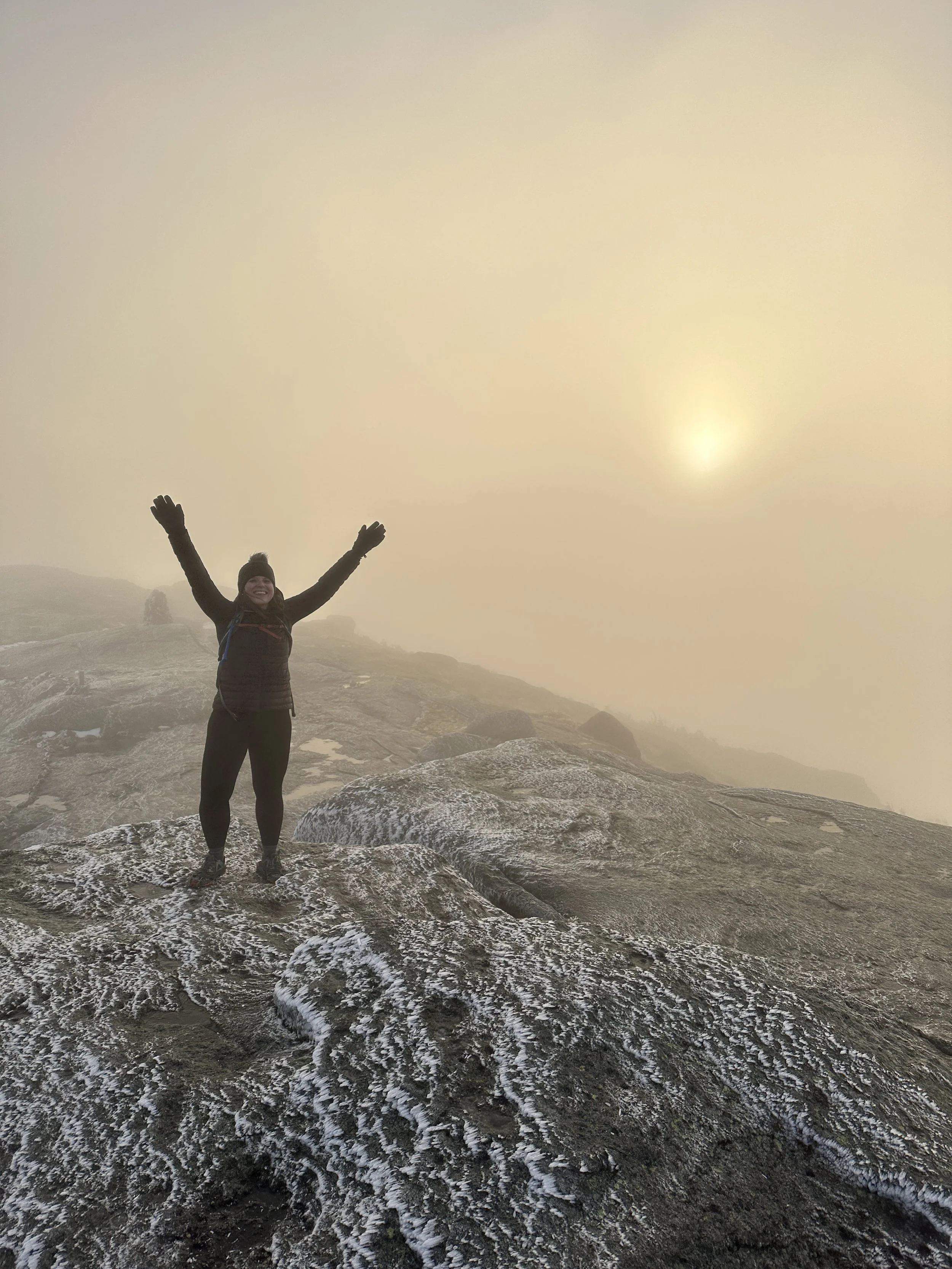
Darkness kept us company as we began our hike along the Van Hoevenberg trail. We made our way to Marcy Dam way faster than I imagined. We chugged along, and then our ascent to New York’s highest point truly began. And so did some stomach issues for me.
Slowly but surely, we made our way. Shockingly, we made it to the summit in time for sunrise. Sadly, spikes were required as winter welcomed us at 5,000 feet. It was a socked in summit, but the sun was visibly rising. It looked like a fireball in the sky. The only other time I experienced a moment like this was atop Sugarloaf in Maine for a New England 67 hike. I had the summit to myself as the sky burst into fiery flames.


Again I found myself at a summit, with Tom this time, that felt like we were on another planet. We took it in for a moment. My hands were frigid and the winds were whipping, so we headed back down. Once we were under tree line again, we took a longer break. Tom let me borrow his warm gloves and we headed to our next summit: Haystack.
Mt. Marcy via Van Hoevenberg Trail > Phelps Trail > Haystack (4,915’)
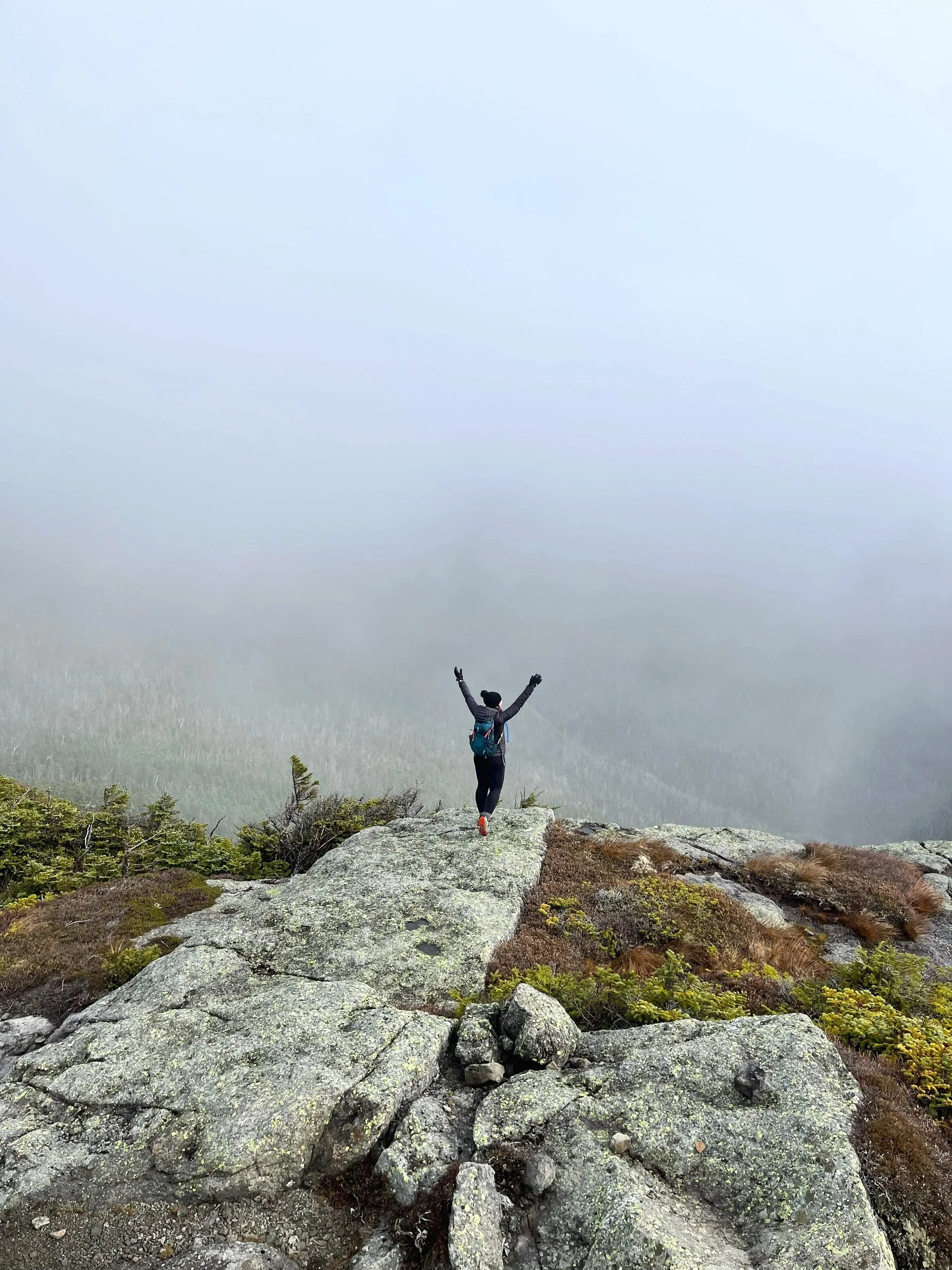
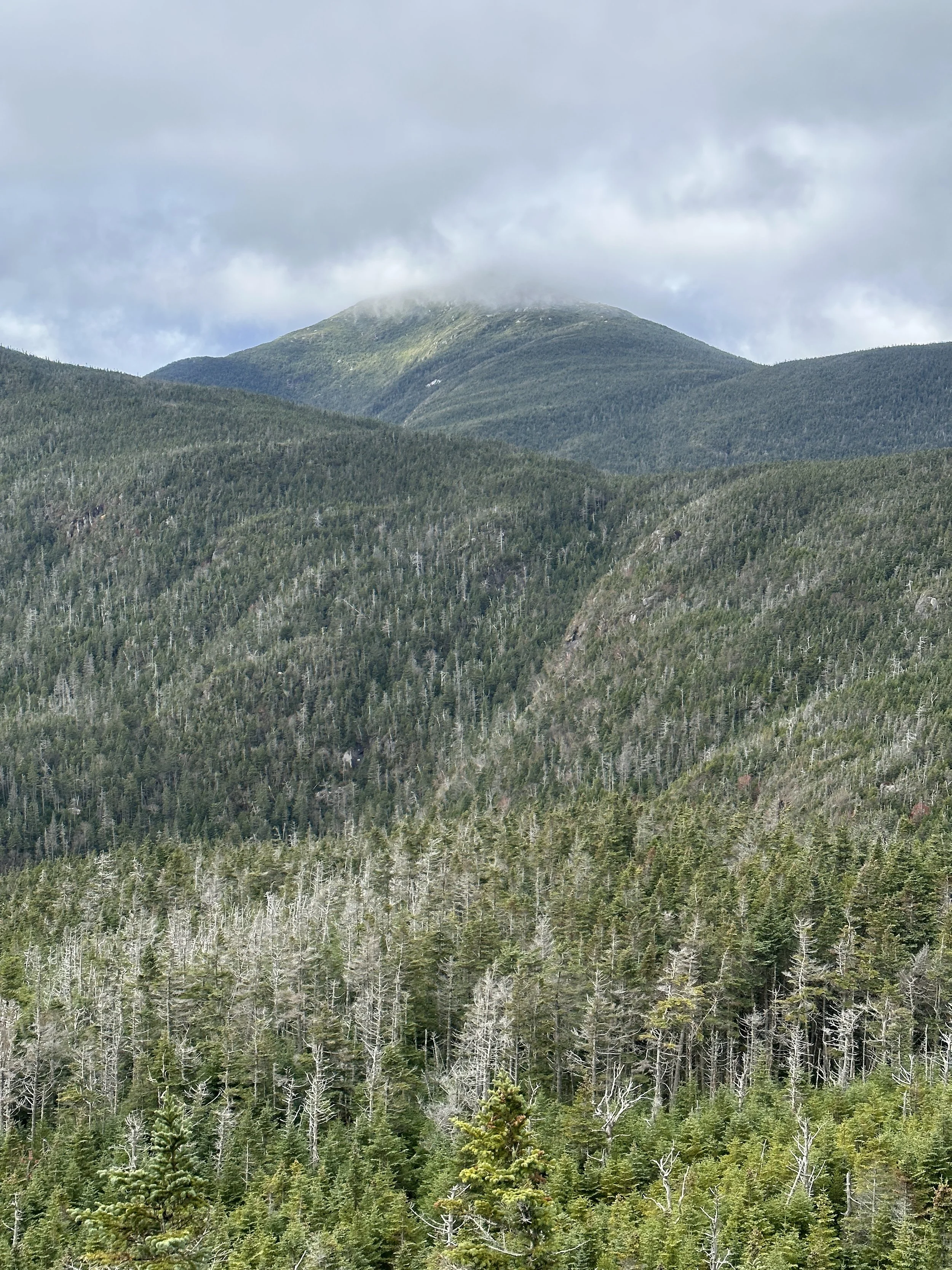
We descended over 1,000 ft before having to summit Little Haystack (4,662’) en route to Haystack. The last stretch along the Haystack Trail led us there. Haystack stands at 4,915’ and was a new summit for me. This one came with a sliver of an opening in the sky’s parting clouds. Some bits of foliage remained in the distance, and we could see Mt. Marcy was clearing up a bit as well.
The sky cleared up a bit for us atop Haystack.


Haystack > Basin (4,817’) >
Saddleback (4,511’)
Haystack was an out-and-back, like Marcy, so we went back down the Haystack Trail and back onto the State Range Trail. That was our last out-and-back on trail. I didn’t feel great because I wasn’t eating, but also mentally I knew the toughest part wasn’t over yet. I’m glad we hiked Marcy first and went the route we did because a large amount of climbing had already been accomplished, but the part I psyched myself out the most by was approaching: the Saddleback cliffs.
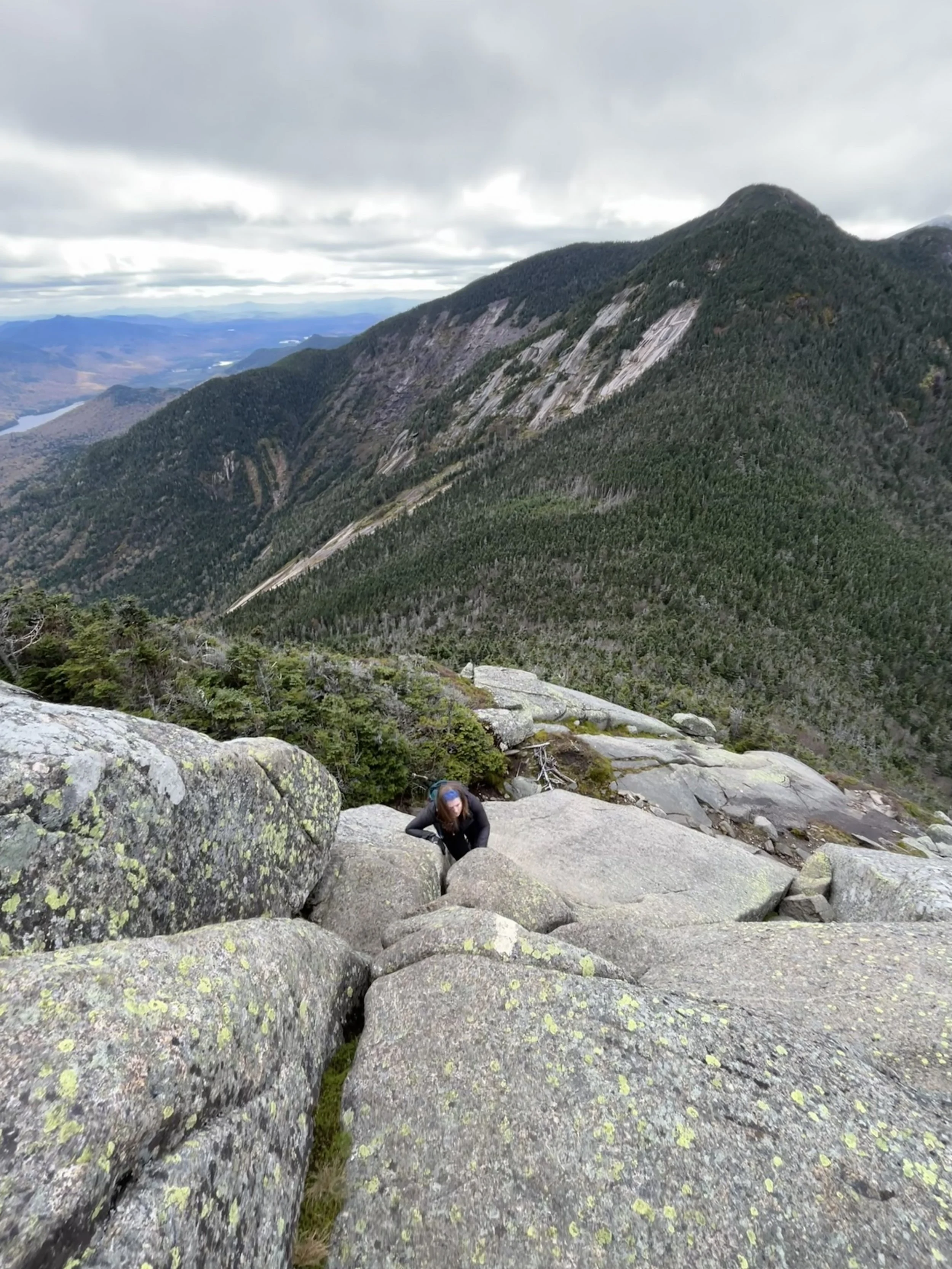
A small section of the Saddleback cliffs.
Saddleback > Gothics (4,675’) > Armstrong (4,331’)
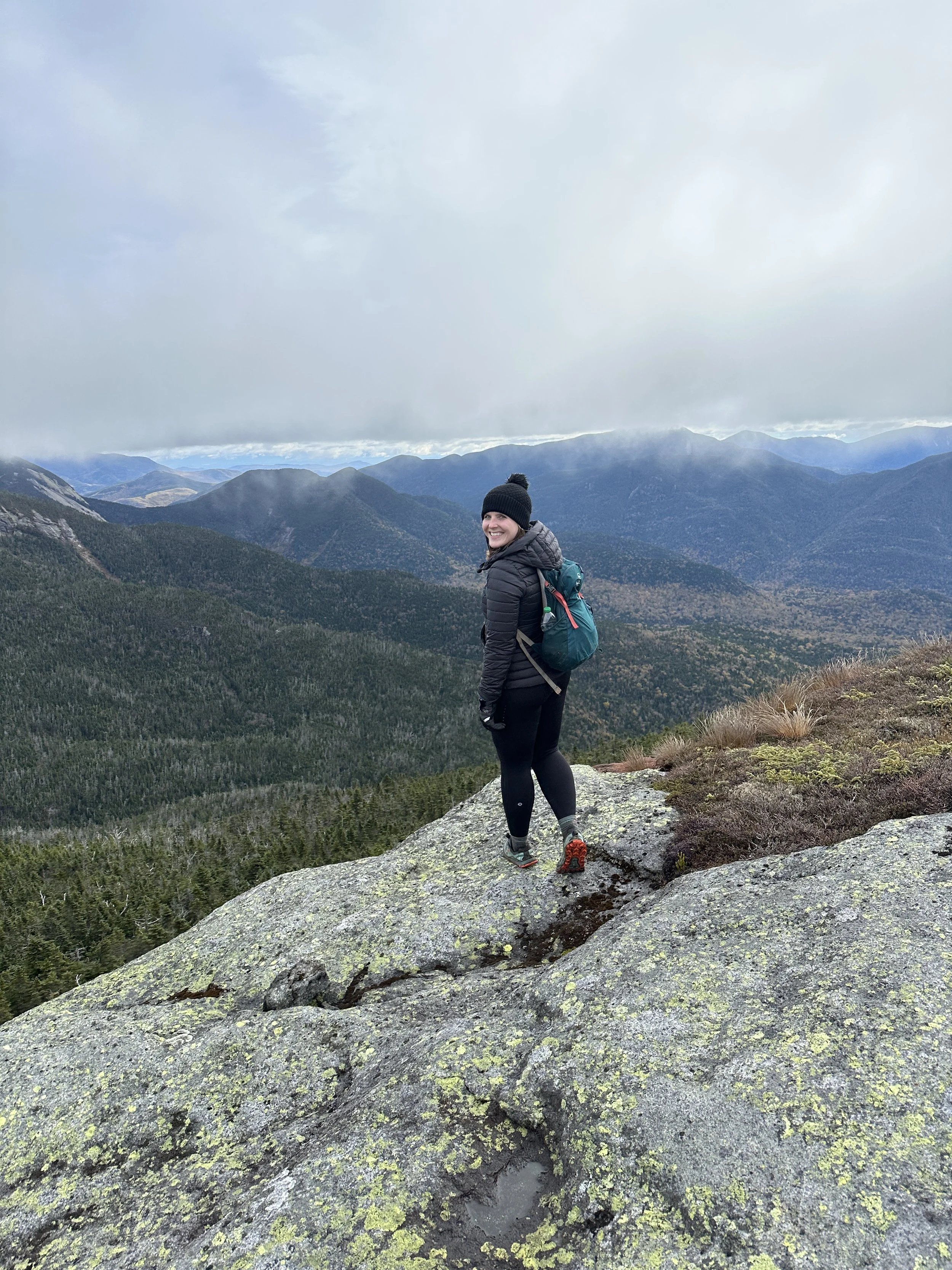
The cliffs were no joke. I’m not tall, so it was very helpful to have Tom go first and I watched his hand and foot placements. Even with him in the lead, I was terrified. I watched a few videos of the cliffs and chatted with hikers around my height who went up the cliffs, but nothing really prepares you. Already hiking a few mountains prior to this moment probably didn’t help. I saw my life flash before my eyes a few times, but I did it. At the top, we sat and ate a bit. That was when I realized my hands were still shaking. I’m not someone with a fear of heights at all, so that was definitely alarming. As we took our break, other hikers approached us, telling us someone had fallen and they assisted them with a rope that hiker had packed. Safe to say I won’t be repeating this section for some time (re: ever).
I was just grateful the “tough” section was done. I told myself the cliffs were the worst part and it would be smooth sailing after that. The Adirondacks, of course, are never smooth sailing.
Next up was our approach to Gothics. I hiked this one years before, very early on in my 46er journey. I was a beginner hiker looking for great foliage views and I found them! I hoped to do Sawteeth at that time too, but hikers at Gothics’ summit told me they crossed paths with black ice, and I played it safe since I didn’t have spikes at the time.
Since I had already been up Gothics and wasn’t traumatized back then, I thought I was in the clear. Then came the cables. I focused so much energy and research on the Saddleback cliffs that I didn’t realize Gothics had its own exciting adventure. Physically I was already weak from the hours we had been on trail, so when I saw a straight incline where using cables was practically a requirement for a great stretch of trail, I realized I was in for quite the arm workout.


As we ascended, a couple hikers descended. I was just thankful to not have to descend this section. Another moment of gratitude for taking the route we did. It looked worse than it was and soon after we headed to Armstrong. I wish I could say more about Armstrong, but I have no memories of this point. I was just glad to be done with the challenging sections.
Armstrong > Upper Wolfjaws (4,203’) > Lower Wolfjaws (4,177’)
With Armstrong under our belts, we had a couple climbs left. At this point, we were chasing the sun. We ascended Upper Wolfjaws and went onwards to Lower Wolfjaws. Neither were too memorable until we found an opening on Lower Wolfjaws just after the sun set behind the mountains. Tom gifted me a 46er patch so I officially became a 46er then. What a moment.


Lower Wolfjaws > Hedgehog Mountain (3,376’) > Rooster Comb Trailhead
I finally felt relief that the day was over, despite us already watching the sun set on the day. It was defeating to realize about five miles of trail remained and we’d have to descend roughly 3,000 feet. My feet were wrecked. Mentally, I was exhausted. Tom took the lead on the descent. We headed down the W. A. White Trail toward Hedgehog Mountain, followed by the Hedgehog Trail, and lastly Rooster Comb Trail. Tom safely got us back to the Rooster Comb trailhead. Honestly couldn’t have gotten out of the woods without him.
I felt an amalgam of emotions as we drove back to my car. Delirium was the strongest feeling in that moment because I hadn’t eaten and I was absolutely exhausted.
Days later I realized what I achieved.
I had just finished the 46. I was officially a 46er – something I never saw myself achieving. People usually laugh when they find out I finished on Lower Wolfjaws (a rather unimpressive peak), but then I mention it was part of the Great Range Traverse that day. Not only did I accomplish the goal I set for myself, secretly years prior, but I also climbed another rung on the ladder toward being a Northeast Ultra 8 finisher. The Great Range Traverse was my second of the Northeast Ultras.
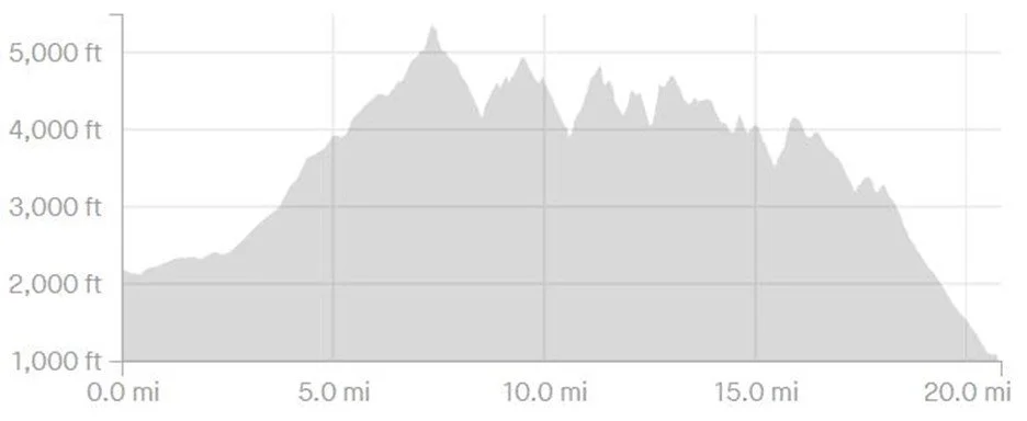
Overall, I’m glad I experienced the Great Range Traverse, but don’t think I’d want to rush these mountains in the future. Of course I wanted to complete them for the ultra, and I’m thrilled I did, but it was a long day. By the end, we hiked 20.8 miles with 8,300 feet of climbing. Our moving time was eleven hours, but our breaks totaled a handful of hours over the course of the day.
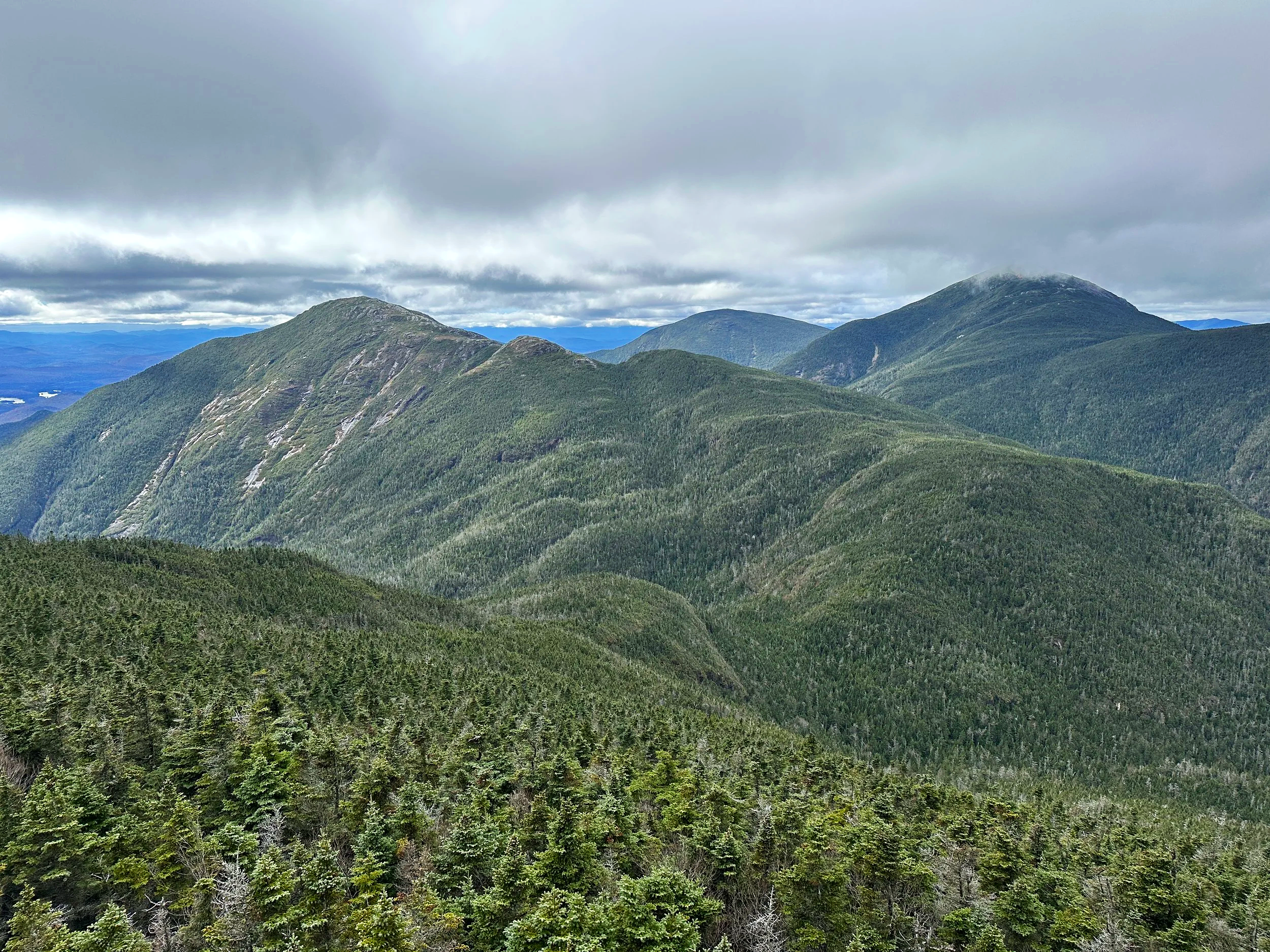
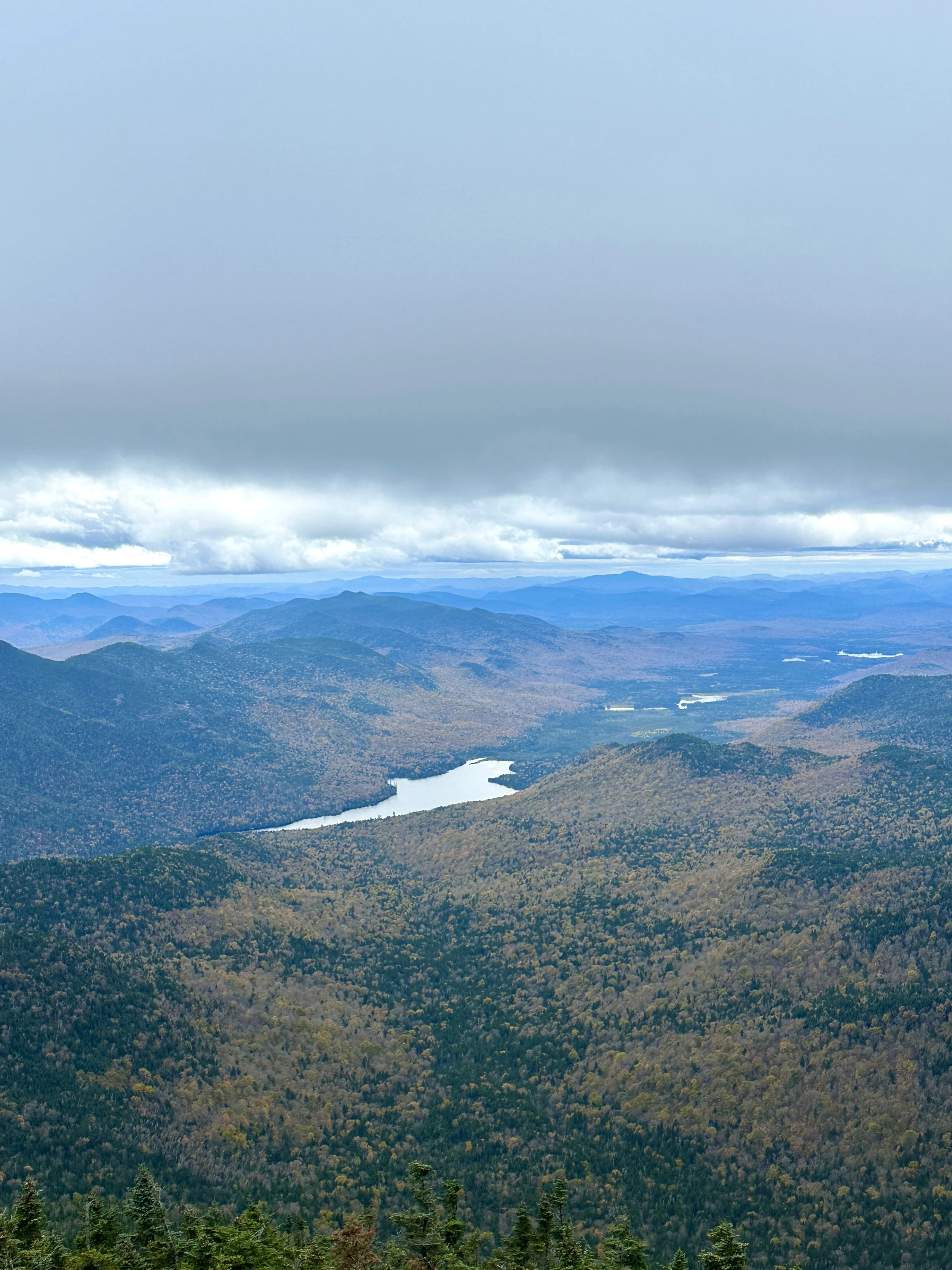
The magical Adirondack mountains.
With the Adirondack 46 complete, I also became a Northeast 111 finisher. Naturally, attempting the rest of the Northeast Ultras was up next.
Have you considered hiking the Great Range Traverse? Would you take on the challenge of completing it in one day?

Hiking Esther Mountain in the Adirondacks
On my hike up Whiteface, we took a slight detour in the wrong direction. When we approached the trail sign for Esther, and read, “path not maintained or marked,” we trudged on to Whiteface. After all, I wasn’t chasing the 46er list.
Joke’s on me because three years later…

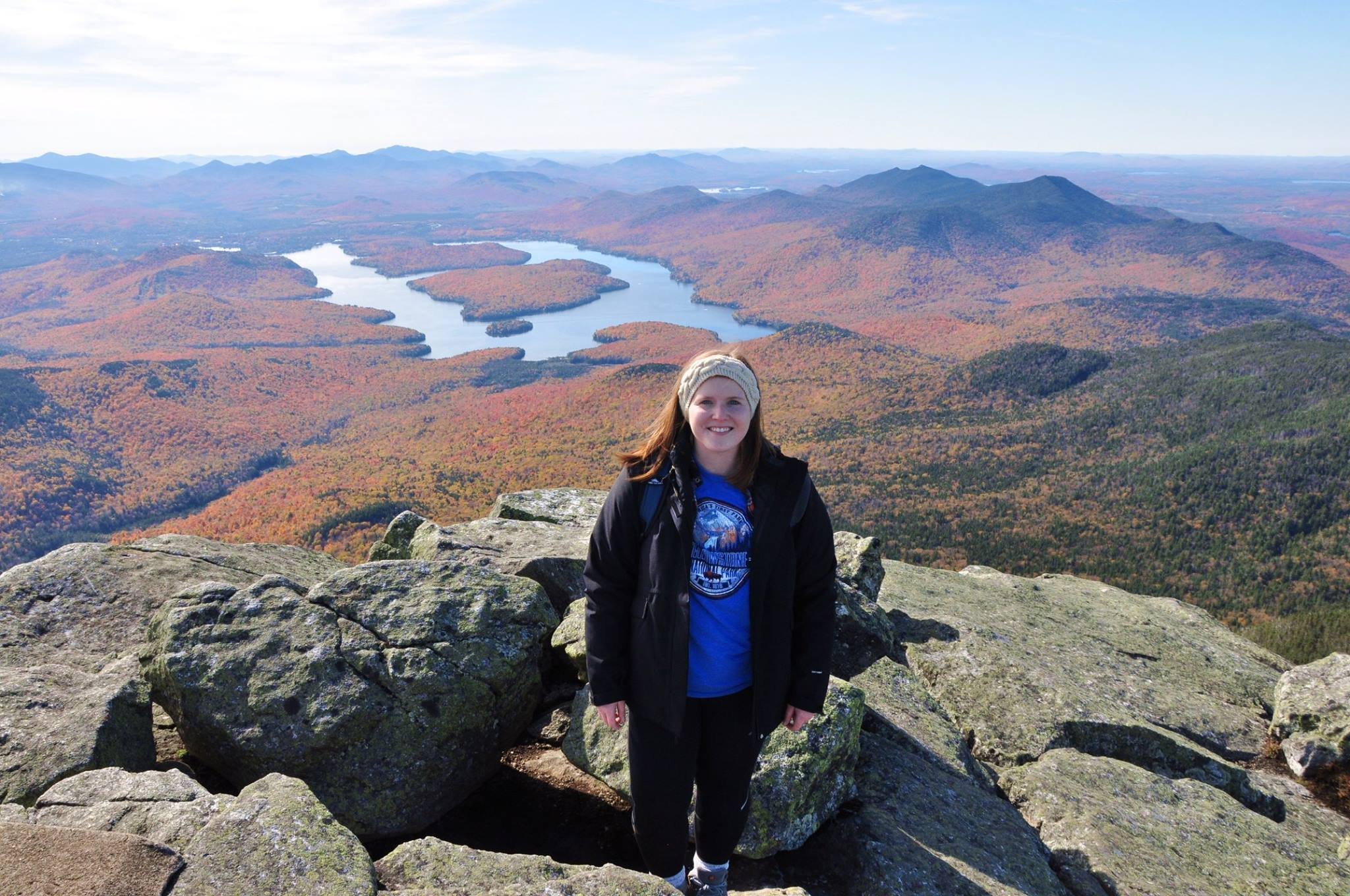
I first discovered the Adirondacks from one of my best friends in college who was living in Hawaii at the time. She sent me a picture of Whiteface’s stony summit path and said, “you have to go there.” Naturally, I drove four hours the next morning (luckily it was the weekend), drove the road up Whiteface, and indulged in the best foliage I had ever seen. Still possibly the best foliage in all my years living in New England since.
I mean look at those colors. I took the photos of Whiteface Mountain below back in October 2016. I had only survived the Franconia Ridge the summer prior and had no idea the mountains and views in store when I’d move to Massachusetts the following year.
Little did I know that five years later I’d hike up the very mountain that first introduced me to the Adirondacks.
Whiteface Mountain in October 2020
Featuring a naive me, thinking I wouldn’t take on the Adirondack 46 at some point.
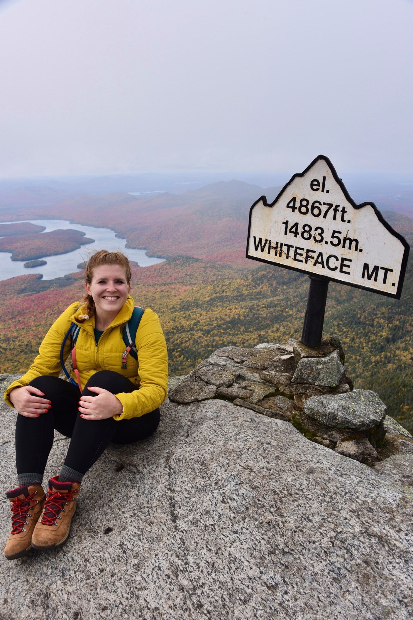
It also comes in at 4,867 feet, making it one of the highest peaks in the Adirondacks. Of course this places Whiteface on the 46er list (New York’s 46 highest peaks). Along one trail to Whiteface is a short detour to Esther Mountain.
On my hike up Whiteface, we took a slight detour in the wrong direction. When we approached the trail sign for Esther, it read, “path not maintained or marked.” Dejected from the detour, we trudged onward to Whiteface. After all, I wasn’t chasing the 46er list. I was there to spend time outside, and see the foliage. Not push on to a viewless summit in uncharted terrain.

Joke’s on me because three years after my Whiteface ascent, I decided I wanted to tackle the 46 highest peaks in the Adirondacks. So here I was with a free Saturday and a craving for a good climb. The weather was sunny and the temperature was moderate. I made a go for it!
Last weekend, I parked at the Atmospheric Sciences Research Center at 110 Marble Mt Ln, Wilmington, NY 12997. Plenty of parking here, but be sure to not park at the center itself. The trail is indicated with a visible sign.
From the start of the trail, it’s a lovely (short-lived) flat path before the 2,000 foot climb begins. A real-world, snow-covered stair climber. What more could you wish for?
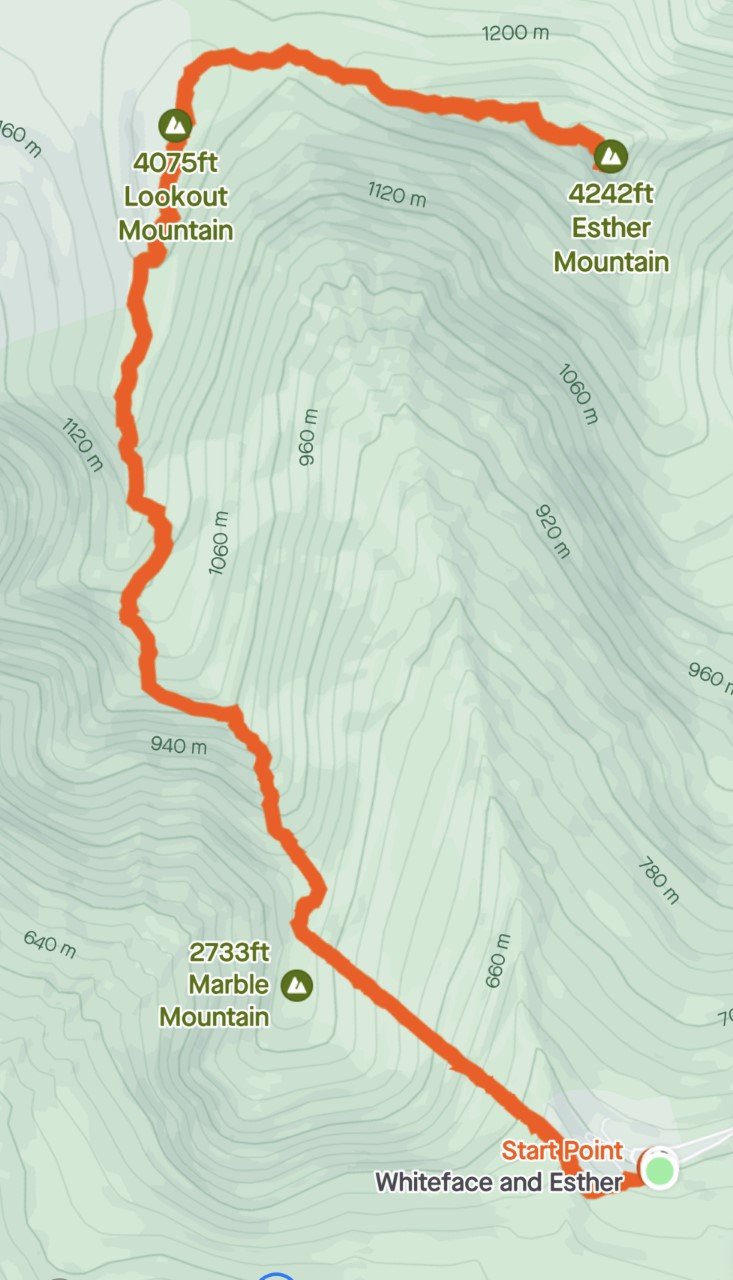
Trail Route from Strava
An out-and-back 6.3 miles with about 2,800 feet of elevation gain.
The great part in summer is that the sunshine is covered for this brutal, sweaty climb. The best part in winter when all the tree branches are bare, is that the sun shines just enough to warm your uncovered face, while the rest of your body is fired up.
I love a good climb, and Esther was no different. At about .8 miles, you reach Marble Mountain, roughly 2,700 feet. A great break spot, complete with rocks to sit on and a view worth gazing at. When you’re done, the next leg of the trip continues to climb (shocking, I know), up to Lookout Mountain at 4,075 feet.
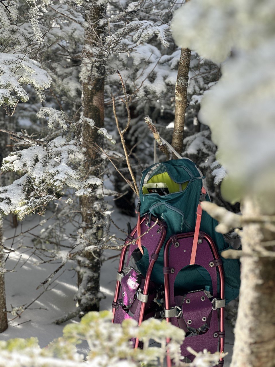
Snowshoes are actually required in the Adirondacks during the winter with more than 8 inches of snow.
The trail was very packed down, so I used microspikes on the ascent. I thought I’d try out my new snowshoes on the descent and they were incredible. These Winter Walker snowshoes from L.L.Bean are super affordable and did me well on a 4,000 footer! They are currently on sale too!

Esther Trail
The iconic Esther sign I referenced earlier is at this point, where you can either turn left for Whiteface, or head right, to the “not maintained” path. The beauty of winter (and several snowshoers before you) is having a very clear path outlined for you. I never faltered from the trail.
After a bit more climbing (several hundred feet), I soaked up the summit to myself. Everyone I have talked to Esther about always brings up the summer mudfest, or the lack of summit views. I’m not sure if it was because this was my first hike back in the Adirondacks after months away with marathon training, or if there were several feet of snow that elevated me, but I loved the far-off views of Whiteface I saw.
I’m a little biased because I also love winter hiking. A lot. I spent about an hour on the summit wanting to enjoy the perfect day before I headed down.
When I reached my car, I clocked in about 2,800 feet of climbing in 6.3 miles of going out-and-back on the Marble Mountain trail to the Esther trail.

The mountain is apparently named after Esther, a fifteen-year-old girl who was the first known person to summit. Turns out, she hiked up here just for the love of hiking. How fitting considering that was the exact way I felt all day up there. Hiking up Esther Mountain in the winter is definitely the way to go.
This was my 21st peak of the 46. Here’s to many more summit smiles!
If you enjoyed this trail review, check out these mountains:
Cascade and Porter Mountains in the ADKs
Twins, Zealand, Bonds Traverse in the Whites